Tahoe Daily Snow

By Bryan Allegretto, Forecaster Posted 9 years ago October 31, 2014
Summary:
Everything is on track for a cold system to push in rain and snow this afternoon with snow levels falling to lake level tonight. Snow showers are expected tomorrow and then clearing and warming Sunday into next week. The next chance of rain/snow will be Thu-Fri, but it's not a good chance right now.
Details:
Last night the forecast models all lined up briefly showing 9-12 inches across the basin above 7000 ft., with 12-15 along the crest and up to 18 near Donner Summit.
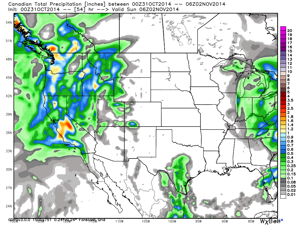
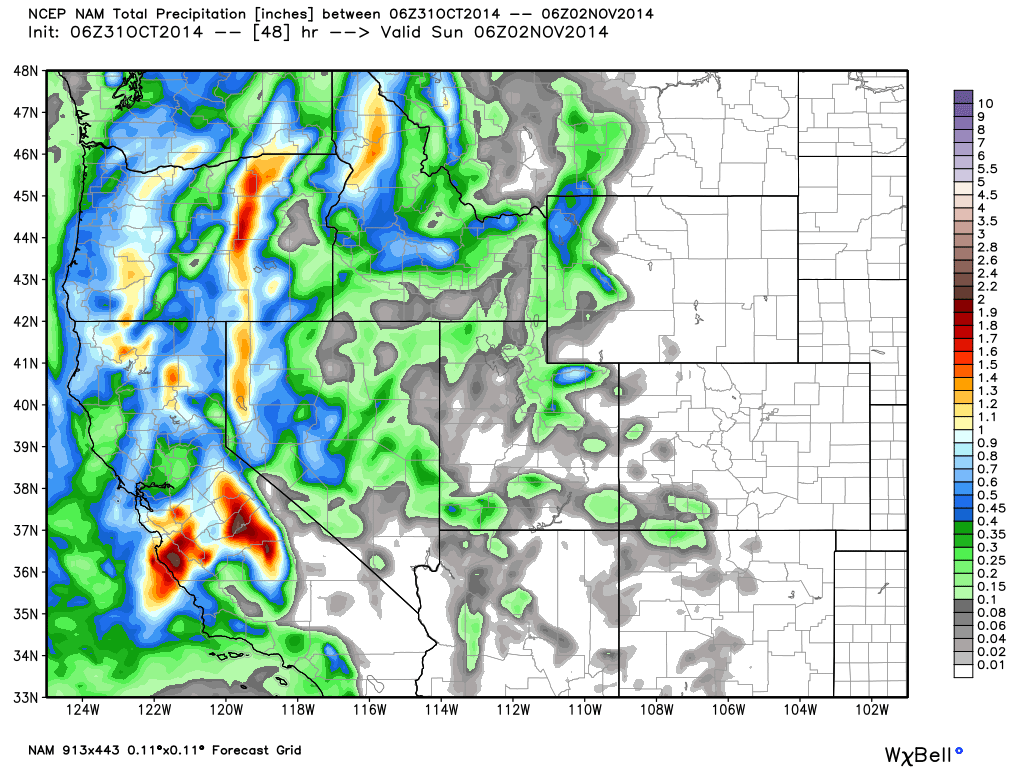
But....they have all shifted on the latest runs this morning back to what they had 2 days ago. I thought it was a fluke when I looked at the Canadian run pushing most of the precip to our South, but then the Euro, GFS, and NAM all showed the same. The bulk of the energy has continued to be forecast to be South near Mammoth as the jet stream dives in to our South and they are better aligned for orographic enhancement from a system with Southerly flow like this one. Yesterday the forecast models showed a second wave behind the front with more of a Westerly flow on Saturday that would bring several more inches. This morning they are showing this to be much weaker with just light snow showers.
Look at how the Canadian has switched back this morning...
And the NAM is doing the same...
Without the secondary wave of snowfall Saturday morning there would be heavy shadowing East of the crest. The heaviest snow looks to fall West of the lake along the crest and South of the lake. The GFS is now the outlier with the heaviest snow behind the front overnight into Saturday morning. It still shows 6-9 inches above 7000 ft. on the East side of the basin, 9-12 inches on the West side, with up to 15 possible on the highest peaks West of the lake along the crest. At lake level 2-6 inches.
The rest of the model runs limit the snowfall behind the front and push the heaviest precip to our South. They show enough liquid for around 3-6 inches above 7000 ft. on the East side of the basin, 6-9 inches on the West side, with up to 12 inches on the highest peaks West of the lake along the crest. The best shot at seeing a foot looks to be above 8000 ft. near Donner Summit and Southwest of the lake near Kirkwood. At lake level since most of the precip falls with the cold front it will rain for a while. Depending on your elevation a hundred feet or so could be the difference between 3 inches or an inch, but a general 1-3 inches is expected.
The precip should begin falling across the basin by mid-afternoon. Snow levels start near 8000 ft. but quickly fall to 7000 as the precip gets going. Then to lake level later this evening. Snow showers are expected Saturday, especially in the morning. Temps will rise above freezing Saturday melting any snow that falls at lake level.
Sunday we clear out. Temps start out cool on Sunday in the 40's but we will be back into the 60's by midweek. The next trough tries to push into the West Coast by Thursday into Friday. The GFS has a ridge off the coast pushing the storm just to our North. The Euro tries to dig the trough farther South with some light precip for us.
Long-Range:
Looking at the CFSv2 climate model it now has November starting out a little drier with only chances of light precip. It shows the storm track to our North to start the month and then lowering down the West Coast as we go through November into December. It basically shows it getting stormier and stormier the closer we get to towards Winter. As much as you can trust a long-range climate model........
Stay tuned....BA
P.S. the maps from TWD are still available on the Tahoe Info page.
About Our Forecaster
Bryan Allegretto
Forecaster
Bryan Allegretto has been writing insightful posts about snow storms for over the last 15 years and is known as Tahoe's go-to snow forecaster. BA grew up in south Jersey, surfing, snowboarding, and chasing down the storms creating the epic conditions for both.
Free OpenSnow App


