Australia Daily Snow

By Mike O'Connor, Meteorologist Posted 11 months ago August 21, 2024
An Ugly Outlook, But Potential Snow On The Horizon
Summary
The next week or two will be wet and windy in the Aussie Alps as a series of fronts move through with a strong westerly flow. The snowpack will suffer, but cooler temperatures will bring snow to higher elevations from Wednesday night through Thursday. Friday will be the best day due to a weak high-pressure ridge, but northwest winds will intensify over the weekend, bringing more rain showers.
Short Term Forecast

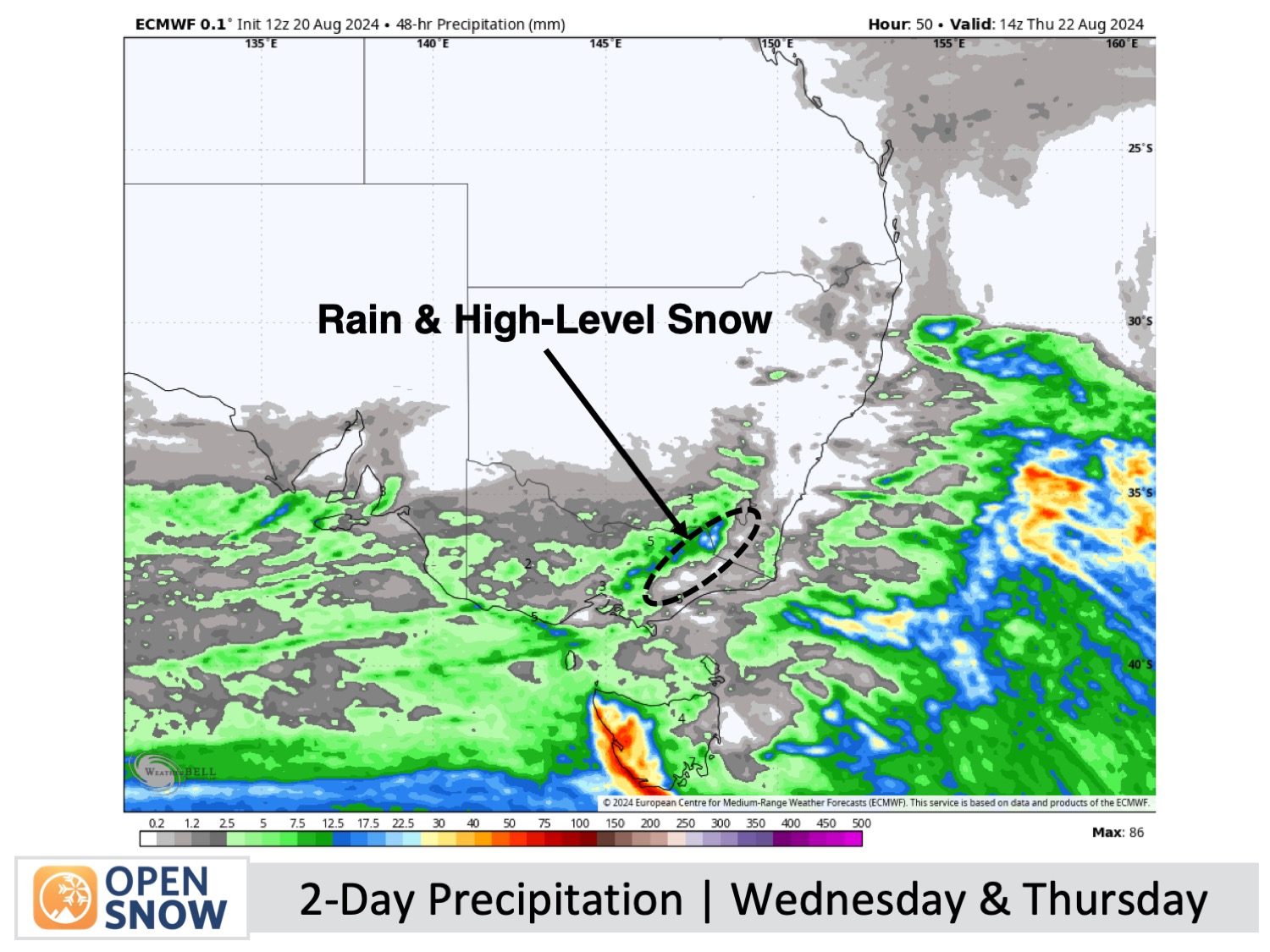
Wednesday & Thursday (21st & 22nd August)
For those eager enough to venture out on Wednesday, expect rain, drizzle, and occasional low visibility, especially in Victoria. Gale-force northwesterly winds will impact exposed areas of New South Wales in the morning, with snow predicted above 1800m by night.
Thursday will have rain and drizzle, transitioning to snow near 1800m, should clear out of Victoria during the afternoon and New South Wales by evening. Northwesterly winds will remain strong throughout the day.
Friday (23rd August)
Strong northwest winds on Friday will result in cloudy and gloomy weather in Victoria with periods of drizzle, while New South Wales will see a mix of clouds and some sunshine.
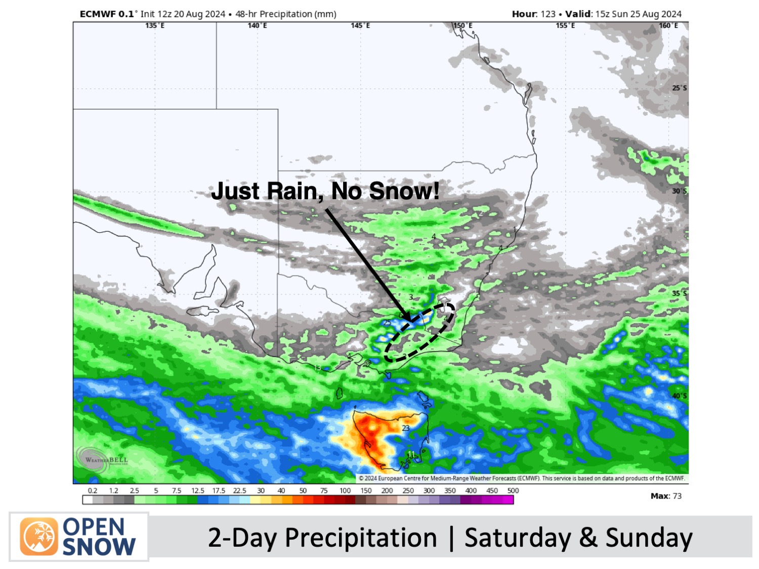
The Weekend (24th & 25th August)
Northwest winds will strengthen this weekend as a few more fronts bring additional rain showers.
Extended Forecast
Thanks for reading. I'll continue to provide these forecasts every Monday, Wednesday, and Friday throughout the southern hemisphere season.
Mike O'Connor
About Our Forecaster


