Australia Daily Snow

By Mike O'Connor, Meteorologist Posted 1 day ago July 29, 2025
Cold Southeast Flow with Flurries till Saturday
Summary
A storm from Friday to Monday dropped 30–60+ cm of dense snow up high, helping the snowpack, though lower slopes mostly saw rain. A low to the north will bring chilly southeast flow from Wednesday to Saturday, with light snow and great snowmaking conditions. High pressure returns Sunday, setting up a potentially epic day.
Short Term Forecast
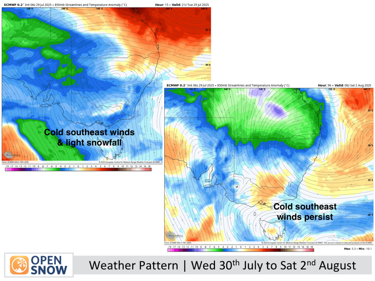
Forecast for Wednesday 30th to Sunday 3rd August
Cold southeast flow over the Australian Alps as a storm sails over northern New South Wales and a ridge of high pressure digs in to the south. The winds will push in cloud and light snowfall at times, although Mt Buller will likely not see much of both, due to it being sheltered. Conditions should also be great for making snow, which is much needed on the lower slopes after the recent soaking.
The southeasterly winds ease and temperatures lift on Sunday as the ridge of high pressure moves on, providing sunny skies and great skiing conditions.
Extended Forecast
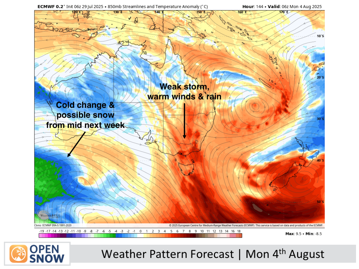
Next week, a front from the west will weaken before reaching the Australian Alps, bringing mainly brisk northerly winds and some rain early in the week. A more uncertain weather system is expected mid-week (July 6–7), with snow forecasts ranging widely, but cold conditions later in the week will allow snow guns to operate well.
Thanks for reading. The next forecast will be out on Friday.
Mike
About Our Forecaster


