News

By Sam Collentine, Meteorologist Updated 19 days ago July 15, 2025
Air Quality & Smoke Forecast Maps
Know the exact location of active fires and avoid getting caught in the smoke.
Our 3D maps in OpenSnow:
- Highlight the exact location and details for active fires.
- Show nearby air quality from PurpleAir sensors.
- Forecast downstream air quality and smoke impacts for the next 2-5 days.
Getting Started
- Tap the "Maps" tab.
- Tap the overlay button.
- Tap any "Air Quality" or "Wildfire" map.
- Scrub the bottom slider.

Air Quality Real-Time
Use this map to view the current PM 2.5 air quality index from PurpleAir sensors. Shown as the 10-minute average for the past 24 hours and available worldwide.
View → Air Quality Real-Time
Air Quality Forecast
Use this map to view the likely location of smoke and other pollutants for the next 5 days. Updated 4 times per day and available worldwide.
View → Air Quality Forecast
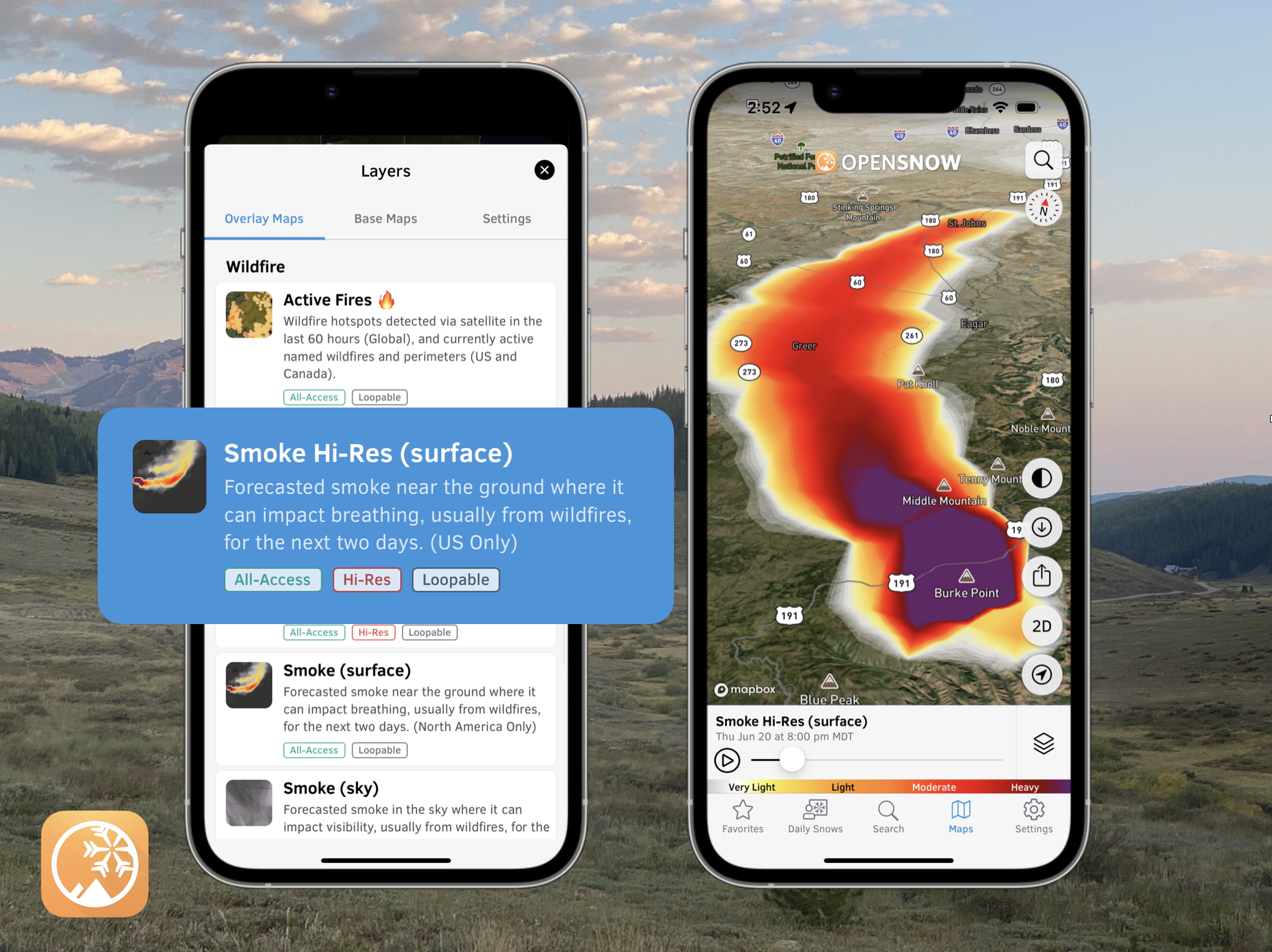
Smoke Hi-Res (surface)
Use this map to track smoke for the next 2 days near the ground where it can impact breathing. Updated every hour and available for the continental United States.
View → Smoke Hi-Res (surface)
Smoke Hi-Res (sky)
Use this map to track smoke for the next 2 days in the sky where it can impact visibility. Updated every hour and available for the continental United States.
View → Smoke Hi-Res (sky)
Smoke (surface)
Use this map to track smoke for the next 2 days near the ground where it can impact breathing. Updated every hour and available across all of North America.
View → Smoke (surface)
Smoke (sky)
Use this map to track smoke for the next 2 days in the sky where it can impact visibility. Updated every hour and available across all of North America.
View → Smoke (sky)
Active Fires (Free)
Use this map to track named fire incidents in the US & Canada, fire perimeters in the US & Canada, and satellite-detected hotspots, globally.
View → Active Fires
Here's an example of the free Active Fires map from the "Falls Fire" in eastern Oregon on Monday, June 22. Tap (mobile) or hover (desktop) over the map to view the details:

Here's an example of the smoke forecast from multiple fires in eastern Oregon on Monday, July 22:

Questions? Send an email to [email protected] and we'll respond within 24 hours. You can also visit our Support Center to view frequently asked questions and feature guides.
Sam Collentine
About The Author


