Boise Region Daily Snow

Heads up, there may be fresher snow! Read the latest Boise Region Daily Snow

By Matthew Platt, Forecaster Posted 1 year ago December 2, 2022

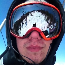
Well that was fun....

Summary

Only scattered showers remain in the region behind our storm. Not a whole lot going on for the next week or so. Looks like some showers move in this weekend and a whole lot of cold air! Let's take a look.

Short Term Forecast

The storm over the past few days performed about as expected. Tamarack and Brundage each got a bit over 24 inches and Bogus ended up with a bit over 10 inches. Not bad at all for an early season storm. As you can well imagine our snowpack is well above average. In face, if you take a gander at the graph below Tamarack is right around 130% of average!

There's not alot going on in the near future. Temperatures are going to be well below average and with the sun angle so low in the sky conditions should remain very good. 

The next storm arrives early Sunday morning. Initially I did not expect this to be much of a storm at all and the models certainly bore that out. However, over the past few days expectations have somewhat shifted and we may get a solid few inches to maybe even 6 inches of fluff. The storm will move in from the southwest and will be remnants of a strong Tahoe storm. 

I don't want to get anyone's hopes up so let's take a bit of a wait and see approach. But assuming the models stay the same then Monday could be a really solid day to ride. 

Extended Forecast

The next storm looks like maybe the weekend of December 10th. I really don't believe that yet though. The GFS ensembles don't support it nor does the Euro. Though the GFS and Euro Ensembles both show a return to snowy weather right around middle of the month. 

Nice part is the cold. Both models and their ensembles show significant cold over the entire USA. 

Take a look at that cold. Probably one of the coldest signals I have ever seen over the entire US. So good news is that riding will be great and the snow will be well preserved. 

Just to put how good this early winter has been across the northern hemisphere check out the graph below:

The snowpack coverage over the entire northern hemisphere is the highest it has been since we started keeping records 56 years ago. In this day and age of warming oceans and higher global temperatures, it is nice to see that the death of winter has been greatly exaggerated. 

Announcements

Obviously the backcountry will be very touchy for the next few days if not weeks. Please check out the different avalanche centers before you head out to your favorite backcountry locations!

Sawtooth Avalanche Center » Home

Payette Avalanche Center » Home

About Our Forecaster

Matthew Platt

Forecaster

Matthew graduated from the University of Nebraska in 2014 with a B.S. in Mathematics and now lives in Idaho with his family. He loves to camp, hike, ski, and explore Idaho with his wife and 3 boys. Matthew has been chasing powder for over a decade and forecasting for the Boise region since moving to the area in 2018.

Free OpenSnow App