Midwest Daily Snow

Heads up, there may be fresher snow! Read the latest Midwest Daily Snow

By Croix Christenson, Meteorologist Posted 1 year ago February 3, 2023

Cold Start Friday

Summary

Lake effect snow is still ongoing over portions of the south shore of Lake Superior and lower Michigan Friday morning as some of the coldest air of the season has settled into the area. Lake effect snow showers will linger Friday before another chance of snow arrives Friday night.

Short Term Forecast

A quick note on the next few forecasts (Friday-Sunday) might be posted irregularly as I will be on a short trip and will have limited internet availability. 

Friday:

Recent snowfall reports:

  • Bohemia in recent days has reported the following snow totals: 3, 3, 7, 10 (a 36-hour report), 7, and 4, and a 7-day total of 20" (although those reports add up to more!) 
    • The bottom line is they have had a lot of snow recently and had chair lift holds on Thursday so there will be lots of powder waiting Friday
  • So far Friday morning resorts in the Traverse City Region are reporting 2-4" over the last 24 hours and 2-7" over the last 72 hours
  • Nothing reported yet, but moderate to heavy snow was reported late Thursday and snow is still falling Friday AM in the western UP from Ironwood all the way up to Bohemia

Shanty Creek early Friday AM:

ABR early Friday AM:

It is brutally cold Friday morning with teens to low 30s below zero being reported in Minnesota and Wisconsin. Teens and single digits below zero were found in southern Wisconsin with single digits above and below zero in lower Michigan. Lake Superior is keeping the UP "warm" with temps near zero to teens below zero. 

Here is an estimate of temperatures this morning based on observed temperatures and model data:

Temperatures will "warm" into the teens in portions of lower Michigan and into the single digits below zero in northern Minnesota on Friday. Check ahead before heading to the slopes as some resorts have already adjusted their hours. 

With lake effect snow showers still ongoing early Friday morning, I think a couple more inches of snow is possible for the lake effect snow belts in the western UP and lower Michigan. Most models had the snow winding down by now but based on webcams early Friday that is not the case! 

Saturday:

Warming temperatures associated with a warm front will be welcomed after the bitter cold Friday. Highs will be mainly in the upper teens to 30s for the Midwest. 

Some light snow will be possible for the Lake Superior region and the northern half of lower Michigan with accumulations in the dusting to a couple of inches range. The best odds of seeing a few inches will be for Loch Lomond, Bohemia, and over to Searchmont. The better-organized snow may sneak down to Nub's Nob and Boyne Highlands area as well. A couple of inches cannot be ruled out for Lutsen with the return of winds from the south. For a brief period, they could see some lake-enhanced snow. 

Forecast precipitation types from the NAM:

Sunday:

Sunday looks to be similar to Saturday, milder with most of the light snow sticking to the Lake Superior region. Temperatures will continue to warm with some middle and upper 30s possible in the southern portion of the Midwest. 

Extended Forecast

First Full week of February (6-12):

  • Above normal temperatures on tap, 30s, 40s, and even 50s for highs cannot be ruled out
    • Likely lasts into the middle of February
  • Will be warm enough for the return of rain for some
  • Monday the 6th into Tuesday the 7th, the first chance of rain and snow arrives 
    • Snow quality will be wet/dense to medium-density powder
    • More details in the Saturday forecast update
  • A little better agreement (~50% of models) have another system around the 9th & 10th
      • This system would bring rain and snow to the Midwest

Fantasy Land Week of February (13-19):

  • Likely continue to see above-normal temperatures overall
  • About half of the models (~40-50%) have a larger system around 14-16 of February
    • This is a surprising signal for something 12 days away

-Croix

Announcements

Road Conditions:

Regions:

North Shore Lake Superior/Northeast Minnesota
Giants Ridge, Spirit Mountain, Mont du Lac, Lutsen, Bearskin, Loch Lomond, Mount Baldy

UP/South Shore Lake Superior/Lake Effect Snow Belt
Birkie, Whitecap, Powderhorn, ABR, Porkies, Snowriver, Ripley, Bohemia, Marquette Mtn, Ski Brule, Pine Mtn, Searchmont

Twin Cities Region
Trollhaugen, Wild Mountain, Powder Ridge, Hyland Hills, Afton Alps, Buck Hill, Welch Village, Mount Kato, Coffee Mill

Central Wisconsin
Granite Peak, Paul Bunyan, Nordic Mtn

Southern Wisconsin Region
Mt La Crosse, Cascade, Devil's Head, Tyrol, Little Switz, Sunburst, Wilmot, Alpine Valley(WI), Sundown(Iowa), Chestnut(Illinois)

Northern Lower Michigan/Traverse City Region/Lake Effect Snow Belt
Boyne Highlands, Nub's Nob, Boyne Mtn, Shanty Crk, Crystal Mtn, Caberfae, Treetops, Otsego

Southwest Lower Michigan/Grand Rapids Region/Kalamazoo Region/Lake Effect Snow Belt
Cannonsburg, Bittersweet, Timber Ridge, Swiss Valley

Southeast Lower Michigan/Eastern Michigan/Detroit Region
Mt Holly, Pine Knob, Mt Brighton, Alpine Valley(MI)

About Our Forecaster

Croix Christenson

Meteorologist

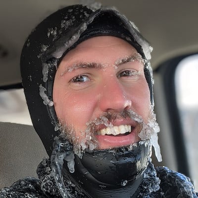
Croix grew up in Saint Paul, Minnesota where he developed his passion for the outdoors and snow. He attended the University of Wisconsin-Madison and received his BS and MS in Atmospheric Science. When not working, you will find Croix exploring his Duluth, Minnesota backyard by skiing, mountain biking, fishing, surfing, hiking with his dog Doppler, or just about any activity that gets him outside.

Free OpenSnow App