New Zealand Daily Snow

By Mike O'Connor, Meteorologist Posted 23 hours ago August 5, 2025
Heavy Rain turns to Powder as Storm Brings Icy Cold Change
Summary
A storm will bring rain, strong winds, and snow across NZ from Thursday. Snow will fall to low levels with a cold southerly change. Southern Lakes get a dusting Friday, Canterbury sees more snow through Saturday, and Ruapehu gets a boost into next week.
Short Term Forecast

Forecast for Wednesday 6th August
Mostly clear skies with some high cloud, but brisk north to northwest winds in open areas.
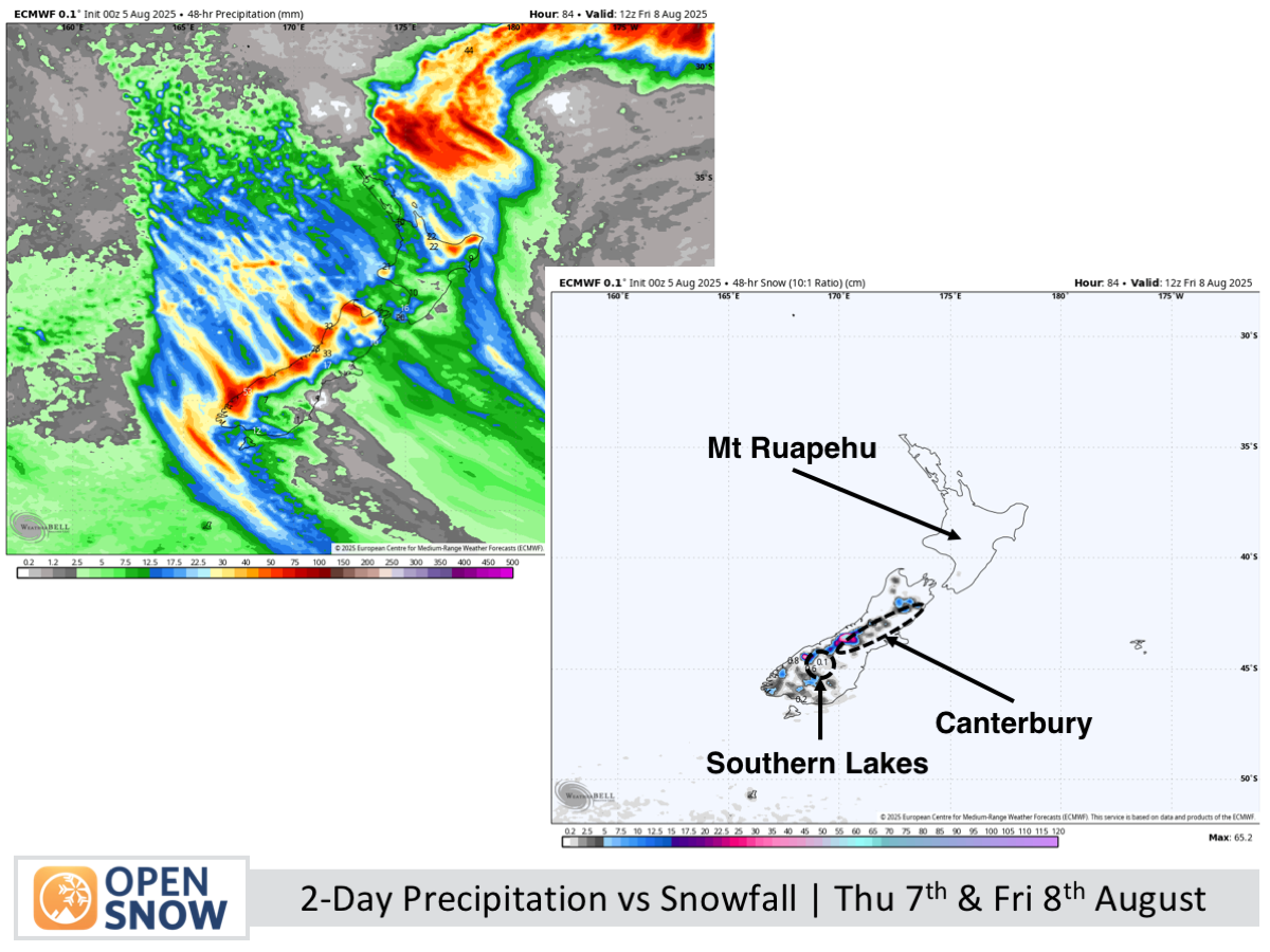
Forecast for Thursday 7th & Friday 8th August
Rain and mid- to high-level snow arrive in the Southern Lakes on Thursday, spreading to Canterbury later that day, with strong northwesterlies likely disrupting lifts. On Friday, a cold change brings low-level snow and fresh powder to Canterbury, while the Southern Lakes see scattered flurries.
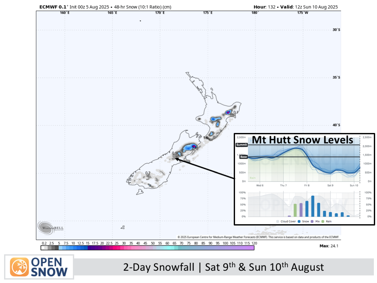
Forecast for Saturday 9th & Sunday 10th August
On Saturday, freezing southerlies bring cloud to the Southern Lakes and Mackenzie Basin, with stronger winds and more low-level snow in Canterbury. By Sunday, easing southeast winds clear skies in the south, while lingering snowfall in Canterbury gradually fades.
Extended Forecast
Cold temperatures persist from Monday to Wednesday (11th - 13th) as a high moves up the South Island, clearing snow in northern Canterbury and Mt Ruapehu while keeping skies calm in the south. On Thursday and Friday (14th & 15th), milder northerlies develop ahead of a likely storm arriving sometime next weekend.
Thanks for reading. The next forecast will be out on Friday.
Mike
About Our Forecaster


