New Zealand Daily Snow

By Mike O'Connor, Meteorologist Posted 2 days ago August 3, 2025
Snow Storm with Big Totals Possible Later This Week
Summary
Cold southerlies brought fresh snow and good snowmaking. Warmer, calmer weather midweek will give way to a front on Thursday with wind, rain, and high snow. A colder change on Friday may bring snow, but forecast models disagree on its strength.
Short Term Forecast

Forecast for Monday 4th to Wednesday 6th August
Mostly fine weather with some high cloud from Monday to Wednesday, and increasingly strong northerly winds, especially in Canterbury.
Forecast for Thursday 7th & Friday 8th August
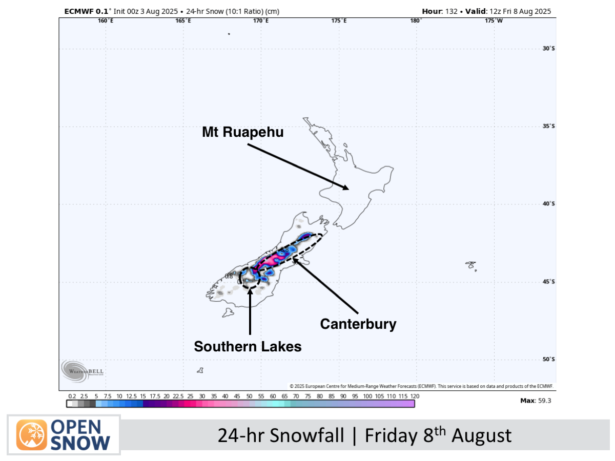
Rain arrives Thursday with upper-slope snow near the Main Divide and gale-force northwesterlies. On Friday, a cold change brings heavy low-level snow and possible blizzard conditions, with Canterbury likely to see the biggest totals.
Extended Forecast
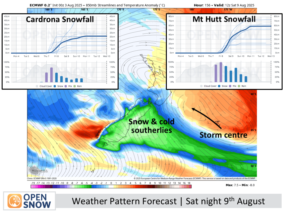
Snow is expected to linger in Canterbury on Saturday 9th August, while easing in the south and reaching Mt Ruapehu, before gradually clearing between Sunday and Tuesday (10th–12th August). However, with models still divided on the storm’s strength, snowfall totals remain uncertain until the next update.
Thanks for reading. The next forecast will be out on Wednesday.
Mike
About Our Forecaster


