Steamboat Daily Snow

By Joel Gratz, Founding Meteorologist Posted 3 years ago February 23, 2022
Snow Wednesday into Thursday
Summary
The storm is not over as flakes will continue to fall through Thursday morning.
Update
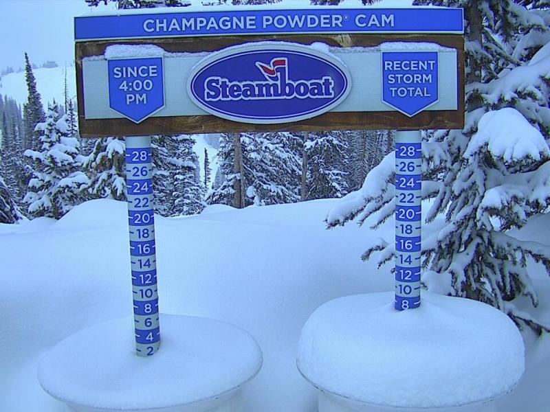
Following the 5 inches of snow on Monday night, Tuesday was dry, and we even saw some sun pop out of the clouds.
Then on Tuesday night, 2 inches of snow accumulated at the summit and at mid-mountain as another round of snow moved across the far northern mountains of Colorado.
On Wednesday, expect a mix of times of dry weather and periods of moderate to intense snow. The best chance to see some of this more intense snow will likely be during the late afternoon, so the last run of the day could offer somewhat deeper powder.
On Wednesday night, the wind direction will switch to blow from a favorable west or west-northwest direction, and this should bring a few more inches of accumulation. Keep your eye on Thursday morning for some soft turns along with chilly temperatures that won't be far from 0°F.
Thursday during the day will be dry and cold with a high temperature in the single digits.
Then on Thursday night, a storm will sneak into northern Colorado and we could get lucky with 1-4 inches of snow by Friday morning. Friday will be another cold day with a high temperature in the single digits.
Saturday will be dry, sunny, and warmer with a high temperature in the 20s. Then Sunday, Monday, Tuesday, and Wednesday will be warm with highs in the 30s. We could see a few flakes on Monday night into Tuesday but I doubt that we will see meaningful accumulation.
Looking far ahead, snow might return as early as Thursday, March 3, and then there is a good chance for a storm (or two) to move through the western US and the Rockies during the March 4-8 time frame. While odds are high that some areas of the western US will see significant snow during this time, it's too early to know how this storminess will impact us here in Colorado.
Thanks for reading and please check back each morning for daily updates!
JOEL GRATZ
Meteorologist at OpenSnow.com
Snow conditions as of Wednesday morning
New snow mid-mountain:
* 2” (24 hours Tuesday 500am to Wednesday 500am)
* 2” (Overnight Tuesday 400pm to Wednesday 500am)
New snow summit:
* 2” (24 hours Tuesday 500am to Wednesday 500am)
* 2” (Overnight Tuesday 400pm to Wednesday 500am)
Last snowfall:
* 7” Monday Night to Wednesday (Feb 21-23)
Terrain
* 14 of 17 lifts
* 169 of 169 trails
* Latest update
Snowpack compared to the 30-year average:
* 86%
About Our Forecaster


