US & Canada Daily Snow

By Alan Smith, Meteorologist Posted 4 years ago April 7, 2021
April powder days ahead for Washington, BC, and Alberta
Summary
An active pattern will set up across the Northwest U.S. and Western Canada over the next several days. Ski areas that are still open and have a chance to score late-season powder days include Mt. Baker, Stevens Pass, Grouse Mountain, Fernie, Kicking Horse, Marmot Basin, Banff Sunshine, and Eaglecrest.
Short Term Forecast
Northwest favored this week
Two storms will impact the Northwest over the second half of this week with cold air and low snow levels expected by April standards. A number of resorts in Washington, British Columbia, Alberta, and Alaska are still open and will enjoy some late season powder between Wednesday and Saturday.

Forecast for Wed, Apr 7 – Thu, Apr 8
The first of two storms late this week will bring moderate to heavy snow to British Columbia, Washington, and Alberta on Wednesday and Thursday with falling snow levels. Lighter snow will extend south and east into portions of Oregon, Idaho and Montana.

Forecast for Fri, Apr 9 – Sat, Apr 10
A second storm will impact the Northwest on Friday and Saturday with snow levels remaining low. British Columbia will be favored for the deepest totals, while Western Alberta and Northern Washington should also do well.

Forecast for Sun, Apr 11 – Mon, Apr 12
Most ski regions will start to dry out during this period, while a storm in the far north will bring heavy snow to the coastal ranges in Alaska.

Extended Forecast
Outlook for Tue, Apr 13 – Sat, Apr 17
Most major ski regions will warm up and dry out during this period with spring snow conditions expected. Exceptions will be a possible storm for the Front Range of Colorado around April 13th-14th and a relatively active storm track for the coastal ranges in Alaska where more snow should fall.

Thanks so much for reading! Check back for my next post on Wednesday, April 14th.
ALAN SMITH
Announcements
Check out our summer service, OpenSummit
Plan your next adventure with expert-level weather data that’s easy to use.
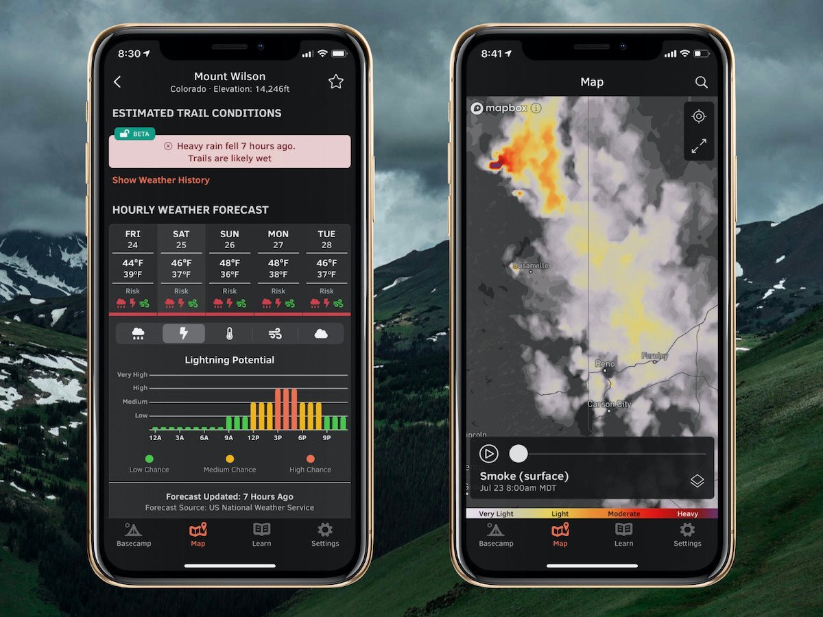
With OpenSummit, you can quickly...
- See if a trail is dry or wet based on recent weather trends.
- View color-coded risk assessment for rain, lightning, and wind.
- Track smoke from wildfires and forecast this smoke for the next 18 hours.
"If you are a person who likes to hike, bike, or just visit the high country and want to have the most accurate weather forecast at various elevations, OpenSummit is absolutely the best app." – Ed, iOS App Review
Download → OpenSummit App
About Our Forecaster


