News

By Bryan Allegretto, Forecaster Posted 5 years ago August 14, 2019
Did Anyone Accurately Predict the 2018-19 Winter Season?
Each August, as we start hearing outlooks for the upcoming winter season, we find it amusing to go back and look at the forecasts from this time last year.
I'm sure some of you find it incredible that forecasters even attempt a forecast 4-6 months out when they struggle to get the forecast right 4-6 days out.
A recent YouTube video forecast for the upcoming season already has over half a million views. Maybe we are hoping to see our area shown with a forecast for above-average snowfall, and we hope there is some validity to the science behind that forecast. Or nervously laugh it off if the forecast is for below-average snowfall.
One thing is for sure, skiers wish they could know the forecast for next season 6 months in advance, especially as they are buying their seasons pass and new gear in the off-season.
"What's going to happen this winter?" is the #1 question we as forecasters get this time of year. More specifically here in California, it has been, "what does the cool summer so far mean for snow this winter?".
Can Forecasters Actually Make an Accurate Forecast 3-6 Months before Winter?

The track record for U.S. forecasters making accurate winter predictions has been so bad in the past, that here at OpenSnow we don't even attempt to publish an official forecast for the upcoming season. Our forecasters will analyze other forecasts and make their own guesses for their region as we get closer to winter, but we focus on shorter-range snow forecasts aimed at accuracy.
When I first started forecasting I remember being told, "the forecast models lose 10% of their accuracy for each day they forecast out into the future".
That would mean 0% accuracy beyond 10 days!
The actual stats are a bit different than this general rule of thumb, but 10 days is still about the limit of a skillful forecast for individual storm systems.
While we cannot predict specific storms more than 10 days out, forecasters do try to predict general trends months in advance, such as the chance that an area will be colder or warmer than average, or wetter or drier than average.
What Did the Forecast Models Show Us Last Year?
The long-range forecast models are heavily used by forecasters when they are putting together their winter forecasts. One of the first things they look at well in advance of the upcoming season is the forecast for the sea surface temperatures, especially in the ENSO regions along the equator which will signal a possible El Niño or La Niña.
This time last year (August 2018), the forecast models were pointing towards a weak to moderate El Niño for the 2018-19 winter season.
This is shown by the red color west of South America, denoting warmer-than-average water temperatures.

Most of the winter forecasters and forecast models will look at the forecast for El Niño and compare it to historical weather patterns during similar El Niño events. Here is a typical weak El Niño weather pattern for the U.S. based on historical records.

We saw the forecast models like the CFSv2 predicting a similar wet pattern across the southern U.S. for last winter.

Typically we would see a warmer western U.S. and a colder eastern U.S. The CFSv2 was predicting warm temperatures for the entire U.S.
Meanwhile, WeatherBell's Pioneer model was predicting a more typical pattern with colder air in the eastern U.S.

What Were Forecasters Predicting for Temperatures?
Most forecasters and forecast outlets were releasing very similar forecasts last summer and fall for the upcoming winter season. They were predicting the typical weak El Niño pattern of a warm western U.S. and cold eastern U.S. Here are the temperature forecasts from several outlets.
NOAA

Weather Channel

WeatherBell

Wilhite Wx

KMVT

So what actually happened last winter?
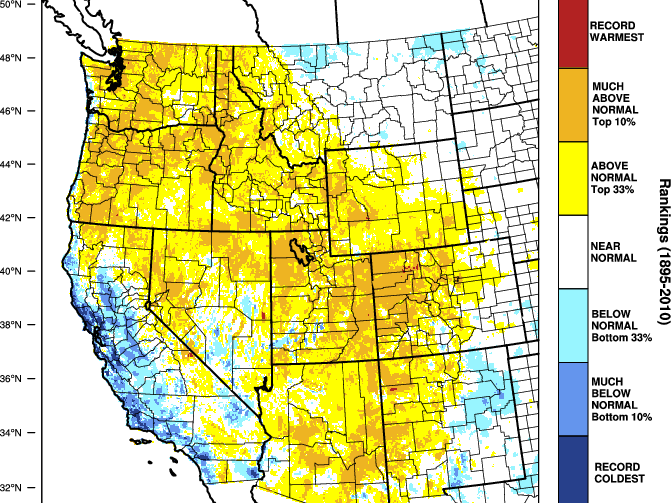
The temperature pattern ended up being almost the exact opposite December through February!

What Were Forecasters Predicting for Precipitation?
For precipitation, most forecasters seemed to be staying in line with the typical weak El Nino pattern and with the forecast models, predicting above-average precipitation across the southern U.S.
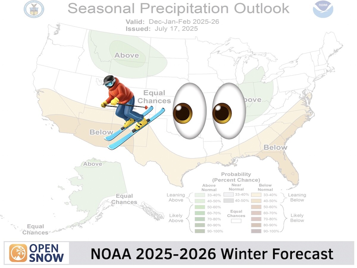
NOAA

Most of of the forecast outlets also produce a 'type-of-precipitation' forecast, not just a total precipitation forecast, so that they can show areas with above or below-average snowfall.
Here is a look a the 2018-19 winter forecasts from several forecast outlets last year.
Accuweather

OnTheSnow

Farmers' Almanac

Old Farmer's Almanac

First Hand Weather

Ski Southeast

Weather Works

Most of them show a similar pattern of warmer in the West, Colder in the East, wetter across the South and up the East Coast, and drier in the West. The exception with the precipitation forecast seems to be a wetter western U.S. on Weather Works, and a wetter U.S. as a whole on the Old Farmer's Almanac.
But no one got the forecast correct, as most of the U.S. ended up having above-average precipitation by the end of February!

Most Importantly, What Were Forecasters Predicting for Snowfall?!
Most predictions were for the cold air and above-average precipitation to bring above-average snowfall to the eastern U.S., and below average for the western U.S.
WeatherBell

Accuweather

First Hand Weather

Neo Weather

All of them were again showing colder and wetter weather in the southeast U.S. leading to above-average snowfall, and drier in the western U.S. with below-average snowfall.
The exception was Accuweather's above-average snow forecast for Tahoe (California), but this 'above-average' forecast was based on reasons that did not actually occur
By the end of February, we ended up with a much different result! The colder air didn't spend much time in the Southeast, and most of the snowfall in the Eastern U.S. was confined to far northern New England.
It was much colder and wetter than expected in the West, leading to above-average snowfall in most locations.

So What Went Wrong?
The winter season forecasts 3-6 months out are heavily weighted on long-term patterns like sea surface temperatures along the equator. There are many more short-term patterns that occur through the winter season that can change the weather pattern, especially during a weak El Niño or La Niña season.
The very weak El Niño didn't seem to be affecting the weather pattern too much through January. Then in February, shorter-term weather phenomenon may have influenced the weather pattern as an active MJO (Madden Julian Oscillation) was stalled over the Pacific. We also had a weaker AO (Arctic Oscillation) going into February. Both the MJO and the AO can only be predicted 1-2 weeks out.
The activity of the MJO and AO in February may have helped to flip the pattern to one where the west was cool and stormy.
The positive PNA pattern on the left is more common during a weak El Nino (warmer in the west), but during February we actually saw the negative PNA pattern on the right (colder in the west).

In fact, it was so snowy in Tahoe that several ski resorts broke records, recording over 300 inches in a single month! Here is the storm track we saw throughout the month.

If February had been an average snowfall month in Tahoe, we would have only had an average to the slightly above-average season, similar to the forecast I made for Tahoe at the beginning of the season.
But February was so cold and snowy for the western U.S. that it destroyed the winter snowfall forecasts for just about all of the forecasters and forecast outlets.
That led to average to an above-average snowpack for most of the western U.S. by the end of the winter season!

So How Do I Plan My Powder Skiing 3-6 Months In Advance?!
The simple answer is, you can't!
It would be pure luck to nail a powder trip this far out for the winter season. The winter forecasts coming out this time of year are based on scientific weather models and long-term patterns that could affect our weather this winter based on history. But the skill is not there yet to make a reliable winter forecast 3-6 months out.
Some forecasters will use years of experience to adjust what the models are predicting, and a few forecasters could get it right some years. But as you can see above, most of the predictions for temperature, precipitation, and snowfall were completely off for last season. There are too many short-term patterns through the winter season that can't be forecasted more than 1-2 weeks out, and it is these short-term patterns that can control whether a certain region is cold and snowy or warm and dry.
Technology will continue to advance and someday we may be able to accurately and consistently forecast the weather patterns 3-6 months in advance!
Until then, stay tuned to OpenSnow throughout the winter season. We will be working hard to get you accurate snow forecasts within a reasonable 5-10 day range!
BA
About The Author


