News

By Joel Gratz, Founding Meteorologist Posted 11 years ago October 28, 2013
Weather for this week - Oct 28 to Nov 1, 2013
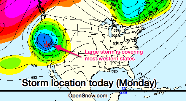
The weather this week will be dominated by a large, slow-moving storm that will bring snow to Tahoe, the Rockies, and the upper midwest.

The storm is swirling over much of the western US as of Monday morning. Source: Map by Meteostar, Analysis by OpenSnow.com.
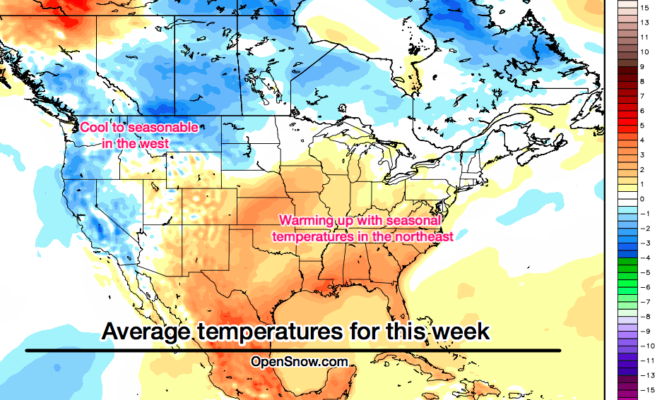
This storm will keep temperatures cool across the west, but allow things to warm up over the east. Importantly, the northeast won't warm up too much, so overnight snow making efforts should continue until temperatures warm further this weekend.

Average temperatures this week, compared to normal. The scale is in degrees Celsius. Source: Map by WeatherBell.com, analysis by OpenSnow.com.
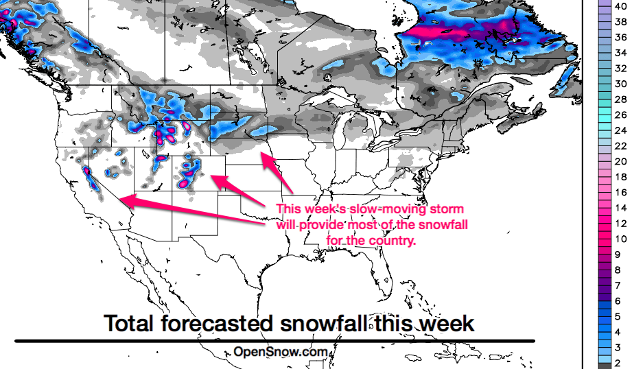
Snowfall this week will be mainly comfined to Tahoe, the Rocky Mountains of Idaho, Montana, Wyoming, Utah, and Colorado, and also areas of the upper midwest focusing on South Dakota. The highest amounts will likely top one foot and fall over the higher peaks of Colorado, Utah, and Wyoming,

Source: Map by WeatherBell.com, analysis by OpenSnow.com
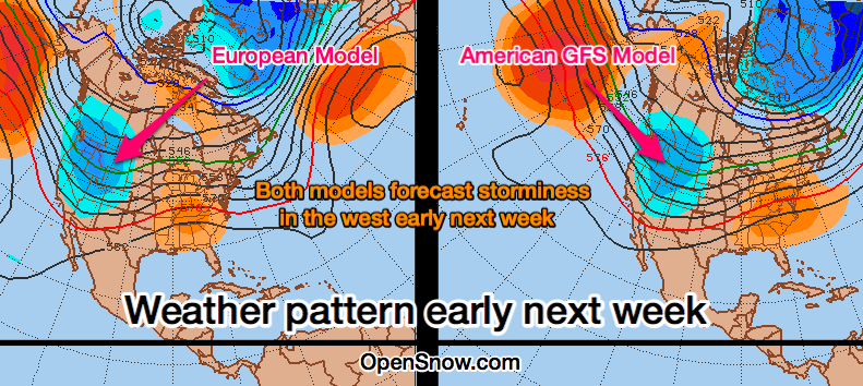
And finally, the big question is always "What's next?" Warmer weather and rain will hit New England on Saturday-ish, then temperatures will cool with a chance for snow showers Sunday into early next week. In the west, the models are hinting at a relatively active pattern setting up along the northern coast and Rockies, and I hope this forecast turns out to be correct!

Source: Map by Penn State e-wall, analysis by OpenSnow.com.
With the large storm pushing through the west this week, use these links to find out more details about where the snow will fall and how much will accumulate.
Links to detailed forecasts for each state and mountain
JOEL GRATZ
About The Author


