Colorado Daily Snow

By Joel Gratz, Founding Meteorologist Posted 10 years ago April 8, 2014
Summary:
Additional powder fell Monday night in the northern mountains, so there are more soft turns to enjoy Tuesday morning. The rest of the week will be warm and mostly sunny, then a storm will bring snow late Saturday night through Sunday night, with the most snow falling along and east of the divide. We should see another storm around Wednesday, April 16th-ish.
Details:
I don't have first-hand knowledge of yesterday morning's powder in northern Colorado, but reports from friends say it was very fun with nobody on the hill. One surprise from yesterday's storm was that after a lull in the afternoon, another wave of snow came through last night with 1-2 inches falling for most areas along and north of I-70, and up to 5-6 inches falling at Loveland. That means there will still be soft turns this morning. Enjoy!
A large ridge of high pressure is now over the western US. This is deflecting the moisture and storms to the north into Canada.
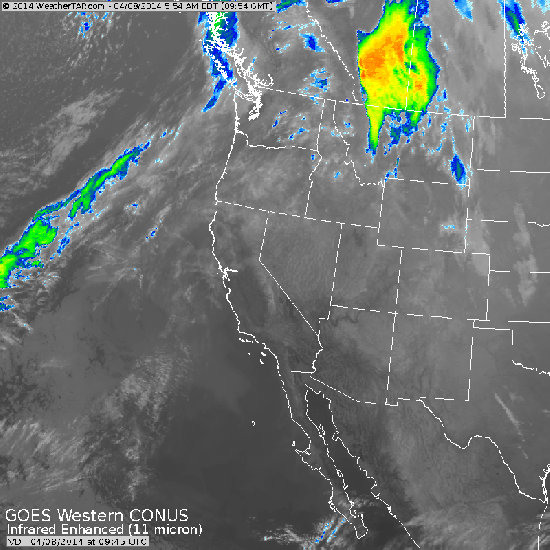
Monday morning satellite image showing most of the action heading north to Canada. The western US will be dry for the rest of the week. Source: Weathertap.com
This week's temperatures will hit 70s on the plains and low elevations of western Colorado, 50s to near 60 for many mountain towns, and upper 40s to low 50s on most slopes. Skies will be mostly sunny, though there could be more clouds and a quick shower from Wednesday afternoon through Thursday afternoon.
The next storm will move in on Saturday night and will last through Sunday evening. Ahead of the storm, we might see a shower on Saturday with more clouds and cooler weather, but the heaviest snow should wait to fall until late Saturday night into Sunday. This storm will similar to the storm we saw during the middle of last week, where up to a foot of snow could fall along and east of the divide (targeting Eldora and the nearby foothills, though Loveland, Abasin, and Winter Park might also do well). Mountains west of the divide might see 2-4 or 3-6 inches, while the plains east of the divide might also see 2-4 or 3-6 inches of snow. Sunday should be a fun powder day ... stay tuned!
Long Range:
After Sunday's storm departs, next Monday should be dry, followed by a weak to moderate storm sometime around Wednesday, April 16th. After that, the models are trending toward dry weather for the weekend of April 19/20, with perhaps a return to active weather for the last 10 days of the month.
JOEL GRATZ
About Our Forecaster
Joel Gratz
Founding Meteorologist
Joel Gratz is the Founding Meteorologist of OpenSnow and has lived in Boulder, Colorado since 2003. Before moving to Colorado, he spent his childhood as a (not very fast) ski racer in eastern Pennsylvania.
Free OpenSnow App


