Colorado Daily Snow

By Joel Gratz, Founding Meteorologist Posted 9 years ago September 10, 2014
Summary:
Mountain weather will be mostly dry and tranquil Wednesday through the weekend. Along and east of the divide, expect showers on Wednesday morning, a strong cold front and snowflakes on Thursday night, then a chilly day on Friday with warmer temperatures for the weekend.
Details:
As the rain showers moved across the state on Tuesday night, temperatures cooled enough to produce snow down to about 11,000ft, mostly in the mountains along and north of I-70. Here are a few webcams that showed the snow as as of about 8am Wednesday morning.
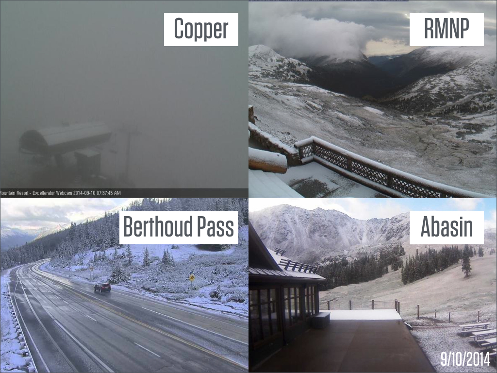
Snow fell on many mountains over 11,000ft last night. "RMNP" means "Rocky Mountain National Park". Most of these webcams are positioned around 11,500ft. Source: Mountain Cams / OpenSnow.com
The last of the rain showers are now moving through eastern Colorado on Wednesday morning, while sun breaks out over the western mountains.
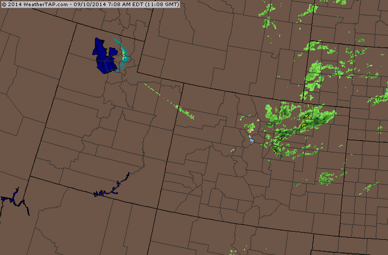
Wednesday morning radar. Source: Weathertap.com
In total, this storm dropped anywhere from 0.50 inches up to 3.0 inches. The map below is mostly derived from radar, and since radar doesn't do well in the mountain because the radar beam is sometimes blocked, I have a feeling that some mountain areas picked up more than what the map shows.
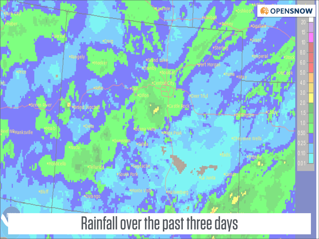
Estimated rainfall from the storm. Source: NWS
Wednesday and Thursday will be nice days over the mountains while the plains east of the mountains deal with low clouds on Wednesday and then a nice day on Thursday.
The next big weather story is a strong cold front that will move through Colorado on Thursday evening.
Most mountain locations won't see much of an effect from this front as temperatures will cool a few degrees Thursday night with frost possible in the north, and that's about it.
However, the foothills and plains east of the divide will see temperatures plummet on Thursday evening and a chance for snow and freezing temperatures on Thursday night. Elevations over 6,000ft have the best chance to see accumulating snow and temperatures at or below 32F on Thursday night. For the bigger cities (Denver, Boulder, Ft Collins, etc), expect some snow flakes mixed with rain drops on Thursday night with temperatures hovering around freezing, but likely just above. For a few hours on Thursday night the jet stream will be overhead, and this could produce a few bands of heavier precipitation. This heavier precipitation could cool the air enough to drive snow down to the lower elevations, so watch out (hope!) for this to happen. Overall, this cold front and possible snow shouldn't affect driving around the cities, but the foothills should turn white with at least a dusting!
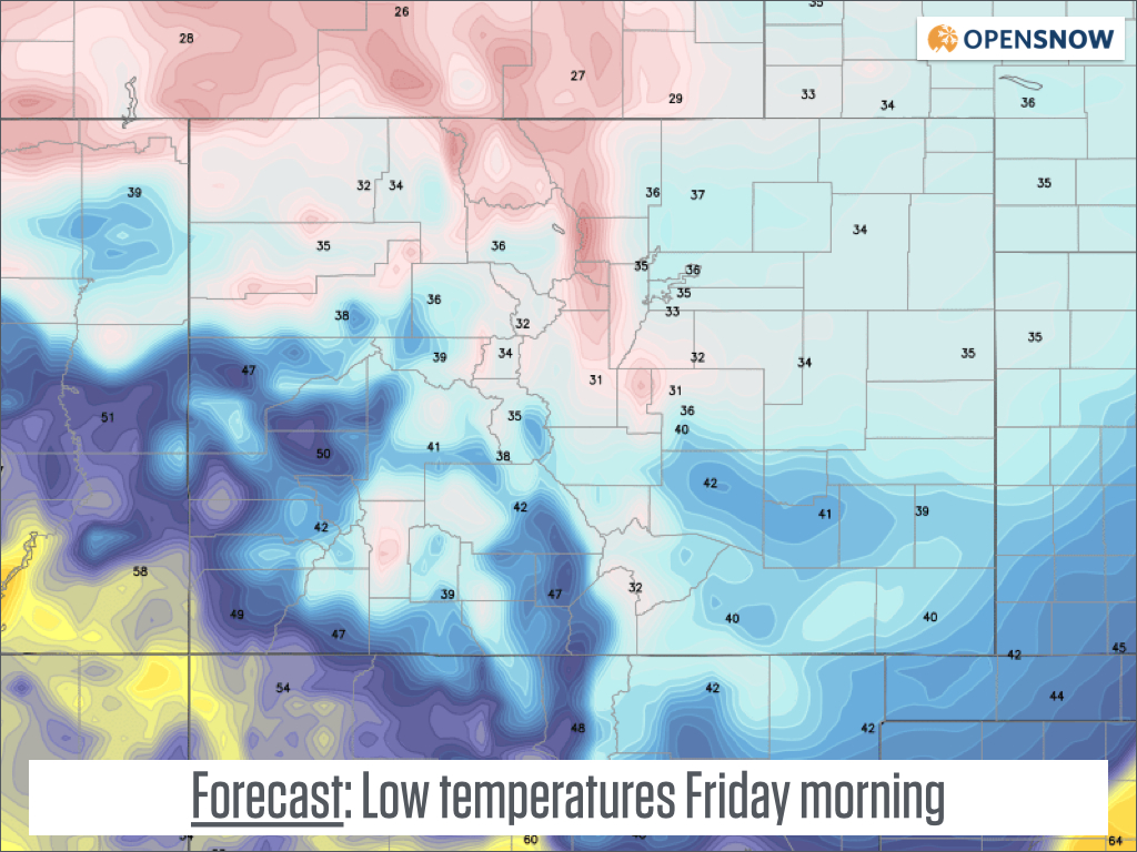
Forecast low temperatures on Friday morning. It'll be close to freezing over the eastern plains, so bring in your sensitive plants just in case! Source: Weatherbell.com
Saturday and Sunday will be dry for all of Colorado with average-ish temperatures. Most of next week looks dry as well, with just a low chance of an afternoon shower over the mountains around mid week. Overall, after the cold front on Thursday night, it looks like we're in for at least one week of calm, beautiful September weather. Get out to enjoy it!
JOEL GRATZ
About Our Forecaster
Joel Gratz
Founding Meteorologist
Joel Gratz is the Founding Meteorologist of OpenSnow and has lived in Boulder, Colorado since 2003. Before moving to Colorado, he spent his childhood as a (not very fast) ski racer in eastern Pennsylvania.
Free OpenSnow App


