Colorado Daily Snow

By Joel Gratz, Founding Meteorologist Posted 9 years ago November 24, 2014
And it's only November
Summary:
- Snow continues Monday for northern Colorado, 3-6 inches
- Low to zero accumulations Monday night
- Another round of snow for northern Colorado Tuesday into Wednesday AM
- Dry Wednesday through next Monday
- Storm likely on Tue/Wed Dec 2-3
Details:
I hope you had a good day on the hill Sunday, or are getting out today. Conditions along and north of I-70 are likely going to top out today, so try not to miss it:-) I had to remind myself a few times yesterday that it was only November 23rd. The snow was awesome!
The best accumulations from on-and-off snow squalls on Sunday and Sunday night occurred along and north of I-70 where 4-8 inches accumulated on top of the 4-7 inches that fell on Saturday night.
Here's the storm total so far at Steamboat (stake has not been cleared during the storm). About 3 inches fell quickly between 4-6am on Monday, and I expect another few inches on the stake by mid-morning on Monday.
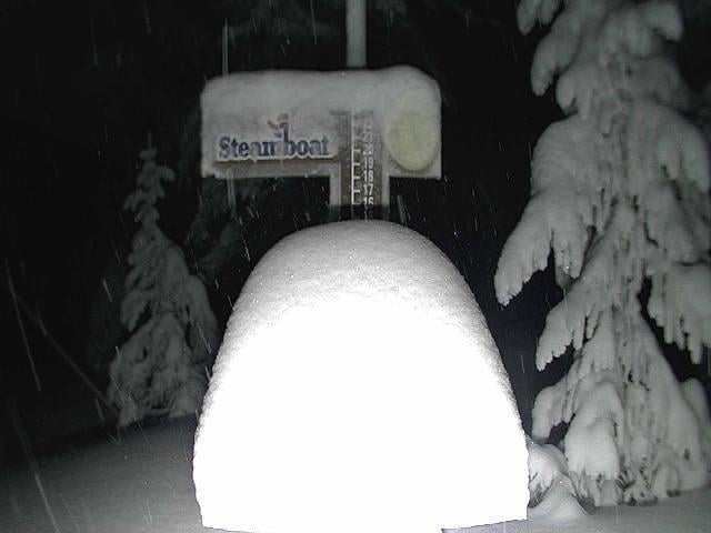
Steamboat snow stake.
The good news is that another wave of energy will move over Colorado Monday morning through midday and this will help to lift the air and create more snow. I have another 4-7 inches in the forecast for favored spots along and north of I-70 today, and this snow will mainly fall before about 1pm. You can see the wave of energy as the green colors on the infrared satellite image as of 6am Monday morning.
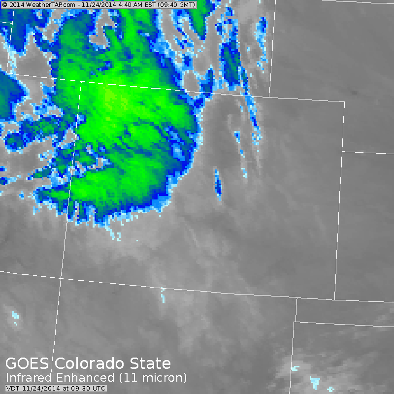
Infrared satellite animation ending at 6am Monday. Source: Weathertap.com
So for the forecast...
Monday: Moderate to heavy snow for northern Colorado through midday with 4-7 more inches. Further south a few more inches will fall.
Monday night: Snow tapers off and/or ends by evening. Little to no additional accumulation, so I don't think there will be a lot of untouched snow on Tuesday morning except if new terrain opens.
Tuesday through Wednesday AM: Moisture will increase for I-70 and north, and the models are forecasting 12+ inches of snow. I don't think this will happen as temperatures will be warming by 10-12 degrees starting on Tuesday midday. Northern Colorado usually sees the best snow with cold or cooling temperatures (like on Sunday/Monday) not with warming temperatures. I put about 3-6 inches in the forecast for this time. It's possible that I'm underplaying this scenario, we'll see. I do expect the powder to settle on Tuesday afternoon into Wednesday with the warmer temps, so even if there is a lot of new snow that falls it will likely feel heavier than the powder on Sunday and Monday.
Wednesday through next Monday: Dry. The more active weather will be up north around British Columbia and the Pacific Northwest.
Next storm: Probably on Tuesday December 2nd or Wednesday December 3rd. Early indications are that all mountains will see snow, so hopefully the favoritism of the northern mountains will even out a bit. Also, this storm could bring heavy snow to Tahoe on Monday December 1st which is great news - they need it!
JOEL GRATZ
PS - Want an early holiday / festivus present? We're giving away a pair of Wagner Custom Skis! Enter the contest here: http://opsw.co/1yyV1pB
About Our Forecaster
Joel Gratz
Founding Meteorologist
Joel Gratz is the Founding Meteorologist of OpenSnow and has lived in Boulder, Colorado since 2003. Before moving to Colorado, he spent his childhood as a (not very fast) ski racer in eastern Pennsylvania.
Free OpenSnow App


