Colorado Daily Snow

By Joel Gratz, Founding Meteorologist Posted 9 years ago December 21, 2014
Heavy snow Sunday night into Monday
Summary:
- Snow increasing during the day on Sunday
- Heaviest snow should fall Sunday evening through Monday morning
- Additional light to moderate snow will continue Monday & Monday night
- Another storm likely on Thursday, Christmas Day
- Best powder will be last run Sunday, Monday, first run Tuesday, Thursday
Details:
The storm is almost here, and there is a lot of snow heading our way. The radar image on Sunday morning shows lots of action to our west, and we'll start to see snow increase by midday Sunday and Sunday afternoon.
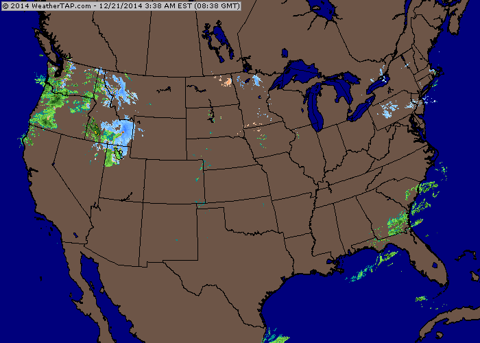
Sunday morning radar. Source: Weathertap.com
The heaviest snow should fall Sunday evening through Monday morning. During this time, there could be road closures due to the high snowfall rates limiting visibility and the plows not being able to keep up with the accumulations. Also during this time, the band of heavier snow should overwhelm the negative affects of a northwest wind for some areas of the central and southern mountains, so I increased snow amounts for these areas, and also shifted the heaviest snow amounts for the northern mountains to Sunday night into Monday morning. Here are my snowfall forecasts for all mountains: http://opsw.co/CO1-5
Snow will continue on Monday with additional accumulations, and the northern mountains could see another few fluffy inches (or more?) on Monday evening and Monday night, which would make Tuesday morning fun as well.
Here is the National Weather Service snow forecast through Tuesday. I think it's overdone in spots as 24+ inches will be on the high side and not the average, but still, there's a ton of snow heading our way, and about the only places that won't see 12+ inches will be the southern San Juans.
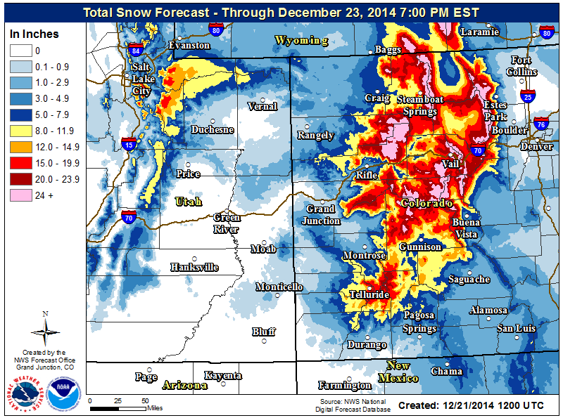
Snow forecast from the National Weather service, Sunday through Tuesday. Source: NWS
The best powder from this storm will be on Sunday last run, Monday, and perhaps also on Tuesday morning.
Then we'll dry out Tuesday afternoon and Wednesday before the Christmas Day storm brings another 4-8 inches to the central and northern mountains with a powder day likely on Thursday.
It's going to be a fun week ... I hope you'll be skiing!
JOEL GRATZ
PS - We are launching a new way to support OpenSnow and get a few additional features & discounts. It's called the OpenSnow All-Access Pass and it's only $19/year and replaces our Pro ($20) and SuperPro ($45) memberships. It's less money than our previous packages, and provides $10 discounts to both Liftopia and skis.com, so the benefits are worth more than the price of the subscription. Thanks for checking it out: http://opsw.co/1wrOOOb
About Our Forecaster
Joel Gratz
Founding Meteorologist
Joel Gratz is the Founding Meteorologist of OpenSnow and has lived in Boulder, Colorado since 2003. Before moving to Colorado, he spent his childhood as a (not very fast) ski racer in eastern Pennsylvania.
Free OpenSnow App


