Colorado Daily Snow

By Joel Gratz, Founding Meteorologist Posted 8 years ago November 24, 2015
Some clarity around this week’s storm
Summary
Snow will fall on Colorado from Wednesday night through Monday, and I think the heaviest snow and the best chance of a powder day will be around Wolf Creek on Friday and Saturday.
The Colorado Daily snow is brought to you by…
… your recently opened Arc’teryx Equipment Denver Store. For a pinnacle brand experience and a full selection of Arc’teryx gear, visit us in the Cherry Creek North Shopping District. Enter in-store for your chance to win an Arc’teryx Cerium LT Hoody, the perfect down jacket for Colorado. Contest ends December 31st, 2015. For more information about the Arc’teryx Denver Store, visit http://opsw.co/1OC65OF
Details
I want to start by saying that the upcoming storm is going to basically stall over the western US and wobble around for 5 days, and this is NOT a situation that leads to forecasts with high confidence. Below I will do my best to give you a general guide to this storm after looking at many different models and many runs of each model.
The first shot of snow from will fall between about Wednesday at midnight through Thursday afternoon. For most areas I only have 2-4 inches in the forecast, and that might be overdone. The European model holds together a decent band of snow that moves across the state from west to east, while other models dissipate this band of snow.
I am somewhat more confident in higher snow amounts along and east of the divide, around Eldora, where will see some upslope flow (wind from the northeast). Along with this northeast wind, very cold air will move into the plains and eastern foothills with light snow for the Denver metro area.
Here is the American GFS model’s precipitation forecast from Wednesday night through Thursday. Multiply the numbers by about 15 to estimate snowfall.
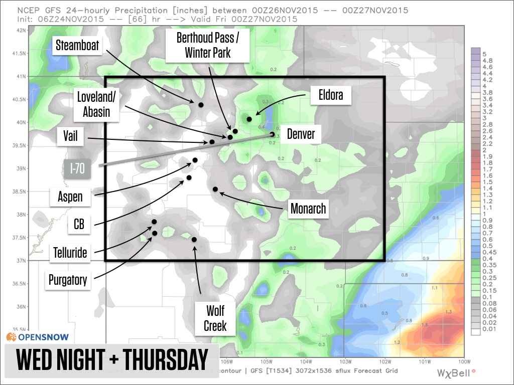
Source: Weatherbell.com
On Thursday night and Friday, the brunt of the storm’s energy and wind direction will favor the southeastern mountains. In the image below, I think the precipitation forecast for most of central Colorado (Aspen, Crested Butte) is overdone, while I do agree that Monarch and Wolf Creek have the best chance for heavier snowfall.
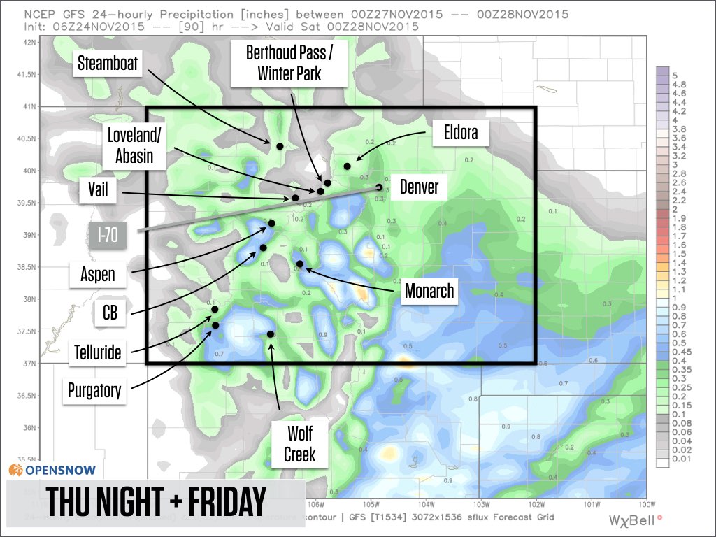
Source: Weatherbell.com
Then on Friday night through Saturday, precipitation amounts could stay on the light side for most areas while Wolf Creek, and perhaps Monarch, continue to see moderate snowfall.
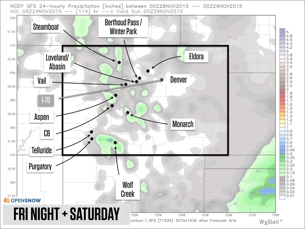
Source: Weatherbell.com
From Saturday night through Sunday, another wave of energy from this storm could increase the snowfall. I have the highest confidence that Wolf Creek would see the most snow from this wave, with less snow elsewhere.
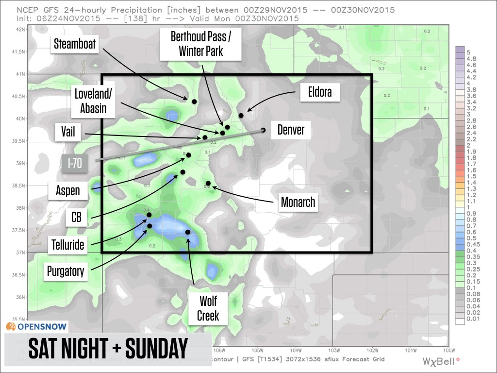
Source: Weatherbell.com
And finally from Sunday or Sunday night through Monday, winds should shift to blow from the west and northwest as the storm moves to our east, and this new wind direction should favor the northern mountains with light to moderate snow.
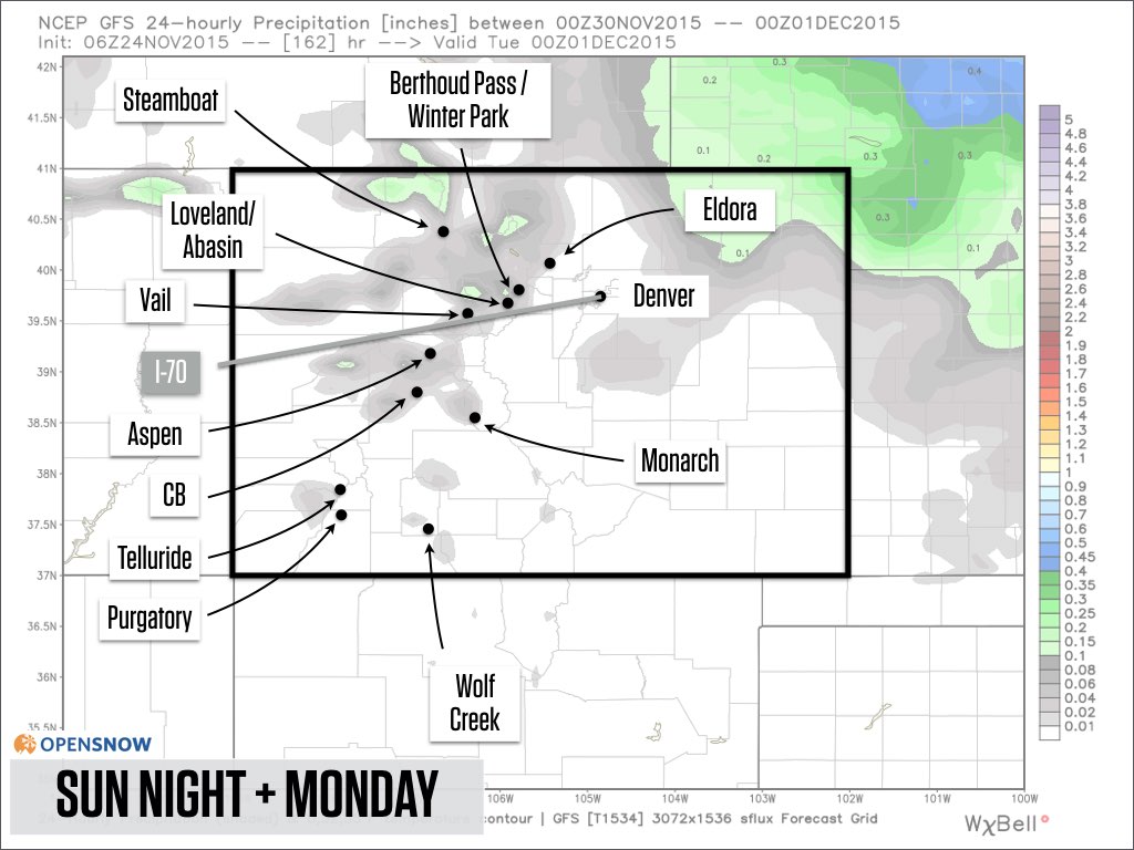
Source: Weatherbell.com
I know that there is a lot going on here, and that you still might have more questions than answers about how this storm will impact your holiday weekend skiing. I feel the same way!
My best attempt at a summary is this: If you’re looking to chase powder, I have the highest confidence that Wolf Creek is your best bet on Friday and Saturday with perhaps 12-18 inches of total snow, and I have medium confidence that Monarch will also get decent snow as well (maybe double digits?). The best powder in the central and northern mountains will likely wait until Sunday or Monday.
Total storm accumulations between Wednesday night and next Monday should be 18+ inches around Wolf Creek, with perhaps 5-10 inches for most other mountains. The total numbers do look good, but remember that this is a 5-day storm, so for most mountains, most of the time, the snow will be very light.
I guarantee you that this forecast will change as the models work to figure out the timing and location of each wobble of this storm. I’ll write a new post on Wednesday morning with an update, or will update sooner if I am confident in any new information that comes from the models.
Looking ahead to next week, there is a chance for another storm around Wednesday December 2nd (plus or minus a day).
As we move into the first and second week of early December, a classic El Nino pattern will develop with a ridge of high pressure (dry weather) over the northern US and central Canada, and a trough of low pressure (stormy) over the north-central Pacific Ocean.
What this means for Colorado is unclear. We could stay dry if the northern ridge is strong, or storms could eject from the trough in the central Pacific Ocean and sneak into the western US if the entire pattern shifts just a bit to the east.
The main takeaway for the early December forecast is that the pattern is changing from what we’ve seen during the last 6 weeks, but how this changing pattern will affect snowfall is not clear. If and when a clear trend emerges in the 7-15 day forecasts, I’ll let you know.
Thanks for reading!
JOEL GRATZ
About Our Forecaster
Joel Gratz
Founding Meteorologist
Joel Gratz is the Founding Meteorologist of OpenSnow and has lived in Boulder, Colorado since 2003. Before moving to Colorado, he spent his childhood as a (not very fast) ski racer in eastern Pennsylvania.
Free OpenSnow App


