New England Daily Snow

By Brian Clark, Meteorologist Posted 9 years ago November 24, 2014
The Bad, Then (Maybe) The Goods
Some housekeeping first. With quite a few resorts having already opened up or opening up by Thanksgiving weekend, I will start daily updates just after the Thanksgiving holiday. Thanksgiving is an extremely busy time for me because of the ski shop that I work in, so the updates will probably start over the weekend. Of course, I will be sure to update between now and then to cover any significant weather, which we may very well have later this week.
So the bad news first: we have some rain on the way. After a fantastic week of snowmaking temperatures last week, a storm cutting up to our west will bring us back to the reality that it's still just late November and not January. Temperatures will rise well into the 50's on Monday and rain could be heavy at times, especially in the morning. Showers will then continue into Monday night.
Let's not dwell too much on the bad news though because there is something much more exciting to talk about. Models are indicating that a strong coastal storm will form Wednesday night, intensify, and move up the coast on Thanksgiving. Coastal storms are always good news for us snow lovers when there is cold air available for the storm to tap into. Thankfully, that cold air will be available. There is still quite a bit of uncertainty though. That uncertainty lies in the exact track of the storm. There is significant disagreement between the major forecasting models as to the weather the storm stays close enough to the coast to bring the resorts of NH and ME a significant snowfall. As of right now, the Euro model and the GFS show a major and moderate snowfall respectively, while the NAM model keeps the storm too far out to sea to bring much of anything to the region. I'm not able to show you the Euro model for licensing reasons, but there are snapshots of the GFS and the NAM at 7 p.m. on Wednesday evening:
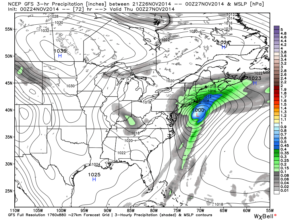
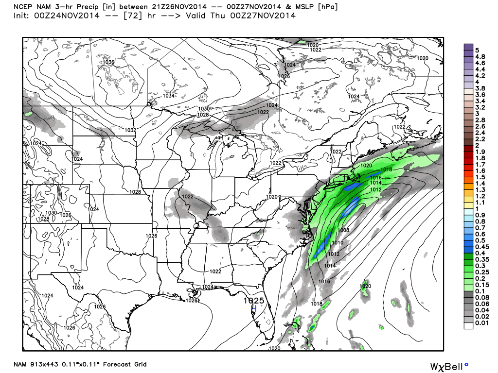
So as you can see, there's a stark difference here in how much effect the storm has on us. Unfortunately, with so little model agreement, it's tough for me to make a call on this storm at this point with any sort of confidence. What I will say is that right now, the NAM is the outlier as the only model showing the storm completely going out to sea. Although sometimes this could mean that the NAM is onto something that the other models haven't picked up on yet, it's more likely that the opposite is true.
About Our Forecaster
Brian Clark
Meteorologist
Brian lives in the Mount Washington Valley and works at one of the best ski shops in New England, Stan and Dan Sports in North Conway. He also teaches at Attitash Mountain Resort and runs a growing business that sells and repairs computers and smartphones.
Free OpenSnow App


