Tahoe Daily Snow

By Bryan Allegretto, Forecaster Posted 9 years ago November 21, 2014
Update Friday PM:
European model on the 12z run jumped on board with systems the weekend after Thanksgiving. That's a change from the discussion below.
Summary:
The ski resorts are reporting anywhere from 1-9 inches overnight, with the most near Donner Summit. The next storm will move in tonight with high snow levels that will slowly drop through Saturday. We could see several inches of snow above 8000 ft. on the mountains. By Sunday the ridge of high pressure builds along the West Coast bringing dry weather through Thanksgiving. The next chance of a storm is the day after Thanksgiving.
Details:
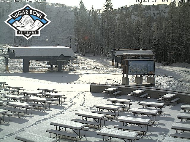
The NW corner of the Tahoe area near Donner Summit saw the heaviest snowfall yesterday evening. Snow levels came down to 7000 ft. pretty fast and came down to lake level 6200 ft. towards the end. It stayed rain most of the storm in Truckee. Reports this morning of 4-5 inches on Donner Summit at 7000', 2 inches at 7200' on Echo Summit, and a coating at lake level. The ski resorts on the East side of the lake and South of the lake are reporting an inch or two. Boreal and Squaw are reporting 5 inches, Alpine 6 inches, and Sugar Bowl is reporting 9 inches up top.
Here is a shot of the base of Sugar Bowl this morning.
The next storm is already pushing onshore this morning. We will see precip begin to fall tonight into Saturday morning. Snow levels are on the rise and should start out around 9000 ft. tonight as the precip starts. By Saturday morning the snow levels look like they will fall near 8000 ft., and then 7000 ft. by Saturday afternoon as the precip moves out. The heaviest precip looks like it will fall Saturday morning as snow levels are near 8000 ft. Therefore, most of the snow accumulations should stay above 8000 ft. We may see snow down to 7000 ft. before it ends but not expecting nearly as much to accumulate.
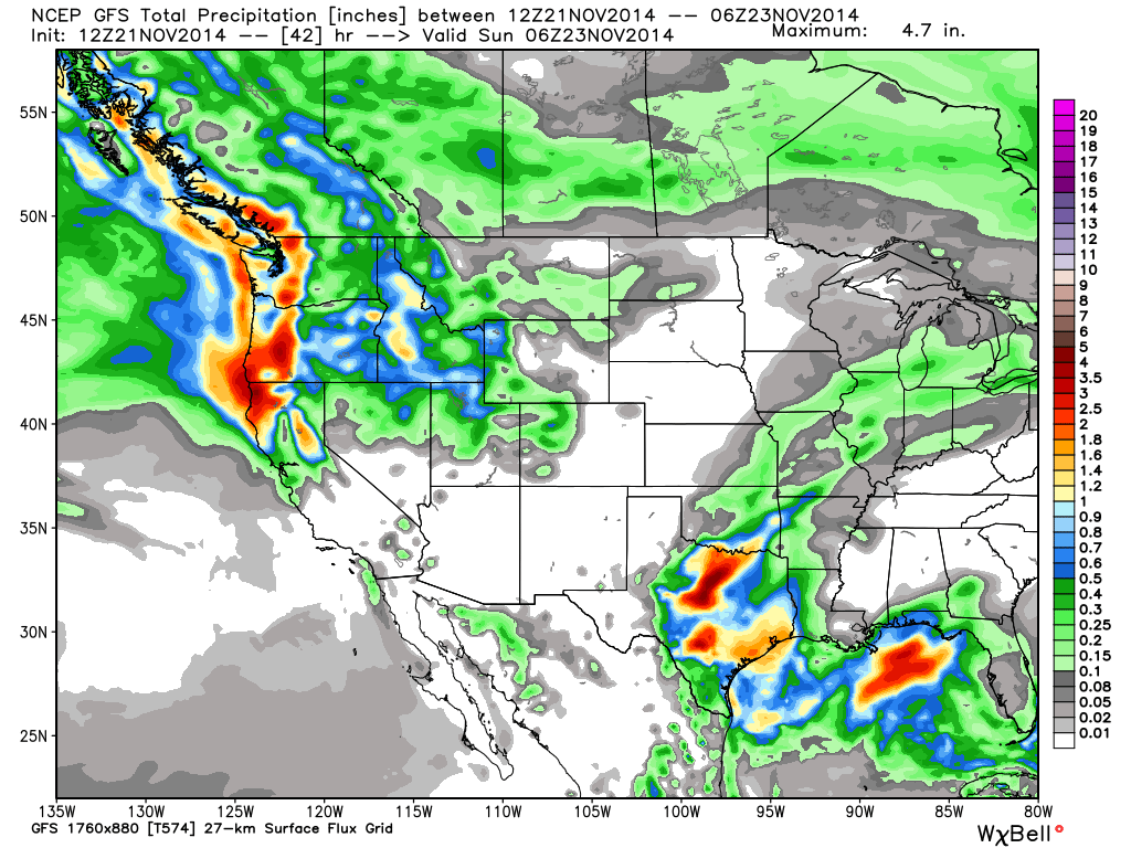
Looking at the latest forecast model runs this morning they are slightly wetter. We could see 3-6 inches on the mountains above 8000 ft. on the East side of the lake and 6-9 inches on the West side. I would guess about a third of that is possible down to 7000 ft. Winds will also be an issue with high winds expected on the ridge tops with this system.
Here is the GFS forecast for total precipitation by Saturday night.
By Sunday the ridge is building in strong along the entire West Coast pushing the storm track well up into Canada. Temperatures should warm up pretty nicely as well with highs possibly breaking 60 at lake level by mid-week. Here is a nice look at the high pressure ridge on the GFS model.
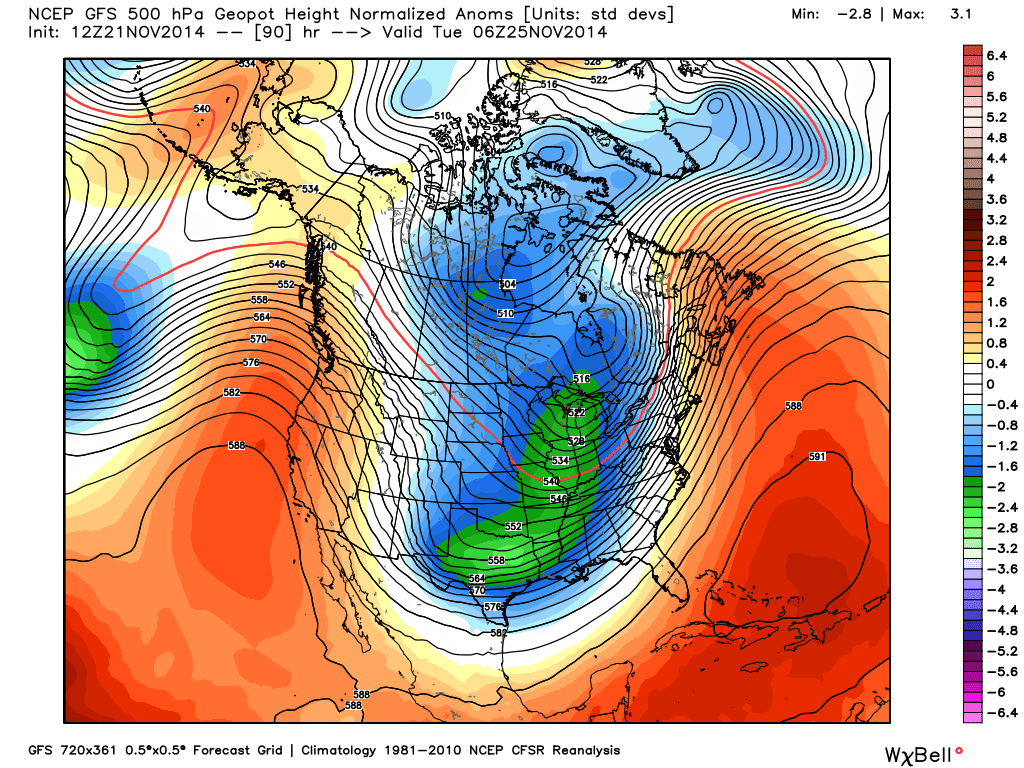
I know many of you are pretty tired of hearing about the ridge after 3 dry years. It's still early, the expected pattern this Winter is for the ridge to be further North with the Southern branch of the jet stream coming underneath into CA.
Long-Range:
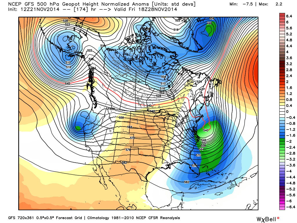
The GFS model continues to show the ridge retrograding away from the coast by Thanksgiving allowing a system to drop in from the Northwest next Friday. The European model runs continue to show the ridge holding along the coast. Here is the GFS height forecast showing the low pressure moving in next Friday.
What is interesting is that the GFS and the European forecast models both show the PNA (Pacific North American) teleconnection pattern flipping to negative phase by the end of next week. That would support a West Coast trough pattern. The European models also suggest the MJO signal is progressive into phase 3 which would also support a pattern change. Some of the other models keep it stalled and weakening.
Hopefully this is a sign the pattern will try to change towards the end of the month into the first week of December into a stormier pattern for us.
Stay tuned....BA
About Our Forecaster
Bryan Allegretto
Forecaster
Bryan Allegretto has been writing insightful posts about snow storms for over the last 15 years and is known as Tahoe's go-to snow forecaster. BA grew up in south Jersey, surfing, snowboarding, and chasing down the storms creating the epic conditions for both.
Free OpenSnow App


