Tahoe Daily Snow

By Bryan Allegretto, Forecaster Posted 9 years ago April 2, 2015
Dusty Morning...
Summary:
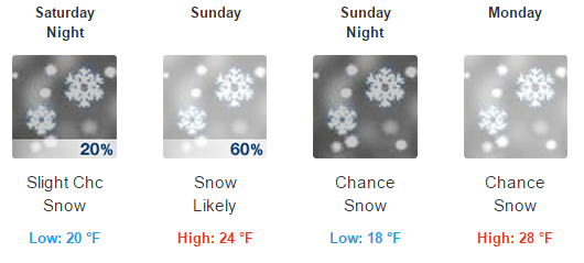
Cold air is in place with some clouds and light snow flurries still hanging around the mountains on the East side of the basin. We will see sun and slightly warmer temperatures Friday into Saturday. Sunday another cold trough arrives with even colder air and snow. Highs may only be in the 30's at lake level Sunday into Monday and 20's on the mountains. Snowfall amounts Sunday night into Monday morning could be in the 1-3 inch range at lake level and 3-6 inches on the mountains. A second system moving in Tuesday could bring similar snowfall amounts. After a break next Wednesday into Thursday we could see another storm the weekend of the 10th.
Details:
Some dustings of snow around the are this morning from snow showers overnight. The precip moved down from the North into Truckee overnight and slid South down the East side of the basin and brushed South Lake. Northstar and Mt. Rose reported an inch of snow overnight.
Temperatures will warm about 10 degrees the next 2 days with sun. The next cold trough pushes through on Sunday with much colder air and snow. This storm does not have a lot of moisture with it, but it will be cold with snow levels well below lake level into Reno. A conservative estimate is still 1-3 inches at lake level and 3-6 inches on the mountains. We could see slightly more on the mountains especially West of the basin along the crest. This is a cold storm too so there could be extra fluff.
It won't be a t-shirt weather Easter for skiing. Here is the forecast for 8k Olympic Valley.
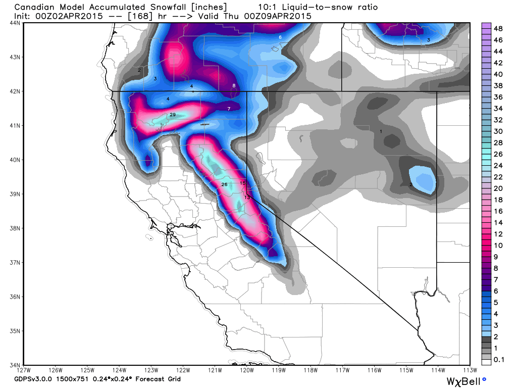
Monday we should have a break before the next system pushes in on Tuesday. Currently this storm looks as if it will drop similar snowfall amounts. These aren't big storms but if they roll in the way they look right now we could see a foot of snow on the upper mountains with more along the crest in total through Tuesday. Here is the Canadian snowfall forecast through Tuesday.
Long-Range:
After a break next Wednesday and Thursday we may see another trough the weekend of the 10th. The European model runs show the next trough by Friday the 10th. The GFS is delaying until later in the weekend.
After that the ensemble runs are all over the place on the pattern, but it looks like we could possibly see more storms through mid-month. If the MJO loops back through phases 1-2-3 again that could help. If not it is cut off low season so we could see more systems rolling around near the coast that are a pain to forecast.
Stay tuned...BA
About Our Forecaster
Bryan Allegretto
Forecaster
Bryan Allegretto has been writing insightful posts about snow storms for over the last 15 years and is known as Tahoe's go-to snow forecaster. BA grew up in south Jersey, surfing, snowboarding, and chasing down the storms creating the epic conditions for both.
Free OpenSnow App


