Tahoe Daily Snow

By Bryan Allegretto, Forecaster Posted 8 years ago September 20, 2015
Fall Seesaw....
Summary:
The meteorological Fall has already begun and Autumnal equinox is coming up on Wednesday. The weather is already responding with cool troughs starting to interrupt the warm ridges. Last weekend it was hot with highs in the 80's. By the middle of this past week it was much cooler with highs in the 40's and 50's. Now we are back close to 80, but another cool trough will cool us back into the 60's this week.
Details:
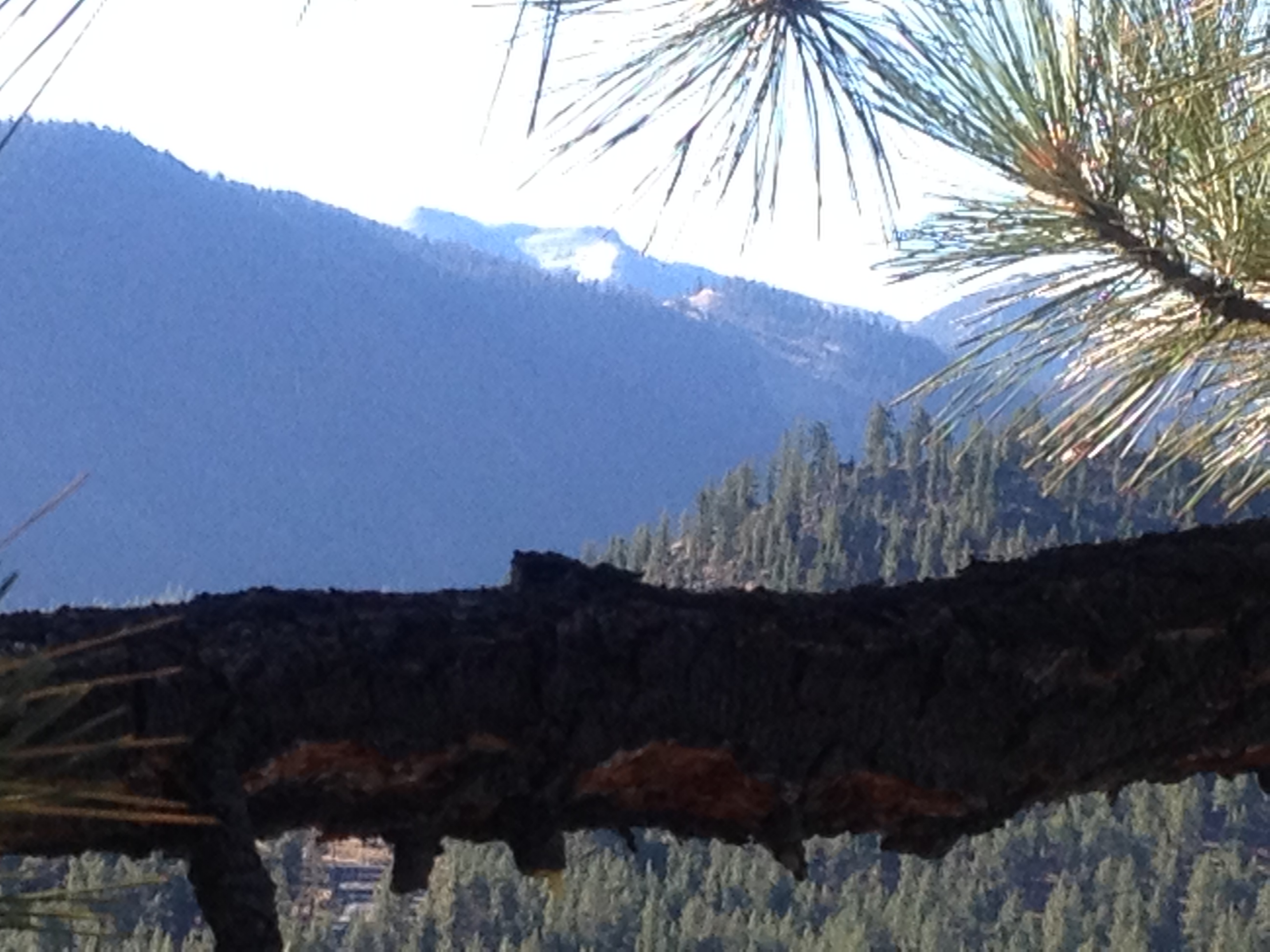
We saw some precip Wednesday around the basin. There were some light snow showers on Donner Summit during the afternoon while I was out working on the snowcat getting it ready for winter. Wednesday night we saw rain and I was curious if the snow levels were down near 8000 feet. It may have snowed that low, but it didn't stick. The top of Sugar Bowl Thursday morning was just brown. Higher up above 9000 feet there was some accumulation on the mountains. Below is a ready photo taken of the top of Heavenly Thursday morning.
The weather is warm again today for the ironman race. Good news is that there doesn't seem to be much smoke in the air. It was pretty thick earlier this week. The ridge off the coast is going to retrograde this week allowing another trough to dig into the Pacific NW. That will bring cooler weather by midweek into next weekend. The precip looks to stay into Washington and Oregon.
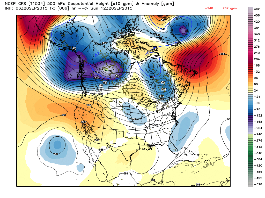
Here is the current pattern with the ridge near the coast and high pressure over CA.
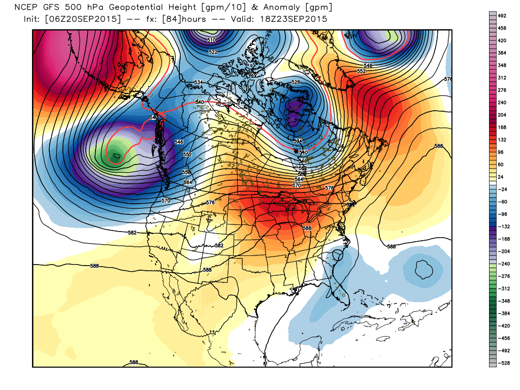
Here is the forecasted pattern on the GFS model by Wednesday with the trough pushing into the Pacific NW and cooler air moving Southward.
Several runs of the forecast models show the possibility of the trough digger further down the West Coast the following week with even cooler air.
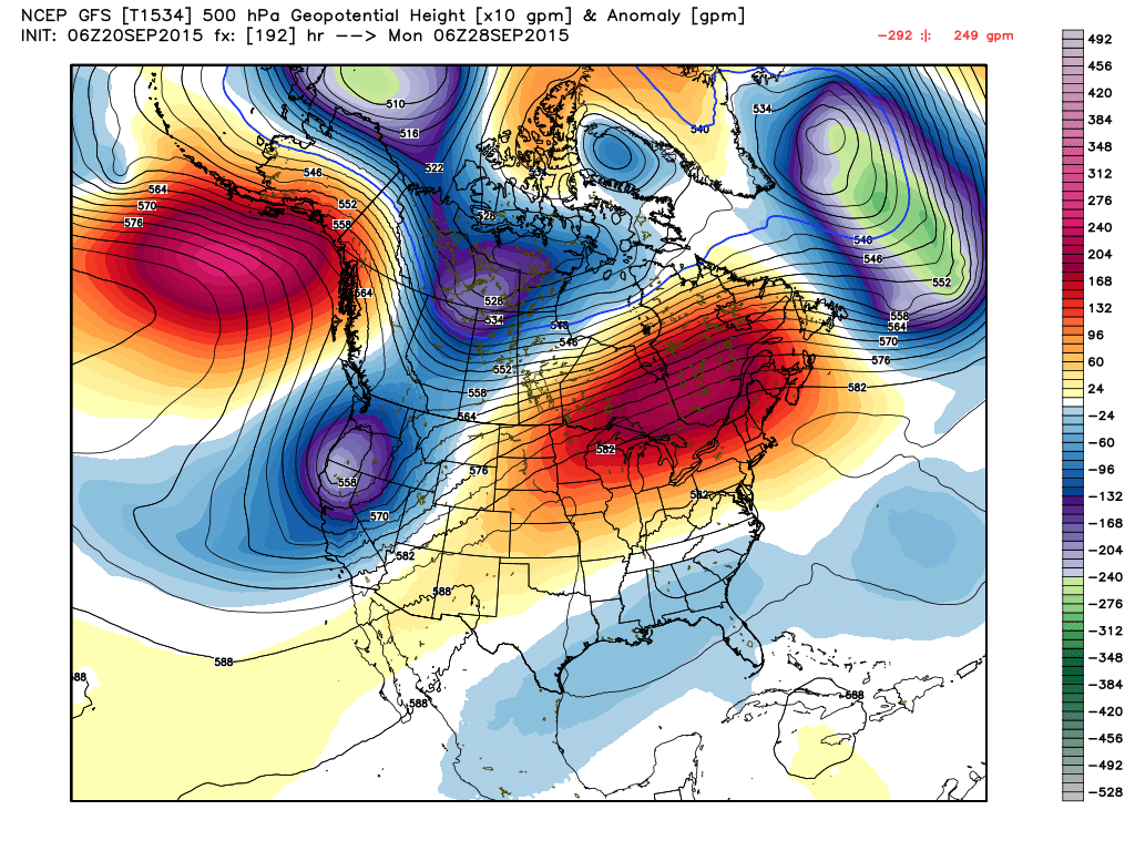
Not much precip being shown with these troughs into Northern CA, yet.... The jet stream will continue to strengthen during the Fall and the chances for precip with the cool troughs will increase. A couple runs of the GFS hinted at some precip the first week of October.
Long-Range:
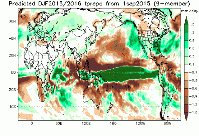
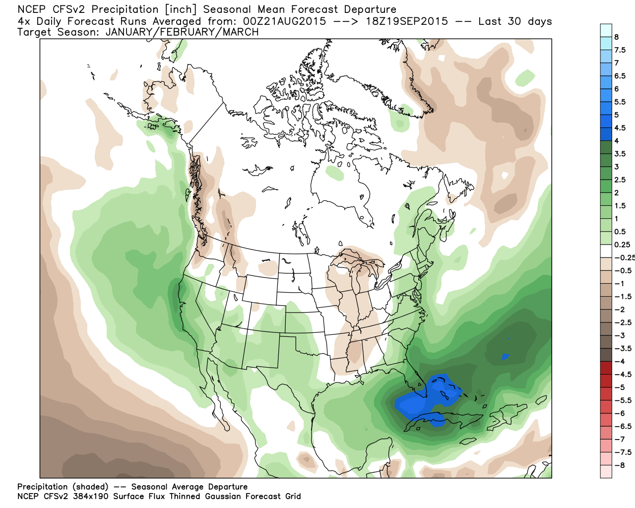
Not much change in the outlook for Winter as we continue to monitor the climate forecasts and conditions that could affect the winter weather pattern. The latest Jamstec continues to show above average precip for CA during the winter.
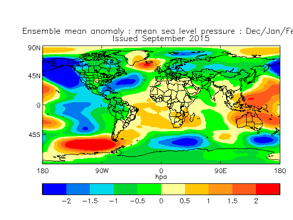
That's based on both the strong subtropical jet stream into Southern CA from El Nino and the trough hugging the West Coast as seen below.
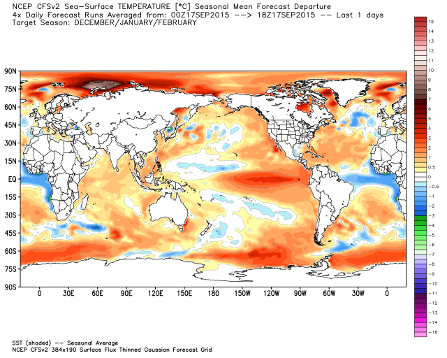
There is still some controversy out there about how close to the West Coast the trough sits most of the Winter. The 82 and 97 strong Nino events did not have the amount of warm water in the Eastern Pacific we have now and the argument is still being made that the trough is further off the Coast and a stronger ridge over the Pacific NW coast down to Northern CA. Many forecasters were using the unreliable CFSv2 Sea Surface Temp forecast to backup their forecasts that the warm water would erode from the wind with the strong jet stream and colder water would push towards the West Coast. The CFSv2 has backed off of that forecast, now showing the warmer water remaining, and showing a slightly weaker El Nino than before for the Winter months.
I talked in the last post about the El Nino not looking like it will go over 3 degrees celcius above average into "Godzilla" territory as some models showed earlier in the Summer. The resorts are still using the Godzilla El Nino language though to market for this Winter. All regions did continue to warm the past week, and are well into impressively Strong El Nino territory.
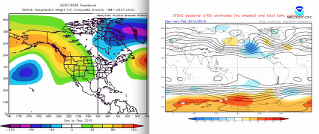
Here is an interesting look at where the CFSv2 put the trough for the Winter forecast last September (on the right), the same place it has the trough for this Winter. On the left is what actually happened with the trough out near Hawaii.
Was it the SST's in the Eastern Pacific or Western Pacific that caused the error in the forecast? If it was Western then the big cool down in the Western Pacific currently may help create a different pattern this Winter. If it was the warm water in the Eastern Pacific then we have the same for this Winter, and the CFSv2 SST forecast shows the warm temps staying now. That is leading some forecasters to argue the trough won't necessarily hug the West Coast. Others say the strong El Nino negates it all.
Either way it still gives me pause to going all in and saying above average precip and snowfall is a guarantee this Winter. But leaning towards better than 50/50 chance we have above average precip. The majority of climate models have above average precip and so do ours. Plus history is on our side. We will have our Winter snowfall forecast for each resort out next month.
The climate models for the Fall continue to show average or even below average precip through December. Historically in strong El Nino events we see above average snowfall in November, but that is not showing up yet. Of course the CFSv2 was wrong almost every month last year on the precip forecast.
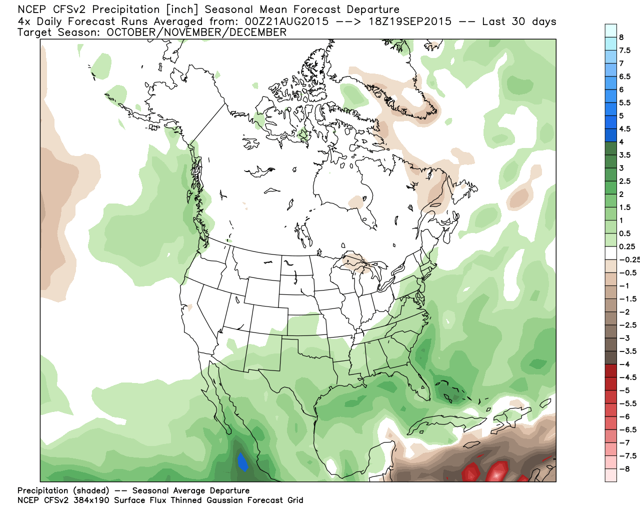
Right now the expectation is that the above average precip for CA will occur Jan-Mar
The last time we had decent snowfall in January was during the moderate El Nino event of 09-10.
For now we just keep watching and waiting. Hopefully some more of these cool troughs will continue to move through. I'm loving the Fall weather when we do get it.
Stay tuned.....BA
About Our Forecaster
Bryan Allegretto
Forecaster
Bryan Allegretto has been writing insightful posts about snow storms for over the last 15 years and is known as Tahoe's go-to snow forecaster. BA grew up in south Jersey, surfing, snowboarding, and chasing down the storms creating the epic conditions for both.
Free OpenSnow App


