Upper Midwest Daily Snow

By Andrew Murray, Technical Founder & Meteorologist Posted 9 years ago December 13, 2014
Fog finally turning to snow!
After a solid week of miserable fog hung over the Upper Midwest with a ridge over the central part of the country, a strong low is expected to move into the region on Monday to help clear the air and bring some much needed snow (and normal temperatures) back.
Sunday looks like another day of well-above normal temperatures for the Upper Midwest with low cloud levels and temperatures in the low 40s for much of the area. Along with the low clouds, there is a chance that many areas will get a misty drizzle during the day as the airmass begins to move a bit during the Sunday afternoon hours. However, because of the higher temps, it will all fall as rain.
As for the storm Monday and Tuesday. The low pressure that brought flooding rains the California and blizzard conditions to the Rockies and Sierras will be making its way to the Upper Midwest. While a lot of the moisture has already fallen across the western US, an extra kick from a trough dropping down from the Dakotas should be enough to bring decent snowfall to a larger area.
For now, both the European and upgraded American model showing this interaction taking place along a large swath of central Minnesota into Northern Wisconsin and the UP. Areas underneath this swath should, even with temperatures struggling to get below freezing quickly, see at least 3-6" during a quick 24 hour burst. Areas outside direct path of the low will be less lucky, with snowfall rates lacking to produce anything more than an inch or two. Most of the snowfall will occur during Monday evening and Tuesday morning, however, lake effect snow should continue throughout the day on Tuesday.
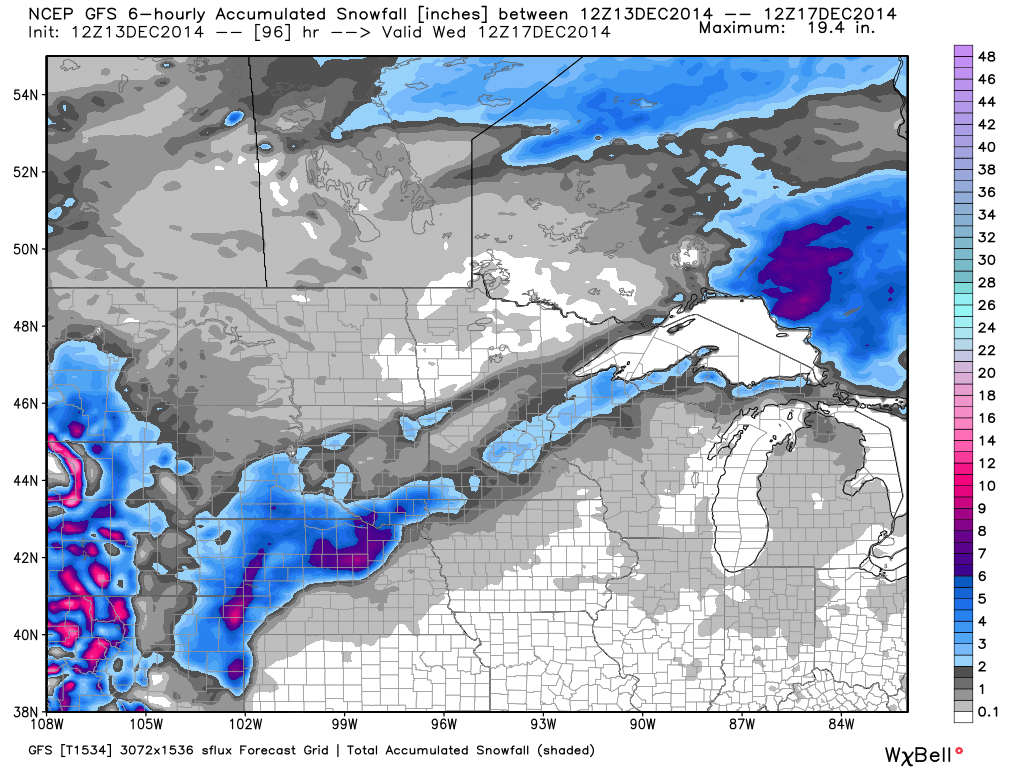 Model snowfall through Wednesday morning.
After the low moves through the area on Tuesday, the entire region should see a return to more normal temperatures for mid-December with highs in the 20s and clearing skies. Looking forward later into the week, the models cannot agree on where yet, but it looks like we could see a storm for Thursday into Friday.
Enjoy the better weather!
About Our Forecaster
Andrew Murray
Technical Founder & Meteorologist
Andrew manages the technology that powers OpenSnow, and he also keeps an eye on the weather for the Upper Midwest from his home base in Minneapolis since 2015.
Free OpenSnow App


