Upper Midwest Daily Snow

By Andrew Murray, Technical Founder & Meteorologist Posted 8 years ago December 3, 2015
Above Average We Go
Remember at the beginning of the season when I mentioned how El Nino usually leads the Upper Midwest towards a semi-dry, warm winter. Well the next two weeks are going to be exactly that, with it feeling anything like a normal December.
Lets start with a recap of what happened on Monday through Wednesday with the storm that never really met expectations. What looked so impressive over the weekend, turned out to be a much needed few inches of snow across the Upper Midwest, but then it turned to rain, and then a grey Wednesday instead all of the snow everyone forecasted.
The hard part with this storm was the models (even the hourly HRRR) kept being optimistic about the temperatures dropping and keeping the precipitation as all snow. However, the dry slot in the low that dominated during the day Monday ushered in slightly warmer temperatures throughout most of the region. This turned a long 3 day snowstorm into a less than impressive slushfest.
Looking ahead, things don’t get much brighter, with very little snow and warmer temperatures dominating the forecast for at least the next week. The best chance of any moisture moving through the region looks to be a short wave trough the middle of next week, and even then it probably will be mostly in the form of rain. As for temperatures, we will struggle to even get below freezing overnight, and with high temperatures in the mid-40s a lot snowmaking is even out of the question.
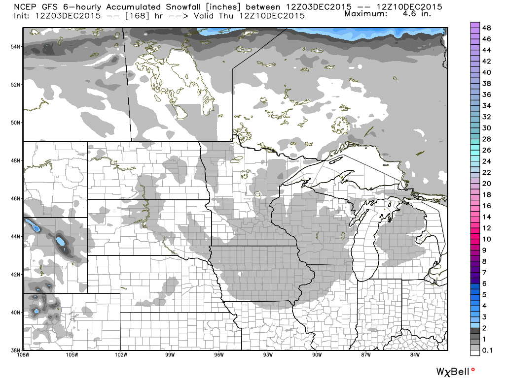 Snowfall over the next 7 days. Uff da! Credit: WeatherBell
In an attempt to reach for a hint of good news, I took a peak at the 45-day temperature averages to see if the late December or January would help balance things out. Now I feel this post is just laying on the bad news, but the 45-day outlook has surface temperature averaging 10-15ºF above normal. That means above freezing highs for most of the Upper Midwest, not good for snow lovers like myself.
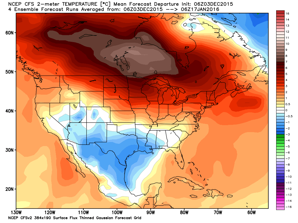
45-day surface temperature average. That's nearly +10ºC over Manitoba! Credit: WeatherBell
Yep, it could be one of those winters. Go enjoy some of the slush out there!
Andrew
About Our Forecaster
Andrew Murray
Technical Founder & Meteorologist
Andrew manages the technology that powers OpenSnow, and he also keeps an eye on the weather for the Upper Midwest from his home base in Minneapolis since 2015.
Free OpenSnow App


