Australia Daily Snow

By Mike O'Connor, Meteorologist Posted 1 year ago June 16, 2024
Snowmaking continues as temps remain cold, only light snow showers expected
Summary
Australian resorts have had to rely heavily on man-made snow throughout the first week of the season as early-season conditions have persisted. That will continue this week as temperatures will remain cold, with only light snow showers on the cards Monday and Thursday-Friday, and fine weather otherwise.
Short Term Forecast
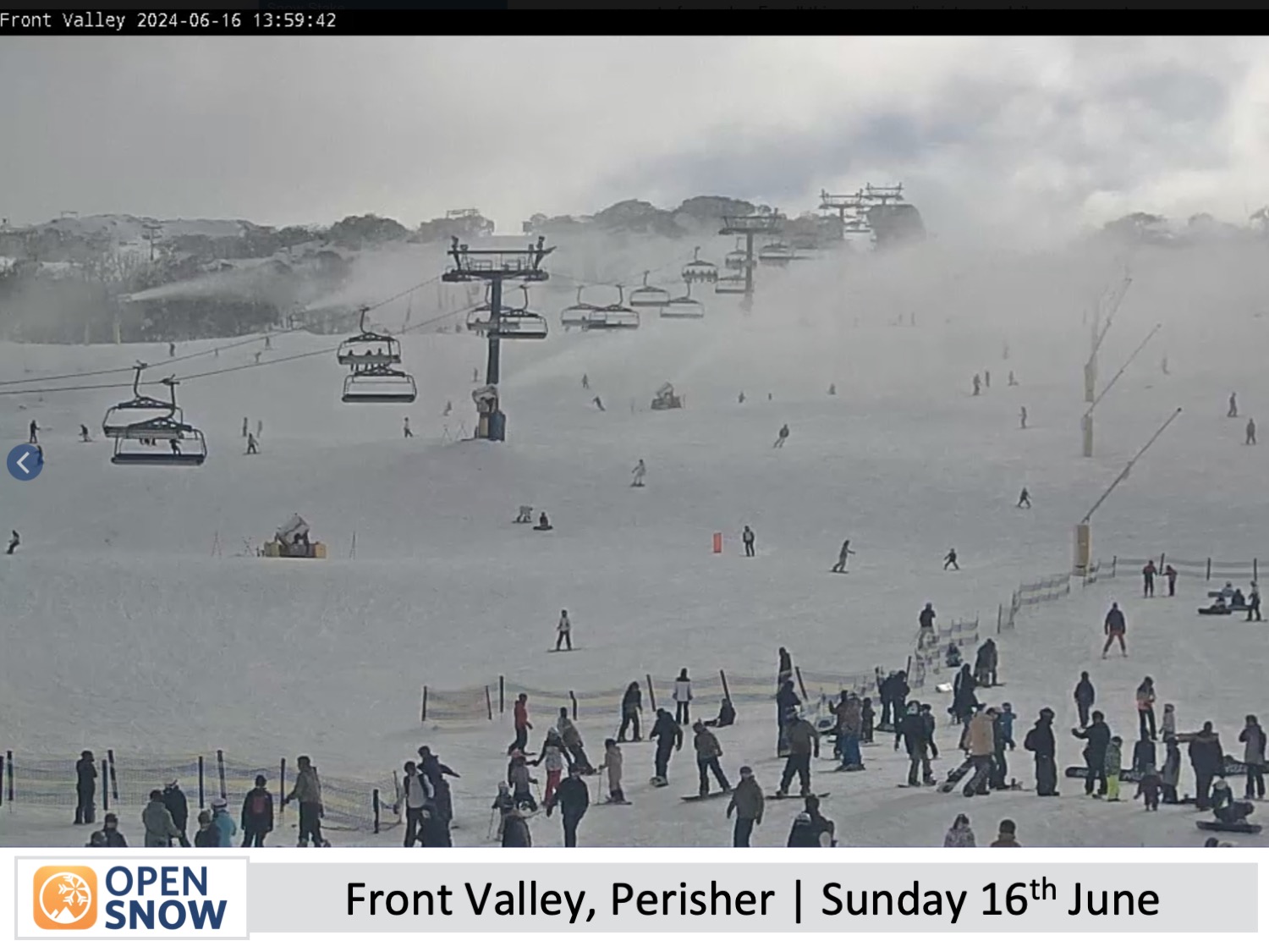
Current Conditions
It was the second weekend of the season for Australian resorts who all had limited terrain open. The weather was a mixed bag of sunshine, clouds, fog, and a few snow showers. The temperatures were sufficiently cold for the snow guns to continue building the early snowpack.
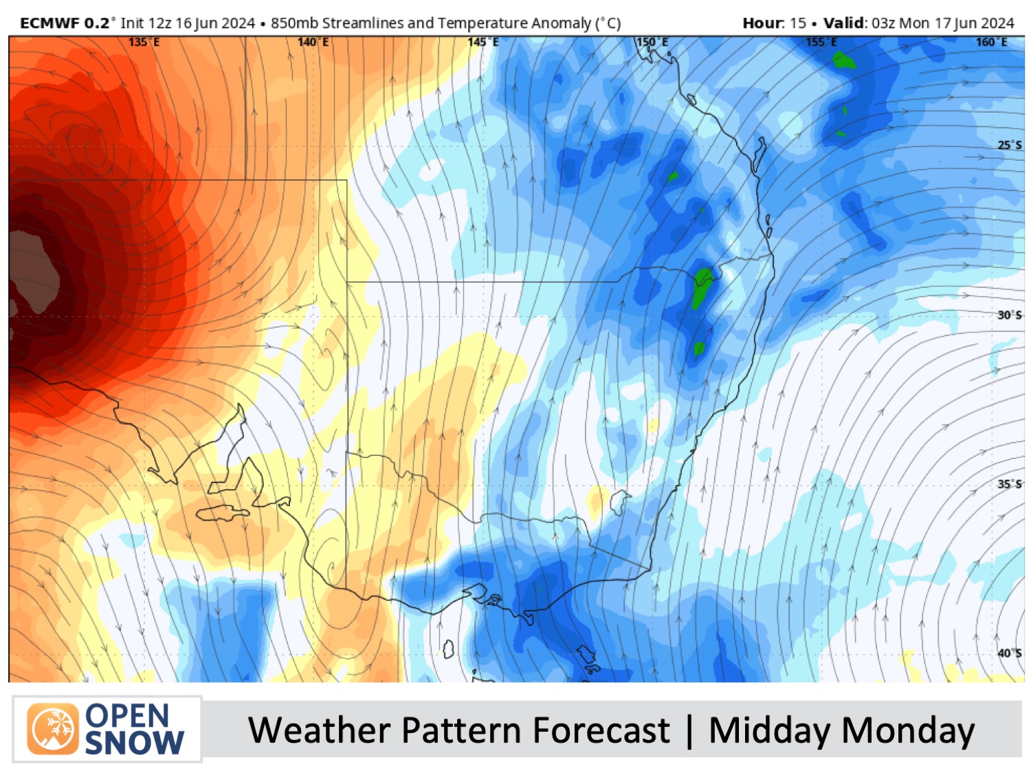
Forecast for Monday to Wednesday (17th to 19th June)
With the storm system still bouncing around in the Tasman Sea, chilly southerly winds will persist through Monday, bringing low-level clouds and fog-like conditions to the Australian Alps, resulting in low visibility at times and one or two snow showers.
Winds will drop off for Tuesday and Wednesday as a ridge of high pressure moves onto the Australian Alps, allowing the cloud to retreat for a couple of sunfilled days. Temps should remain cold enough for the snowmakers to bolster and expand the main runs, so it'll be a good couple of days to get your first turns of the season in if you haven't already.
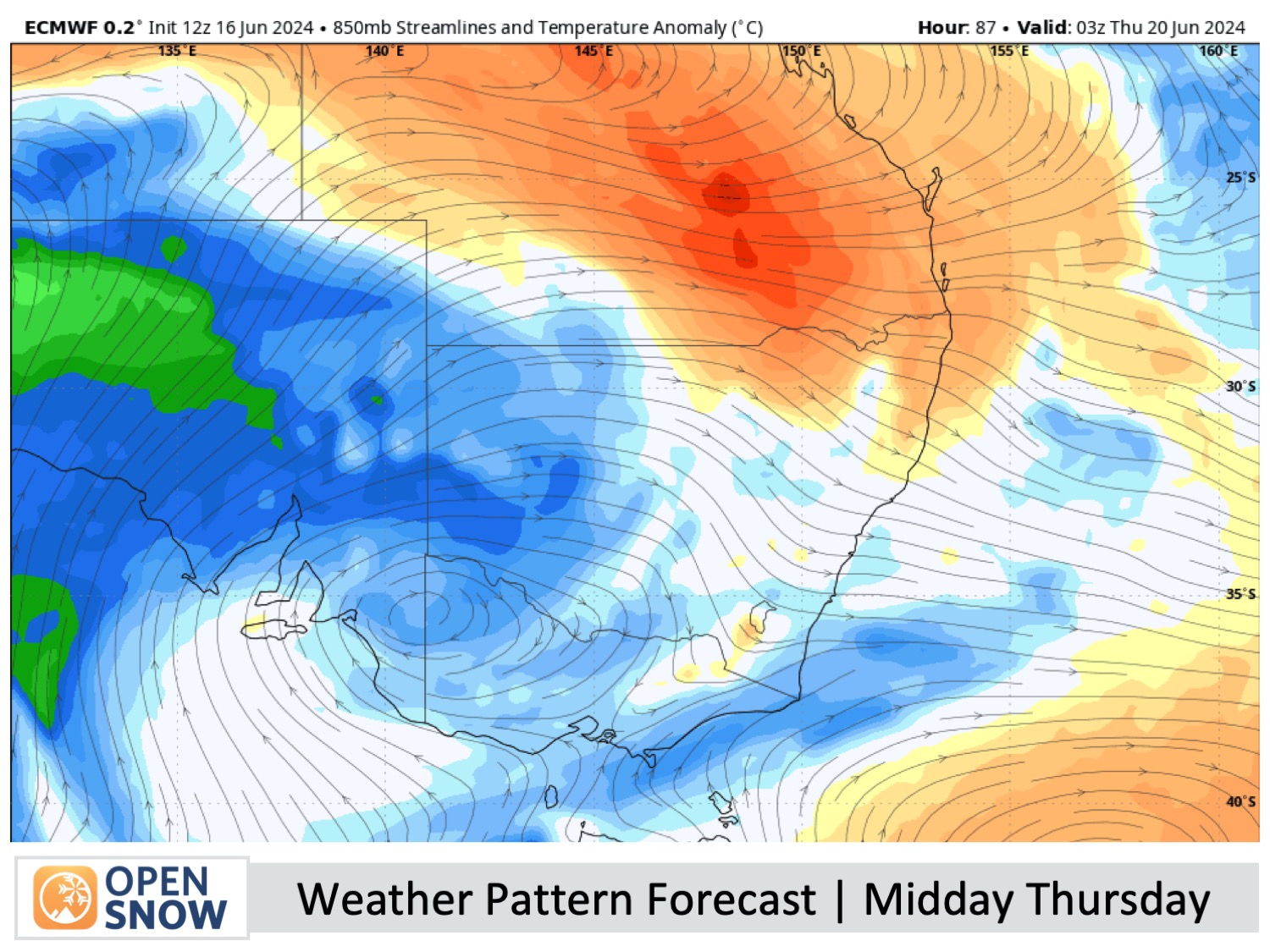
Forecast for Thursday & Friday (20th & 21st June)
A weak storm system is expected to pass north of the Australian Alps during Thursday and Friday. Forecast models are currently at odds about the details, but we'll likely have at least some cloud cover, and there is a chance we'll also see light snow showers during this time, although models keep backing off on this.
Winds will be light on Thursday, mostly from the northwest, changing to a cooler southerly for Friday, and we should see more snow being made.
Extended Forecast
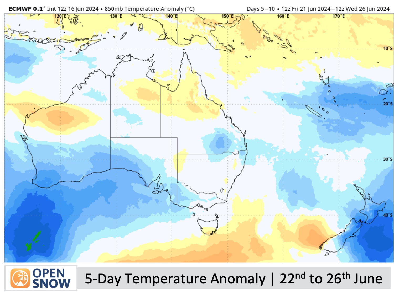
Australian resorts will continue to rely on man-made snow to build a base as high-pressure moves in for a settled weekend, the 22nd-23rd of June.
Looking ahead, the next potential snowfall could occur during the latter half of next week, starting around Wednesday, 26th June. This is still a long way off and models are already jittery about it, so we'll have to wait closer to the time.
Thanks for reading. I'll keep these forecasts coming every Monday, Wednesday & Friday throughout the southern hemisphere season.
Mike O'Connor
About Our Forecaster


