Australia Daily Snow

By Mike O'Connor, Meteorologist Posted 1 year ago June 18, 2024
Sunny Skies Wednesday, Thursday & this Weekend, with Snow Showers Friday
Summary
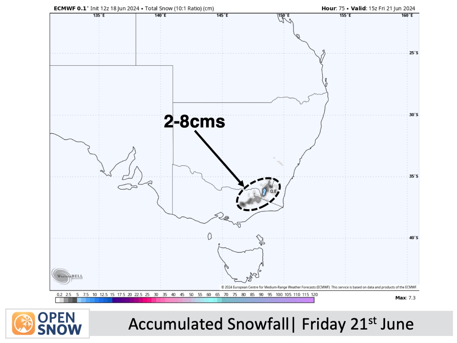
Australian resorts will continue expanding their skiable terrain over the next several days thanks to great snowmaking potential, and an additional 2-8cms of natural snowfall on Friday. On either side of Friday's weak storm, high pressure will bring sunny, calm conditions.
Short Term Forecast
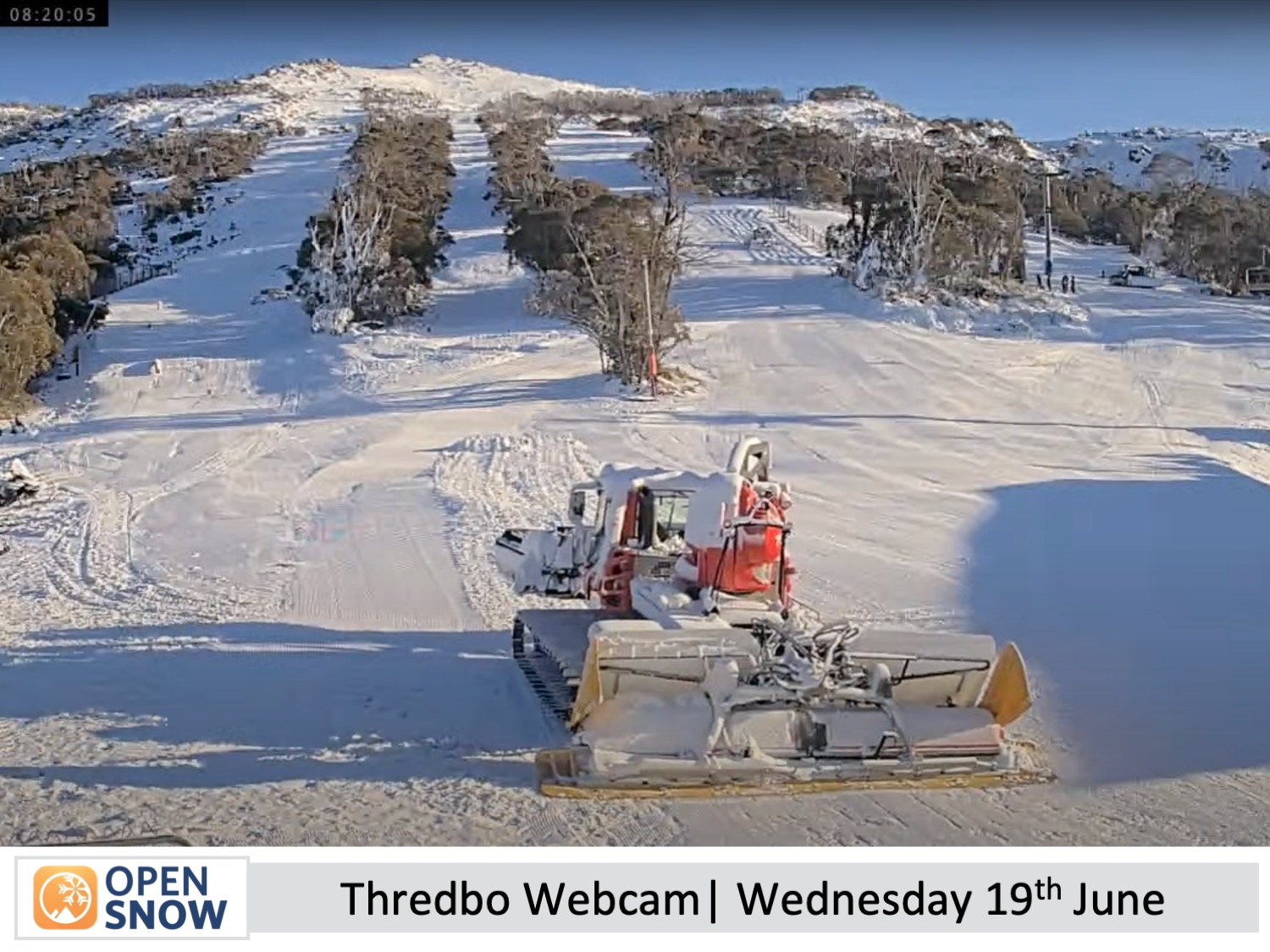
The light snow showers turned up on Monday as forecasted, leaving a light dusting of 1-3cm to add to the slowly building tally. After the clouds cleared, Monday and Tuesday nights have been perfect for manufacturing snow, which the resorts have made the most of. The result is an expansion of open and skiable terrain on the main runs, while off-piste is still thin and bony and unskiable.
Forecast for Wednesday and Thursday (19th & 20th June)
A ridge of high pressure will keep skies clear and crisp Wednesday through most of Thursday, with more snowmaking potential. Winds will be light too, so it'll be a great couple of days to ease the muscles into shape for the season ahead.
Forecast for Friday (21st June)
A weak storm passes over the Australian Alps from the west Thursday night through the early hours of Friday, with mostly light snowfalls lowering to resort base levels. Snow showers will continue through Friday as southerly winds develop. Wind chill and limited visibility will likely be a factor, but overall, resorts should chalk up between 2-8cms.
Forecast for the weekend (22nd & 23rd June)
It'll be a nice weekend to be up in the mountain as high pressure will once again move in. Skies clear up early Saturday and calming the wind. Temperatures should get low enough for more snowmaking potential during the early hours of Saturday and again Saturday night.
Extended Forecast
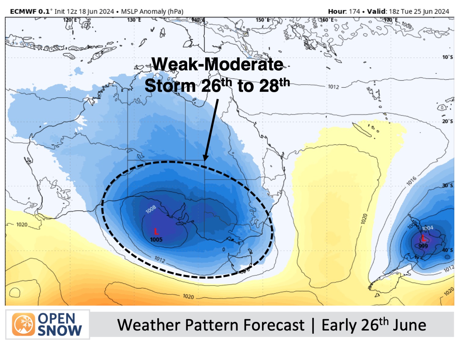
Another storm from the west will take charge from Tuesday, June 25th to Friday, June 28th. This unsettled period will likely begin with strong north-northwest winds, rain, and high-elevation snow, followed by cooler westerlies and snow showers to lower elevations. It doesn't seem like it will be a major event, with only light to moderate snowfall expected.
Thanks for reading. I'll keep these forecasts coming every Monday, Wednesday & Friday throughout the southern hemisphere season.
Mike O'Connor
About Our Forecaster


