Australia Daily Snow

By Mike O'Connor, Meteorologist Posted 10 months ago August 29, 2024
Powder Aid on Monday After Snowpack Takes More of a Beating
Summary
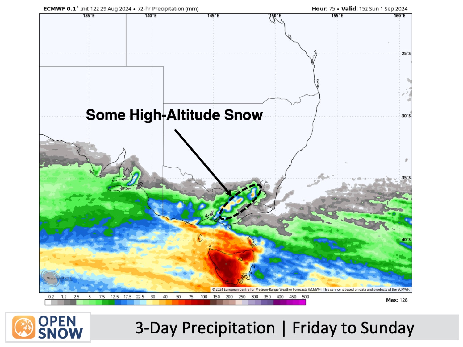
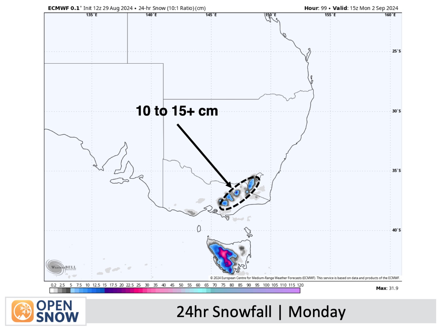
New South Wales received 5-7cm of snow and Victoria 2-3cm, but this is not enough to recover recent losses. More snow will melt due to wet, windy weather with gusts up to 120 km/h this weekend and Monday. However, 5-10cm could accumulate at higher elevations on Saturday, and a cold front on Monday may bring 10-15cm, potentially up to 20cm in some areas, improving conditions.
Short Term Forecast
Friday and this Weekend (30th August to 1st September)
Expect rough conditions with showers and gale-force northwesterly winds. Friday will see snow falling to around 1800m. On Saturday, strong winds and showers continue, with snow briefly lowering to 1700m in the morning and up to 5-10cm accumulating at higher elevations. Sunday will bring severe gales with showers, initially falling as snow on the peaks, especially in Victoria.
Monday & Tuesday (2nd & 3rd September)
Monday will see a cold front bringing snow in the early morning, which will ease to snow showers before clearing by night, accompanied by gale to severe westerly winds. A high-pressure ridge on Tuesday will calm the winds, resulting in clear skies and fresh snow, turning it into the best day in quite a while.
Extended Forecast
Northwest winds are forecast to strengthen on Wednesday, 4th September, and persist for several days due to a nearby front. Unfortunately, no snow is expected during this time.
Thanks for reading. I'll continue to provide these forecasts every Monday, Wednesday, and Friday throughout the southern hemisphere season.
Mike O'Connor
About Our Forecaster


