US & Canada Daily Snow

By Sam Collentine, Meteorologist Posted 4 years ago August 17, 2020
Wildfire Smoke Maps
Update
Since we last chatted on June 25th, we've added forecast radar, wildfire smoke, and temperature maps for the next 18 hours, along with an industry-first feature, Estimated Trail Conditions, to our summer service, OpenSummit.
The new map overlays are available to All-Access subscribers for $19 per year, which includes unlimited access to OpenSnow. Use the same email and password to log in to both services.
Forecast Radar
High-resolution precipitation forecast for the next 18 hours.

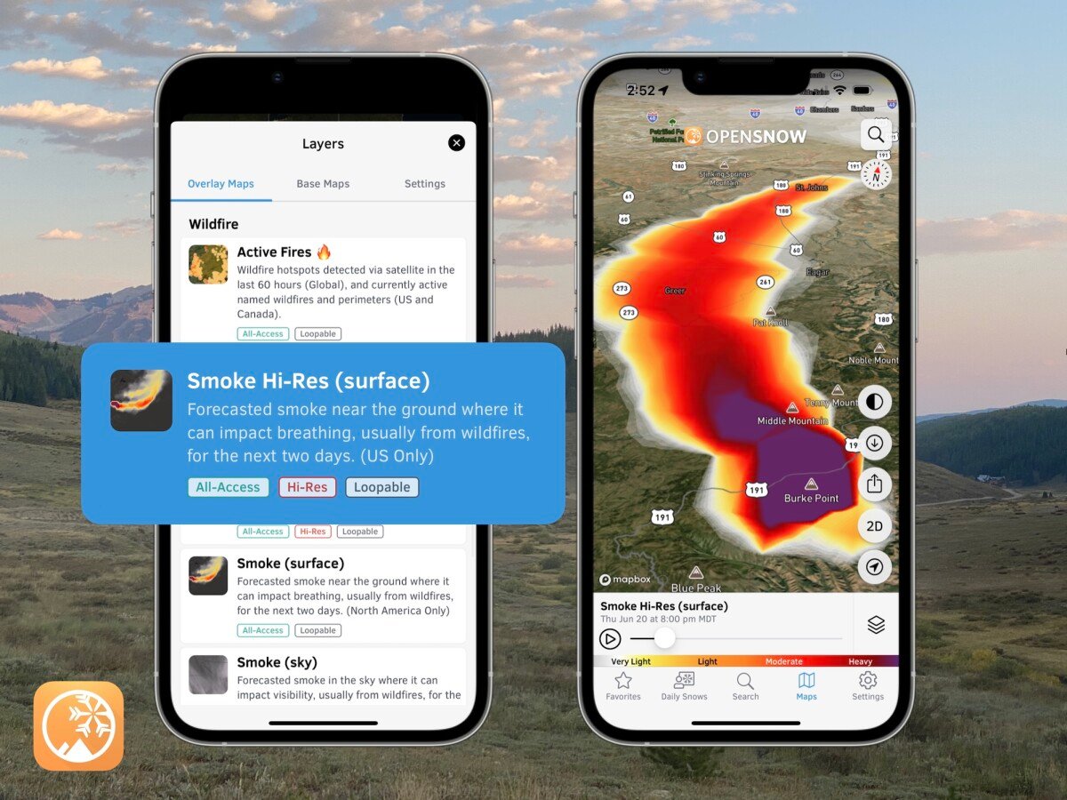
Wildfire Smoke (surface)
Experimental product from NOAA that tracks smoke near the ground where it can impact breathing, usually from wildfires, for the next 18 hours.

Wildfire Smoke (sky)
Experimental product from NOAA that tracks smoke in the sky where it can impact visibility, usually from wildfires, for the next 18 hours.

Temperature
High-resolution temperature forecast for the next 18 hours.

Estimated Trail Conditions
Wondering if it rained over the past 24 hours and if the trail is dry? You can now answer these questions with OpenSummit.

Every location in OpenSummit now includes Estimated Trail Conditions, which uses recent weather conditions to estimate if the trail is muddy, a little wet, or dry, and we update this every hour.
But don’t take our word – we offer one-click access to a visual history of precipitation and temperature during the past 24 hours so that you can make your own call.
We believe that OpenSummit is now the only app + website where you can see high-resolution current radar, forecast radar, snow depth data, wildfire smoke maps, estimated trail conditions, and hourly weather forecasts specifically for your next outdoor adventure.
If you play outside, the OpenSnow + OpenSummit All-Access subscription for $1.58/month is a no-brainer.
Sign Up → OpenSummit.com/register
Download → OpenSummit iOS App
Download → OpenSummit Android App
Thank you so much for your support!
SAM COLLENTINE
About Our Forecaster


