Utah Daily Snow

Heads up, there may be fresher snow! Read the latest Utah Daily Snow

By Evan Thayer, Forecaster Posted 5 years ago December 1, 2018

One More Round

Summary

Plenty of fresh snow over the past few days in all Utah mountains. The season is off to a great start. More snow showers move in tonight into Sunday with additional accumulation. A break in the action possible for the upcoming week.

Short Term Forecast

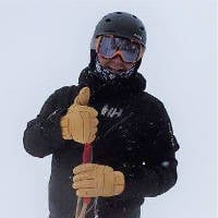
Everything behaved as expected yesterday.  We had a break in the morning and snow started to move back into the region in the afternoon.  Plenty of fresh snow to start the day, plenty of refills to end it.  I had another great day of bell-to-bell skiing: 

In the afternoon, it was graupel that skied extremely well. This is a photo of it gathering on my ski pants on the chairlift ride up: 

NW flow overnight brought additional snow.  Totals vary greatly from just a few inches, to over a foot in LCC which is highly favored in a NW flow.  

Essentially, there are four sectors to this storm cycle.  The weak wave on Wednesday, the SW flow warm sector on Thursday, the NW flow sector we had last night, and finally another trailing cold system tomorrow.  So far we are 3/4 of the way done and have seen anywhere from 15-30" of new snow.  The final wave will push in later tonight and snow showers will develop.  Again, best accumulation should be in areas favored by NW flow.  This is not a strong system, but 3-6" is likely with 5-10" in the Cottonwoods and other favored locations.  Here is a map of snowfall thru Monday morning: 

Don't pay too much attention to the amounts, as this model has a tendency to overdo things by quite a bit.  But you can see the general regions which should see more snowfall.  

We should clear out with cold temps on Monday.  Warming in the mountains this week as high pressure builds.  Later this week, a closed low will push into the desert southwest and spin some moisture up into Utah.  A few showers could be possible, especially in southern Utah.  Otherwise, we are in an extended break after this weekend.  

Extended Forecast

Our break in the active pattern looks like it will last thru at least December 10th or 11th.  Then, models hint at a return to active weather.  I am still waiting for more consistent runs and agreement before we really start to dig into any details.  Until then, enjoy the great conditions with more terrain opening daily! 

Evan | OpenSnow

Announcements

I will do a snowpack analysis tomorrow morning.  Hint: we are now above normal nearly statewide! 

About Our Forecaster

Evan Thayer

Forecaster

To Evan, 'The Greatest Snow on Earth' is more than just a motto - it’s a way of life. In 2010, he started Wasatch Snow Forecast as a way to share the best powder days with his fellow snow-lovers. Evan brings the same quality forecasts and weather discussions to OpenSnow and hopes you enjoy skiing/riding Utah as much as he does.

Free OpenSnow App