Western US Daily Snow

By Alan Smith, Meteorologist Posted 18 hours ago July 30, 2025
T-Storms Favoring Colorado, Eastern Rockies, & Interior Northwest
Summary
A series of low pressure troughs will lead to frequent rounds of showers & thunderstorms across parts of the Northwest & Northern Rockies. Colorado & Northern New Mexico will see more t-storms as well with monsoon moisture in place, while Utah & Arizona will remain very dry with little in the way of fire relief. The monsoon continues to look weak & inconsistent heading into August.
Short Term Forecast
Helpful Links:
Wildfire and Smoke Update:
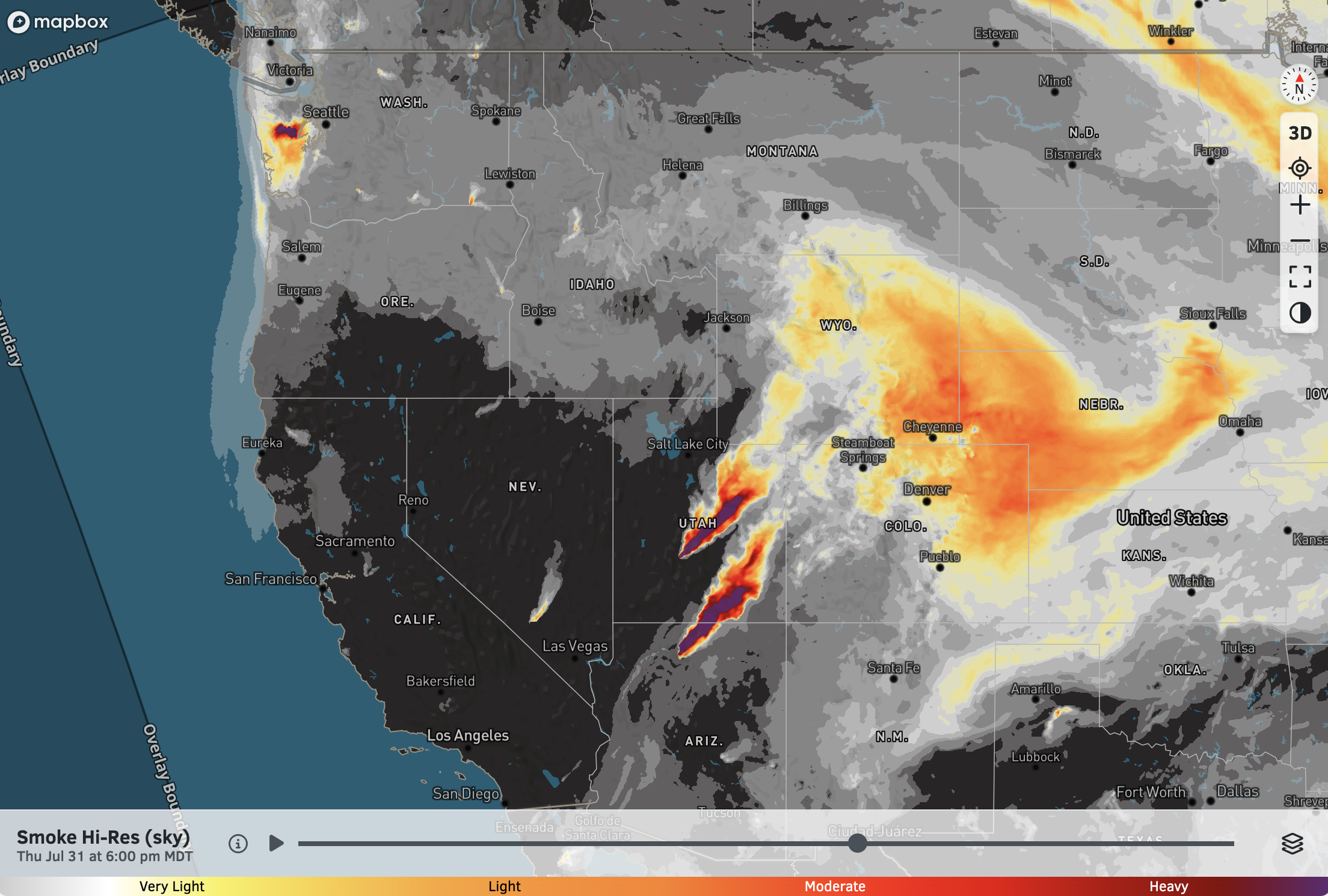
The Dragon Bravo Fire (Arizona) and Monroe Canyon Fire (Utah) remain active, thanks in part to abnormally dry conditions for late July. Smoke transport from these fires will continue to impact portions of Colorado and Wyoming at times.
The Bear Gulch Fire in the Olympic Mountains of Washington has also been producing locally heavy smoke.
High-Res Smoke (Sky) Forecast for 6 PM Thursday:
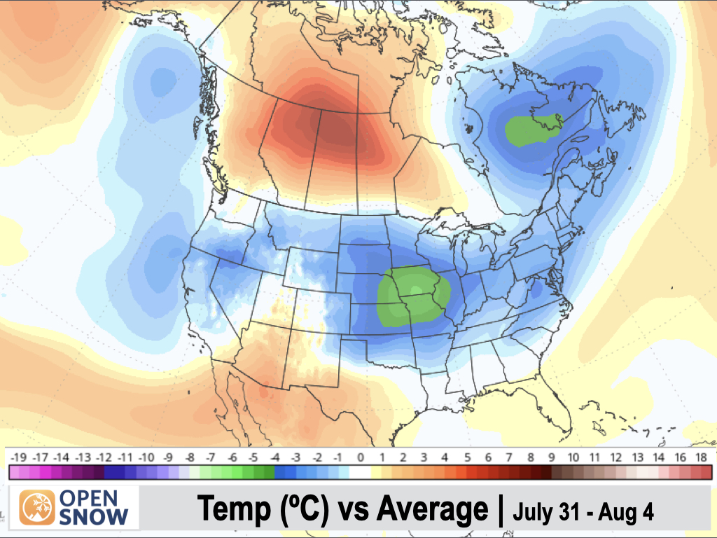
5-Day Temperature Outlook:
Temperatures will be below normal across much of the West thanks to a trough-dominant pattern in place, except for the Southwest, where temperatures will be above normal.
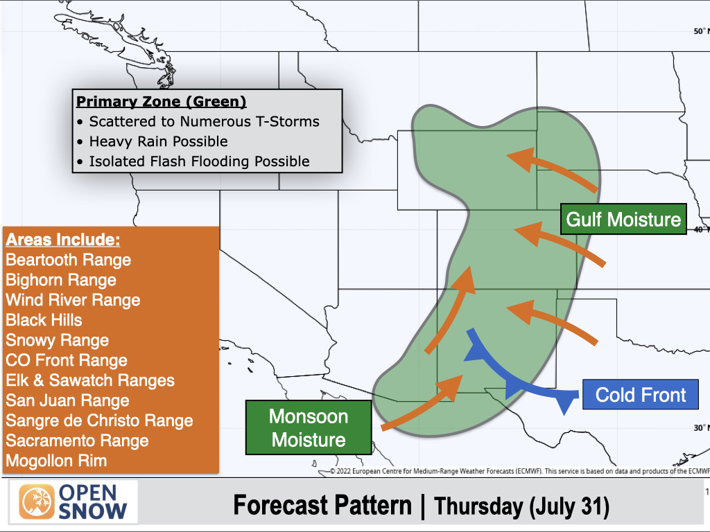
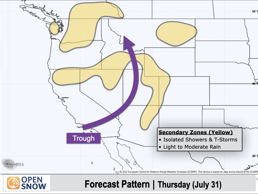
Thursday (July 31):
A cold front will slide into Southern New Mexico with easterly winds behind the front reinforcing Gulf moisture along the east side of the Divide from Southern Montana to New Mexico.
Monsoon moisture will also be in place across Southeast Arizona and Western New Mexico, extending northward into Western Colorado (more so than indicated in previous forecasts).
Green-shaded areas will be favored for scattered to numerous afternoon thunderstorms, some of which will produce heavy rain.
Up north, Pacific moisture associated with a trough moving inland will result in scattered showers and thunderstorms across Oregon, Northern Idaho, and Western Montana, with stronger storms capable of producing heavy rain.
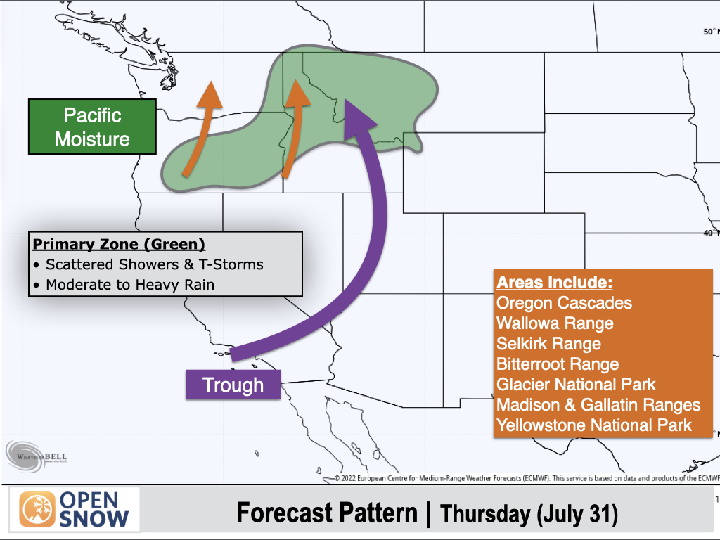
Yellow-shaded areas will see mainly isolated showers and thunderstorms with light to moderate rain expected.
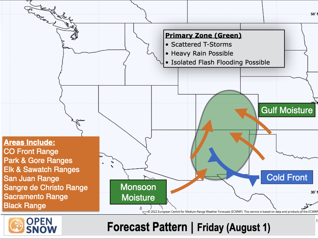
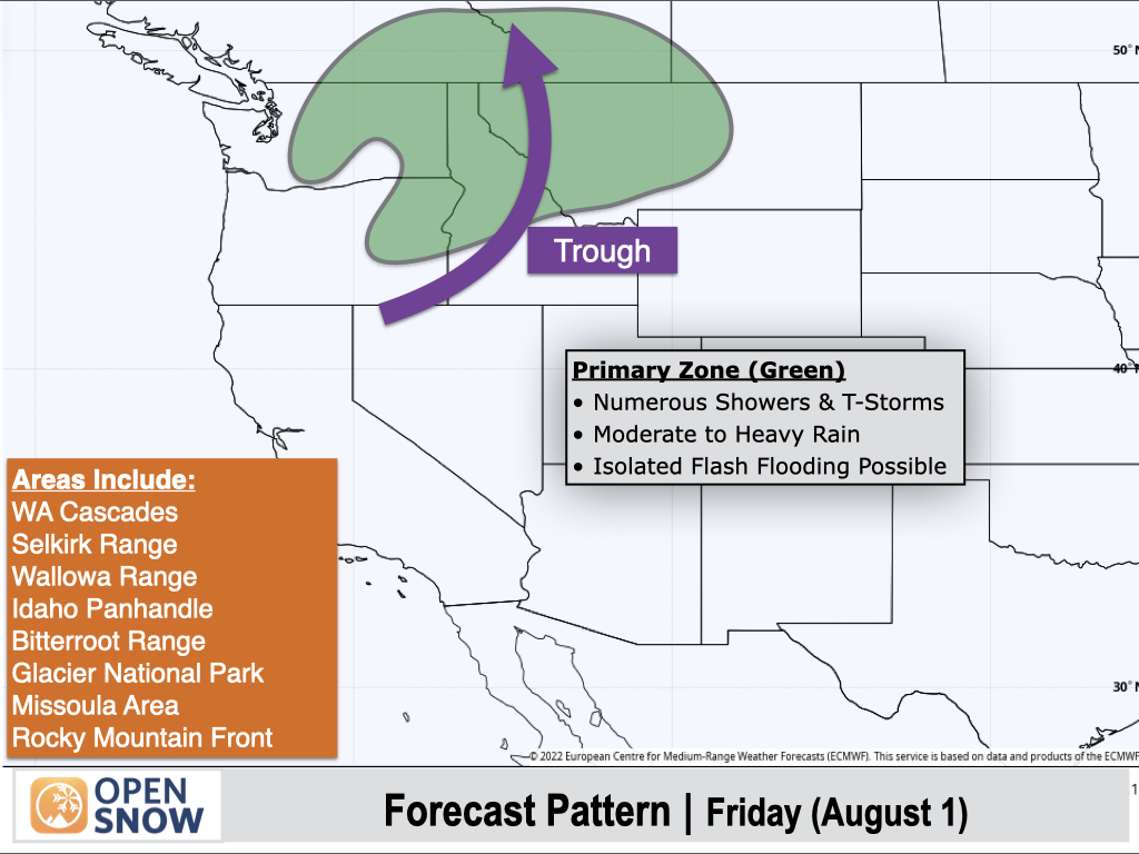
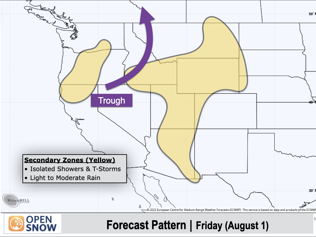
Friday (August 1):
A stalled cold front will remain over Southern New Mexico with easterly winds behind the front reinforcing moisture transport along the eastern slopes of the Rockies in Colorado and New Mexico. Monsoon moisture will also remain in place over Western Colorado and Western New Mexico.
These areas will be favored for thunderstorms once again, with stronger storms capable of producing heavy rain.
The northern trough will slowly lift to the north and east with showers and thunderstorms favoring the Washington Cascades, eastern portions of Washington and Oregon, Northern Idaho, and Western Montana. Stronger storms will be capable of producing heavy rain.
In between, the yellow-shaded areas will see isolated showers and thunderstorms with light to moderate rain.
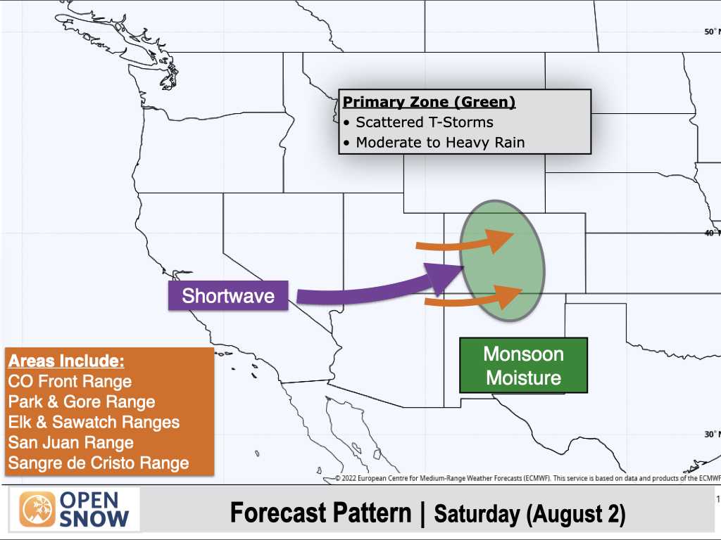
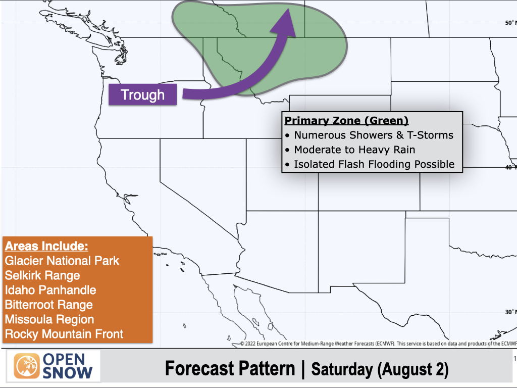
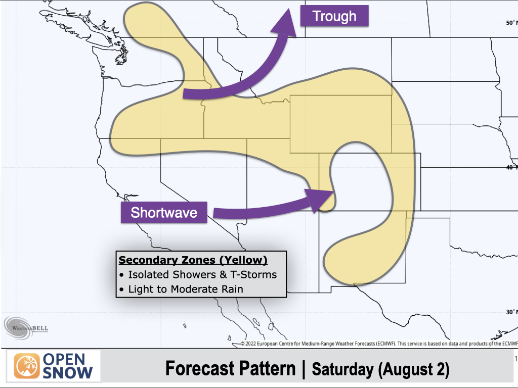
Saturday (August 2):
A shortwave trough will move across the Southern Rockies with drier air moving into Arizona and Southern New Mexico. However, the shortwave will tap into lingering monsoonal moisture over Colorado and Northern New Mexico to result in another active thunderstorm day with locally heavy rain possible.
The northern trough will also remain a factor with numerous showers and thunderstorms expected across Northern Idaho and Montana. Heavy rain will remain possible with stronger storms in this area.
In between areas shaded in yellow will see more isolated showers and thunderstorms with light to moderate rain expected.
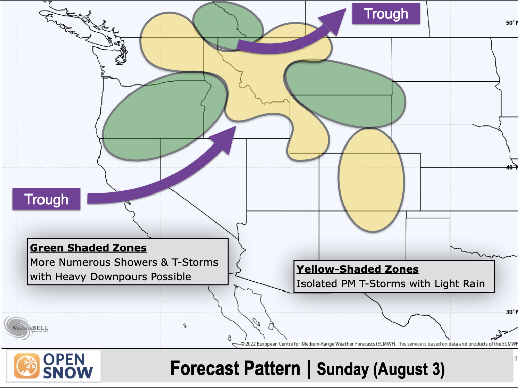
Sunday (August 3):
Monsoon moisture will decrease across Colorado, and only isolated thunderstorms with light rainfall are expected as a result.
To the north, one trough will exit Northern Montana while another trough will reach the West Coast, leading to more active weather across northern areas.
Favored areas shaded in green include Oregon, Glacier National Park in Montana, and the Montana/Wyoming border region east of the Divide, and these areas will see more numerous thunderstorms with heavy downpours possible.
Yellow-shaded areas will see more isolated thunderstorm activity with light rainfall.
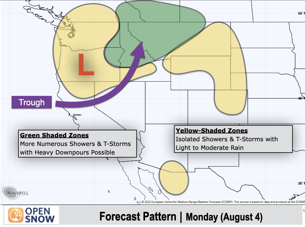
Monday (August 4):
As the trough moves inland on Monday, Northern Rockies areas shaded in green will be the most favored for thunderstorms, along with the potential for moderate to heavy rain.
Shower and thunderstorm activity will be more isolated across the Cascades and Columbia Basin, as well as over South Central Montana, Wyoming, and the Northern Colorado Front Range.
Western and Southern Colorado and much of the Southwest could stay storm-free, while Southern Arizona could see some isolated activity.
Extended Forecast
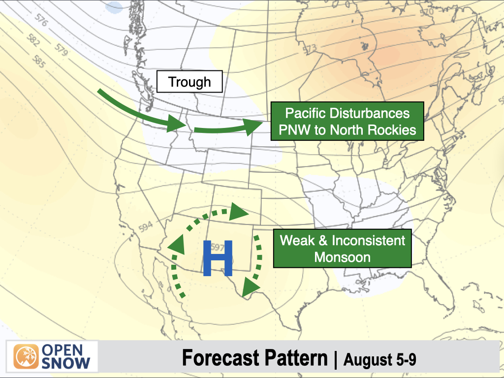
August 5-9:
A trough-dominant pattern will continue over the Northwest and Northern Rockies with Pacific disturbances leading to additional shower and thunderstorm chances across Washington, Northern Idaho, and Montana.
These frequent Northern Rockies troughs will continue to disrupt the typical monsoonal flow that we see at this time of year. As a result, only a weak and inconsistent monsoon is expected across the Four Corners region, with isolated thunderstorms and light and spotty rainfall expected.
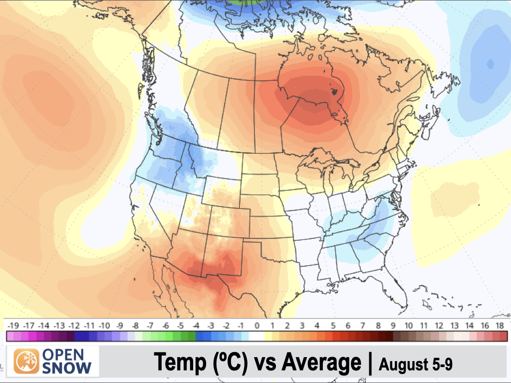
Below-normal temperatures are expected across the Pacific Northwest, while the Southwest and Four Corners region will trend hotter than normal with limited influence from the monsoon.
August 10-14:
Heading into mid-August, we see some model discrepancies arise, but the general trend is for high pressure to strengthen across the West as a whole, with fewer and weaker disturbances across the Northwest.
The monsoon is still expected to remain weaker than normal, with isolated thunderstorm activity and limited rainfall amounts projected across the Four Corners region.
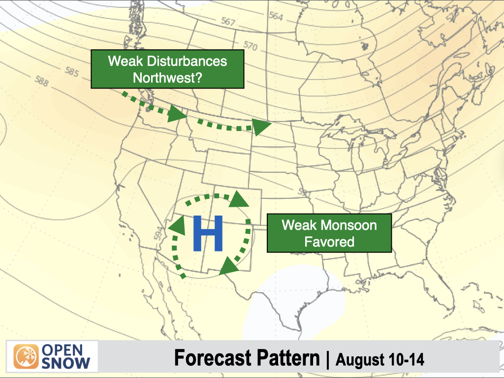
Temperatures are also expected to warm to above-normal levels throughout the West.

Thanks so much for reading! Next update on Friday (August 1).
Alan Smith
About Our Forecaster


