Western US Daily Snow

By Alan Smith, Meteorologist Posted 1 day ago August 1, 2025
Inland Northwest Showers & Storms, Monsoon Fades in the Southwest
Summary
Colorado will see one more active t-storm day on Saturday, then a significant drying trend will take hold throughout the Southwest & Southern Rockies as the monsoon weakens substantially. Low pressure troughs will continue to track across the Northwest, bringing frequent showers & t-storms & cool temps to OR, WA, ID, & MT. Only a weak monsoon is expected in the SW thru the first half of August.
Short Term Forecast
Helpful Links:
Wildfire and Smoke Update:
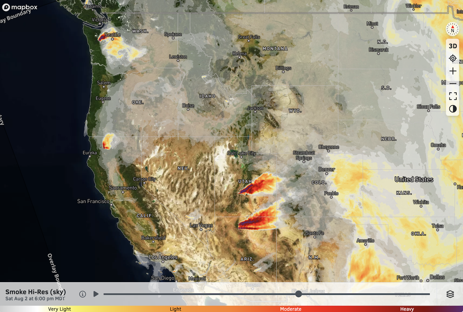
Large fires remain active in Utah and Northern Arizona, and waves of smoke from these fires will continue to reduce visibility and air quality at times downwind in Colorado.
The Bear Gulch Fire in the Olympic Mountains of Washington will also lead to smoky conditions at times across the Puget Sound area, including Seattle.
High-Res Smoke (Sky) Forecast for 6 PM Saturday:
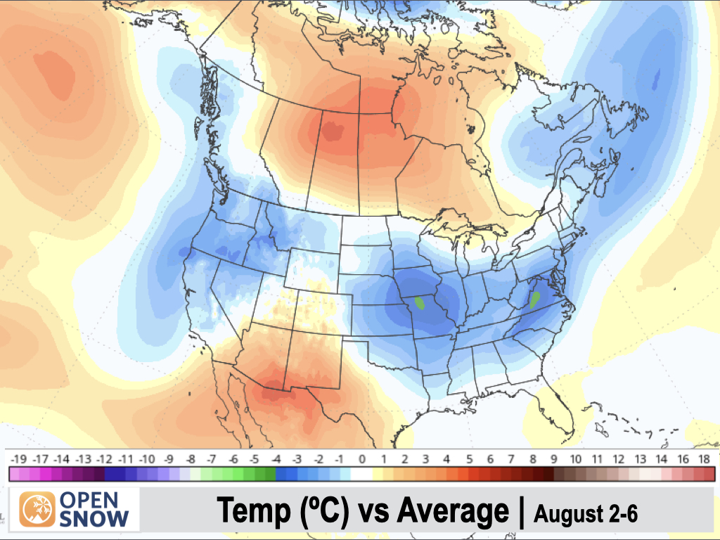
5-Day Temperature Outlook:
Temperatures will remain below-average along the West Coast and over the Northwest during the first few days of August, while Arizona and New Mexico will be warmer than average.
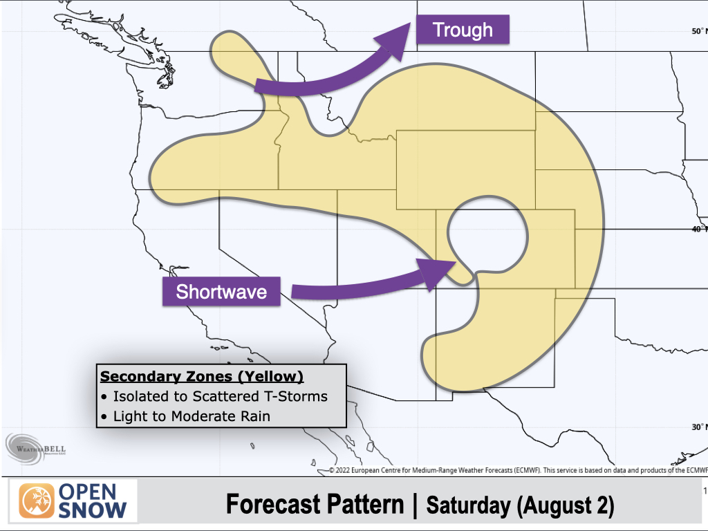
Saturday (August 2):
A trough will move across the Northern Rockies with another active day of showers and thunderstorms expected in Northwest Montana and Northern Idaho. Heavy rain will be possible with stronger storms, along with the potential for flash flooding.
To the south, monsoonal moisture will hang around for one more day across Colorado as a shortwave trough moves through, with scattered thunderstorms developing. Northern and central portions of Colorado will be the most favored, with more isolated storms in Southern Colorado (San Juans to Sangres).
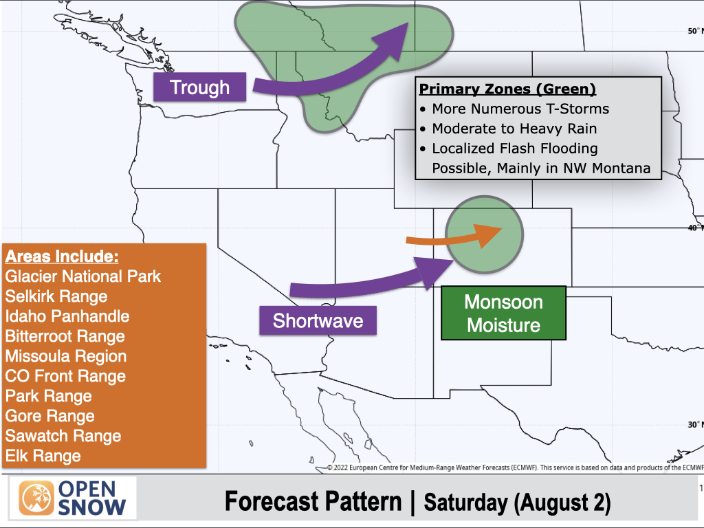
Yellow-shaded areas will see isolated to scattered thunderstorms with light to moderate rain.
Sunday (August 3):
Another trough with Pacific moisture will move into the Northwest with scattered thunderstorms developing across Central and Eastern Oregon and Western Idaho. Stronger storms will be capable of producing moderate to heavy rain.
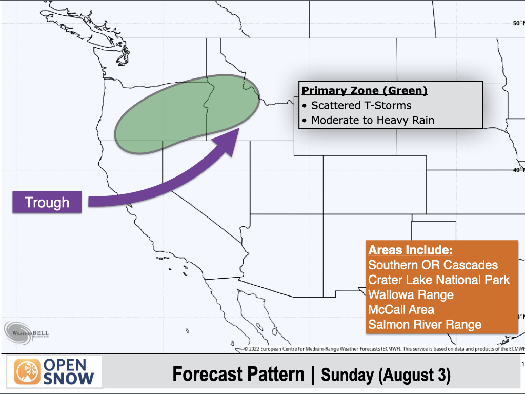
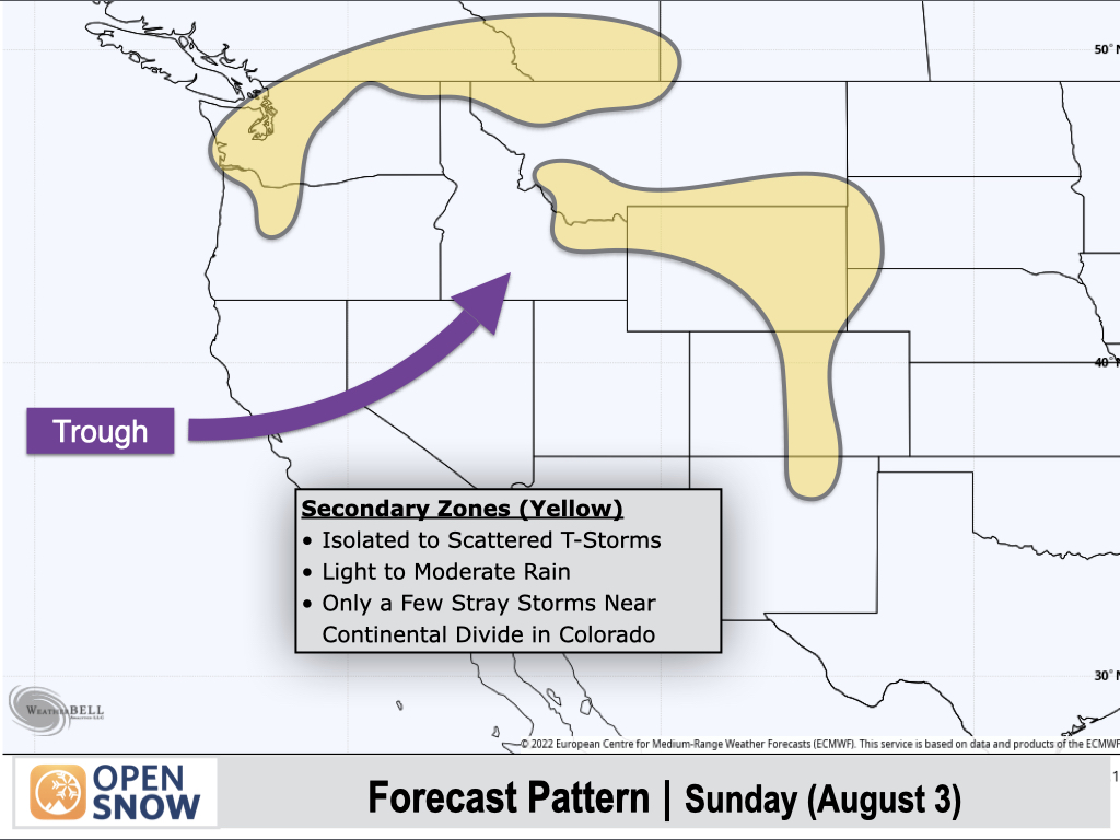
Yellow-shaded areas will see isolated to scattered showers and thunderstorms with light to moderate rain expected.
A notable drying trend will occur over the Southern Rockies, with only some isolated thunderstorm activity and light/spotty rain expected over the eastern ranges of Colorado and along the Continental Divide. Western Colorado should stay thunderstorm-free.
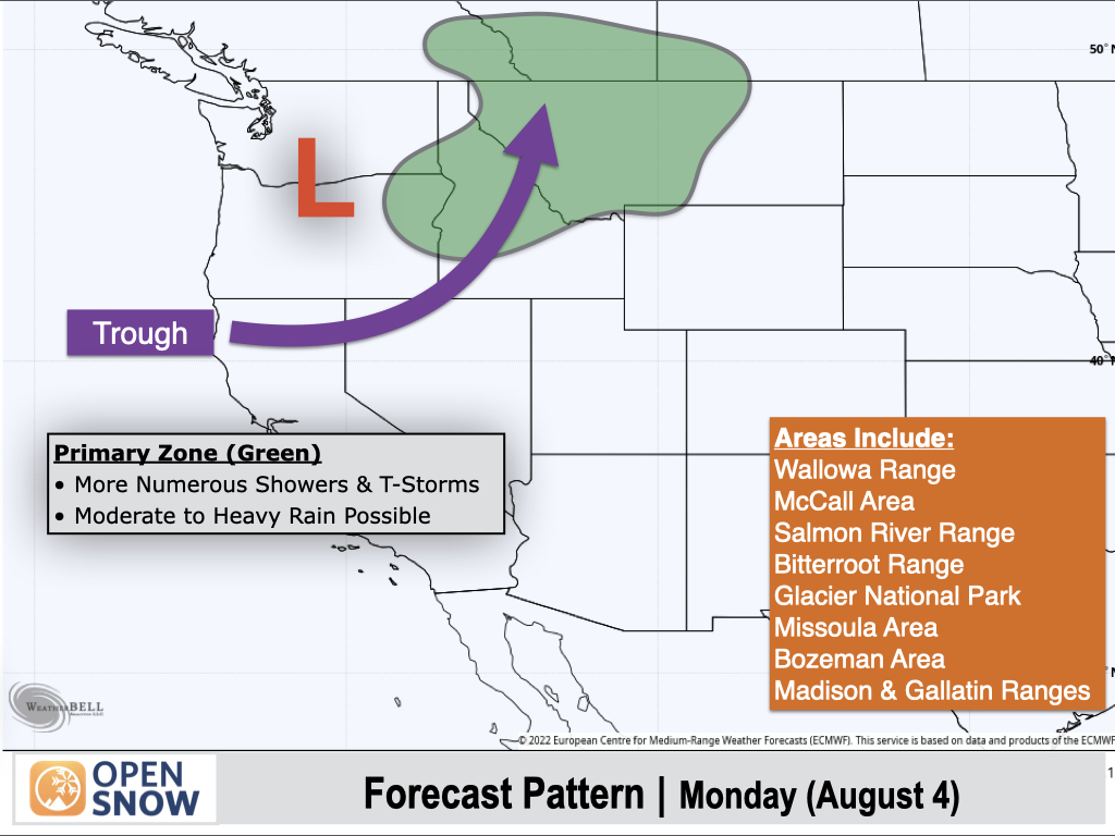
Monday (August 4):
As a Pacific low pressure system moves inland and lifts to the northeast, showers and thunderstorms will develop across Northeast Oregon, Central and Northern Idaho, and Western and Central Montana, with locally heavy rain possible.
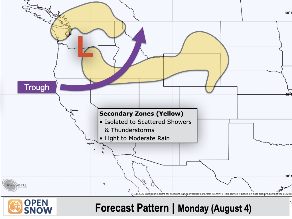
Yellow-shaded areas will see isolated to scattered showers and thunderstorms with light to moderate rain.
Most of Colorado should see a thunderstorm-free day with anomalously low moisture levels for early August, though a stray storm couldn't be ruled out over the Northern Front Range. The rest of the Southwest will also remain dry.
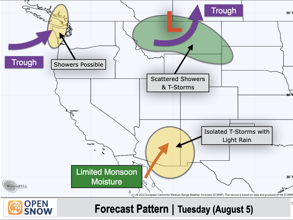
Tuesday (August 5):
A departing trough will move east across Montana with lingering moisture favoring additional showers and thunderstorms, though coverage and rainfall amounts should be lighter.
Another trough will approach the West Coast with light to moderate showers possible over the Olympic Peninsula and the west coast of Washington.
To the south, limited monsoonal moisture will push into Southern and Central Arizona with isolated thunderstorms possible, which will generally produce light rain.
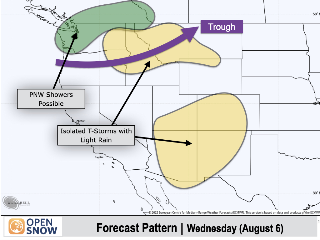
Wednesday (August 6):
As the next trough moves across the Northwest, Western and Northern Washington look to be the most favored for rain showers, though confidence in the details is low at this time. For now, it looks like areas further south and east, including Idaho and Montana, may end up with more isolated showers and thunderstorms.
A weak monsoon will return to the Four Corners region with generally isolated thunderstorm activity expected, along with spotty light to moderate rainfall.
Extended Forecast
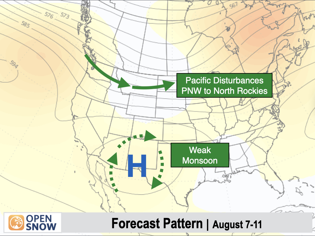
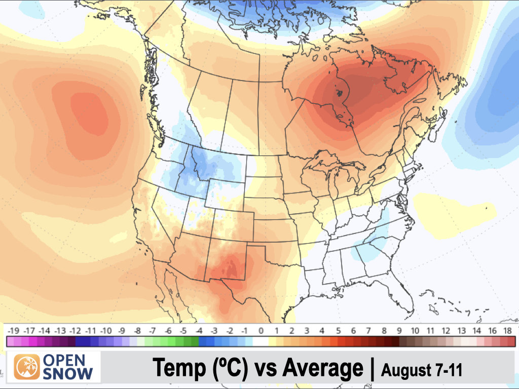
August 7-11:
The overall pattern looks similar with a weak monsoon over the Four Corners region (spotty thunderstorms with light to moderate rain), while additional Pacific disturbances could bring more showers and thunderstorms to Washington, Idaho, and Montana.
Temperatures are expected to remain cooler than average across the Interior Northwest and Northern Rockies, while the Southwest will be warmer than average. California is also expected to see a warming trend.
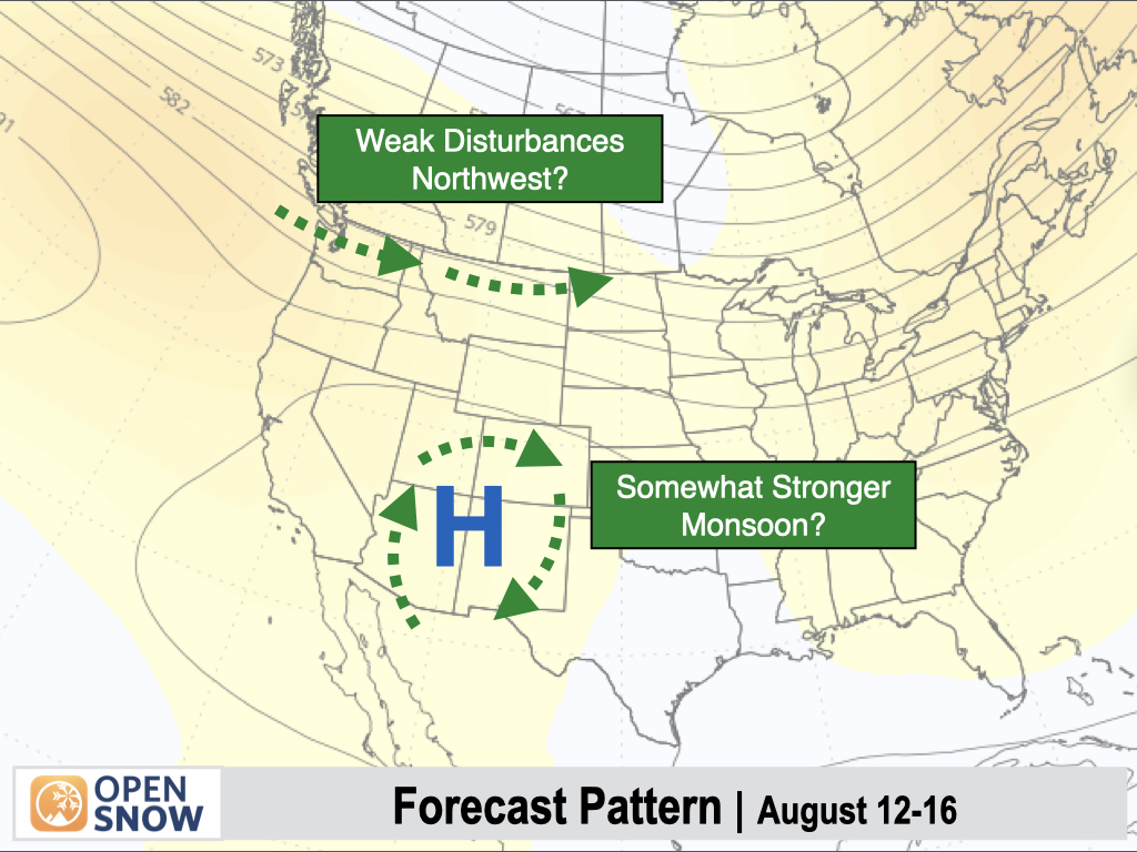
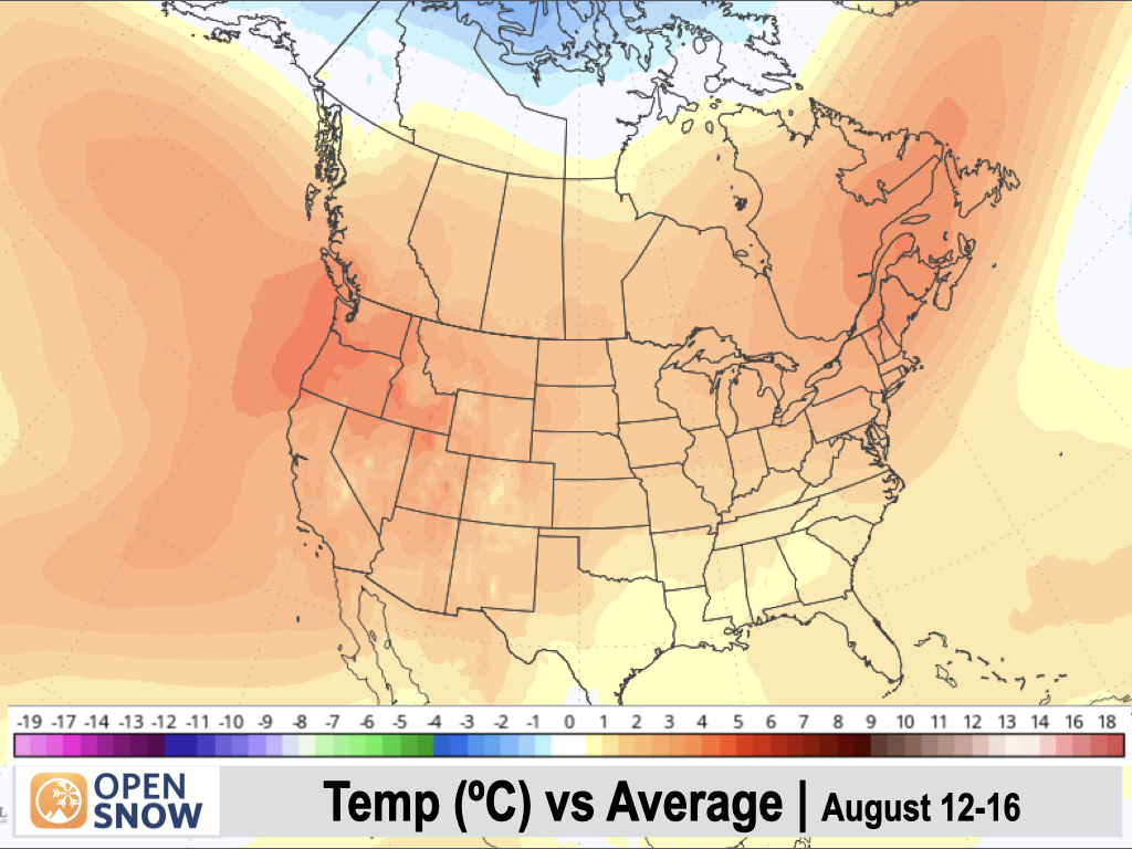
August 12-16:
Heading into mid-August, confidence in the pattern decreases somewhat. Overall, the monsoon looks to remain fairly weak for this time of year, but it may strengthen somewhat compared to early August with perhaps some higher thunderstorm coverage across the Four Corners states.
Still, models are in poor agreement, with some indicating a stronger monsoon and others projecting the monsoon to remain very weak. We'll see how this looks as we get closer.
Similarly, models are in poor agreement on whether or not Pacific disturbances will continue to impact the Northwest and Northern Rockies, or if these disturbances trend further north into Canada with a drying trend in the Northwest U.S.
Most models favor a large-scale warming trend to some extent, with above-average temperatures possible throughout the West.
Thanks so much for reading, and have a great weekend! Next update on Monday (August 4).
Alan Smith
About Our Forecaster


