Western US Daily Snow

By Alan Smith, Meteorologist Posted 3 hours ago August 5, 2025
Rain Coming to the Northwest, Worsening Wildfire Smoke in the Southwest
Summary
An impressive frontal system for August will move across the Northwest from Tue to Thu with widespread rain showers developing from the Olympics & Cascades to the Northern Rockies. In the Southwest and Colorado, a very weak monsoon will re-emerge later this week with only isolated thunderstorms. Drier-than-normal conditions & gusty winds are also fueling wildfire growth across this region.
Short Term Forecast
Helpful Links:
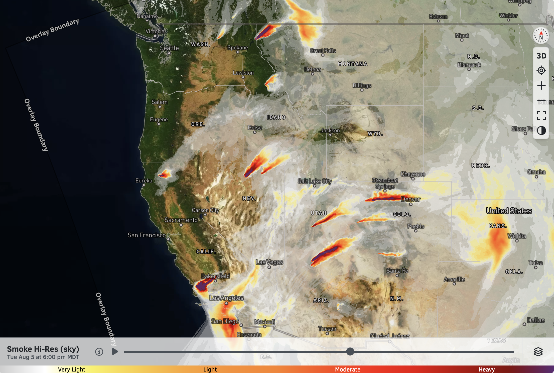
Wildfire and Smoke Update:
Since last weekend, a major uptick in wildfire activity has occurred, especially over the Southwest. In addition to the previously large wildfires burning in Utah and Arizona, active fires are also burning in Colorado, Nevada, and Southern California.
A few large fires have started in the Interior Northwest as well, though these fires will see some rain later this week.
Smoke will impact portions of the Southwest, including Utah, Colorado, and Southern California this week, with day-to-day and hour-to-hour fluctuations depending on winds and fire behavior. The Seattle area has also been experiencing smoke from a fire in the Olympics early this week, but a rain event on the way should help.
Be sure to view our smoke forecast and air quality maps (links above) for the most up-to-date information.
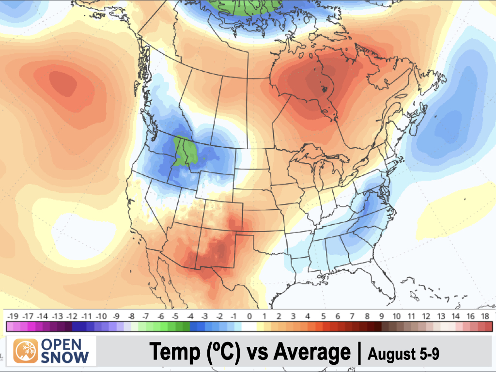
5-Day Temperature Outlook:
There will be a sharp temperature difference across the West this week, with below-normal temperatures across the Northwest and above-normal temperatures (i.e. scorching heat) in the Southwest.
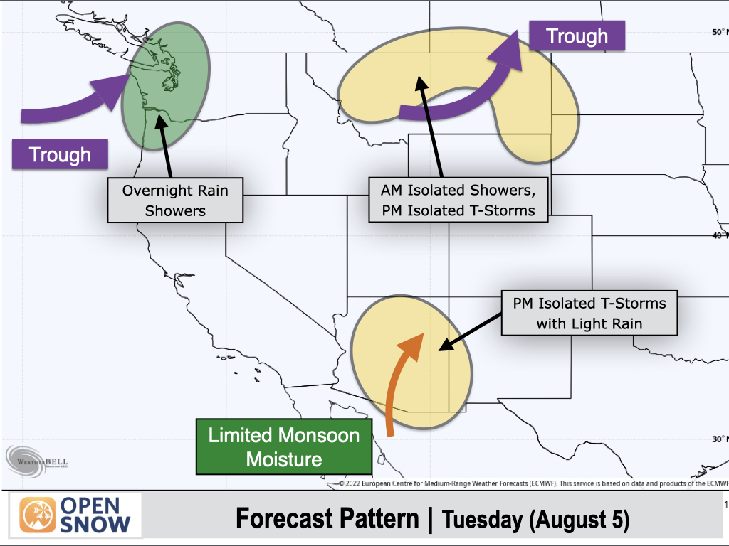
Tuesday (Aug 5):
This is shaping up to be a quiet day for most of the West.
A departing trough over the Northern Rockies will lead to a few showers in the morning across parts of Montana, followed by isolated thunderstorms in the afternoon.
The leading edge of a more significant weather system will reach the West Coast on Tuesday night with showers developing across Western Washington and Northwest Oregon.
To the south, conditions will remain dry across Colorado and Utah, while a weak monsoon will re-emerge over Arizona with isolated terrain-driven thunderstorms expected. These storms will generally produce light rain and gusty winds.
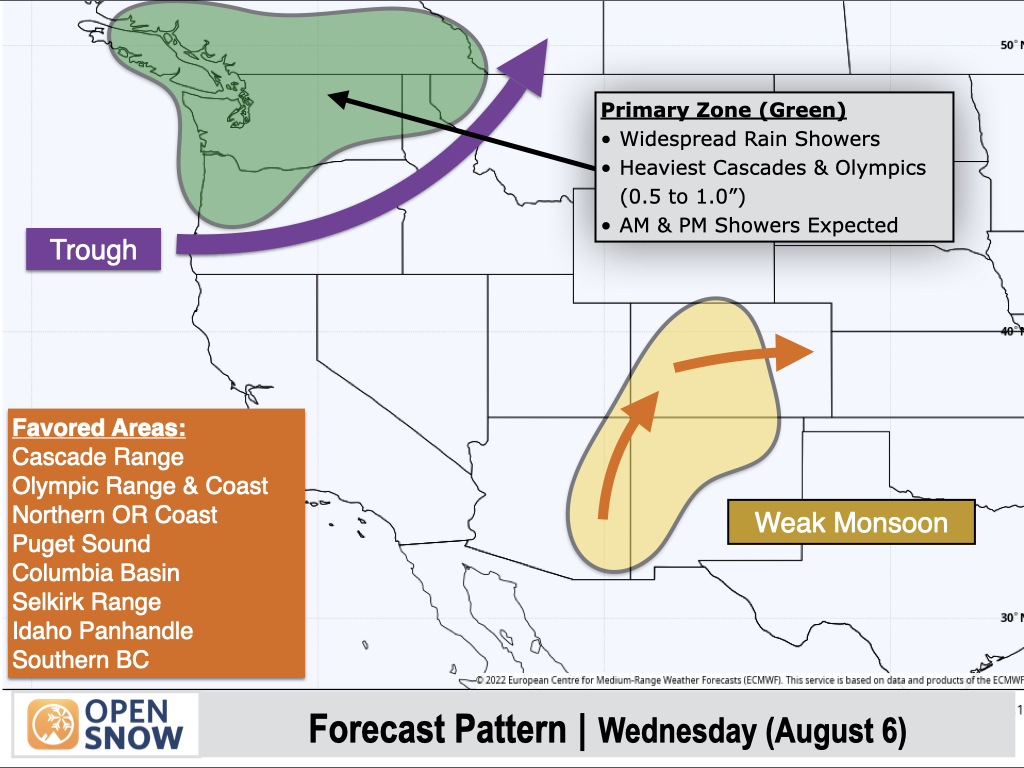
Wednesday (Aug 6):
A potent low pressure trough and surface cold front will move across the Northwest with widespread rain developing over the Olympics, Cascades, Puget Sound, and lowlands. Rain showers will also reach Northeast Washington and Northern Idaho later in the day, and even the Columbia Basin will pick up some meaningful rain.
The higher terrain of the Cascades and the Olympics will pick up a half-inch to an inch of rain (isolated higher totals possible), which is pretty good for early August and will hopefully help with the Bear Gulch Fire burning in the Olympics.
To the south, low-grade monsoonal moisture will spread into Colorado and New Mexico with isolated afternoon thunderstorm chances returning, mainly to the higher terrain. This is still a fairly tame setup by early August standards, with any storms producing light rain and gusty winds. Still, it's good to be aware of lightning potential if you have outdoor plans.
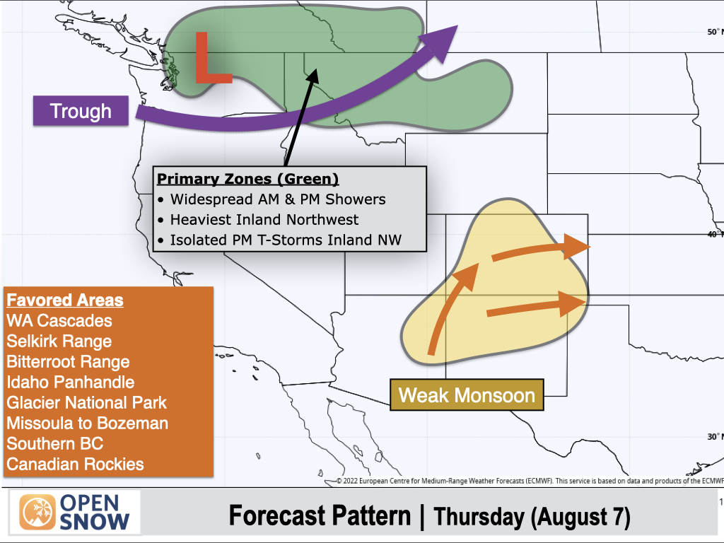
Thursday (Aug 7):
The low pressure system will continue to track across the Northwest with lingering rain showers over the Washington Cascades, while shower activity will become more widespread across Northern Idaho and Montana.
Isolated thunderstorms are also possible from the Selkirks to the Northern Rockies in the afternoon, though cool temperatures may limit the extent and strength of thunderstorms.
To the south, isolated thunderstorms can be expected over Colorado, New Mexico, and Eastern Arizona with a weak monsoon pattern in place.
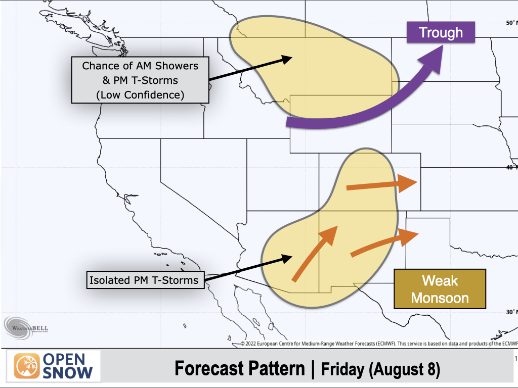
Friday (Aug 8):
The low pressure trough will continue to push east, but models are in poor agreement with how quickly it exits. Most models are projecting moisture to decrease fairly quickly with only isolated showers and thunderstorms across the Northern Rockies, but a few models are projecting a slower exit with wetter conditions possible.
The pattern will remain the same across the Southwest with isolated thunderstorms and light/spotty rainfall in Colorado, New Mexico, and Arizona. Gusty winds across the Southern Rockies associated with the trough passing to the north will not help the fire situation either.
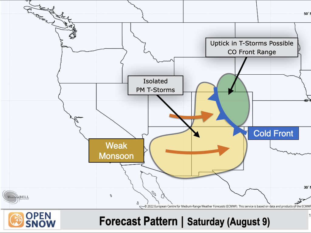
Saturday (Aug 9):
A backdoor cold front will slide into Eastern Colorado, potentially leading to an uptick in thunderstorm chances along the Front Range and Sangre de Cristo Range, and eastern foothills and plains.
West of the Divide in Colorado and further south into Arizona and Utah, an isolated thunderstorm setup can be expected once again, with any storms producing light rain and gusty winds.
Extended Forecast
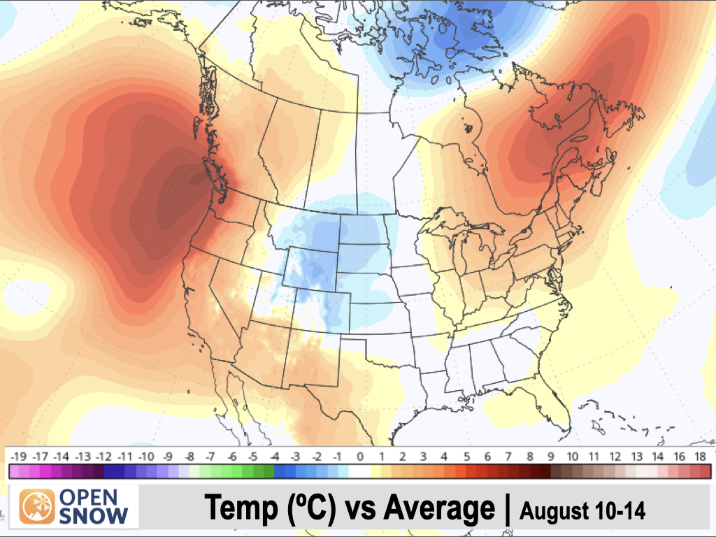
August 10-14:
A tall ridge of high pressure will develop over the Pacific Northwest, leading to a major warm-up along the West Coast and especially over the Northwest.
A weak monsoon pattern will remain in place with moisture shifting westward a bit, favoring southern New Mexico and Arizona, and possibly extending into the Sierra Nevada Range in California as well, where we could see some thunderstorm chances arise at times.
Subtle disturbances and cold fronts sliding down the east side of the Continental Divide could also lead to occasional thunderstorms along the eastern slopes of the Rockies from Montana to Colorado.
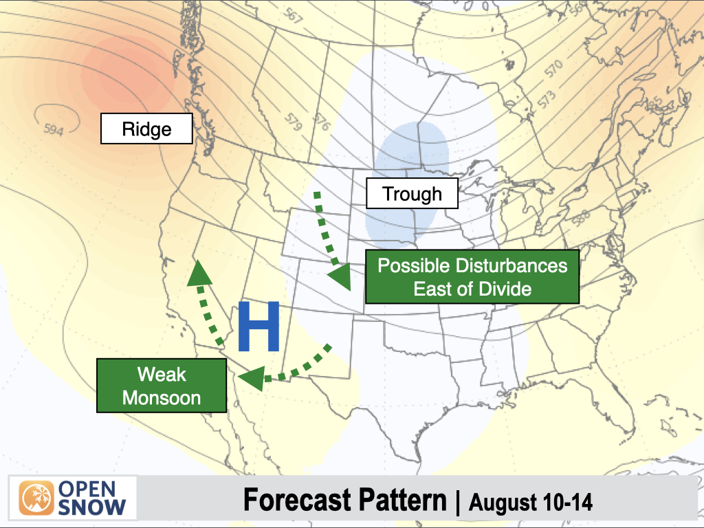
Temperatures are expected to be warmer-than-normal along the West Coast and Southwest, with the potential for below-normal temperatures over the Eastern Rockies.
However, there is some model disagreement. The European AI Ensemble Model is shown below, which has performed well recently, but other longer-range models are projecting the ridge to push further inland with warmer conditions overall across the West than what this model is showing, so we'll see...
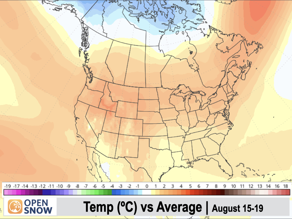
August 15-19:
A weak monsoon is expected to continue over the Southwest, though models are in relatively poor agreement in terms of where over the Southwest the "favored" circulation will set up. There are still no clear signs that would indicate any significant monsoon pushes, however.
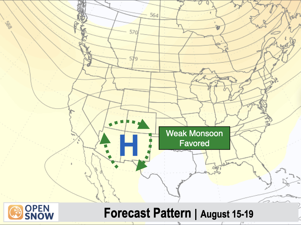
Temperatures are generally expected to be warmer than average throughout the West, though there are some question marks in terms of the extent and severity of the heat.
Thanks so much for reading! Next update on Wednesday (August 6).
Alan Smith
About Our Forecaster


