Western US Daily Snow

By Alan Smith, Meteorologist Posted 3 hours ago July 17, 2025
Monsoon Uptick for the Southwest & Rockies Through Sunday
Summary
A surge of monsoonal moisture will lead to an increase in thunderstorms across the Southwest from Thu to Sun, with UT, CO, & NM favored for the most consistent activity. Northern AZ will see active days Thu-Fri with fewer storms in the days to follow. The Northern Rockies will also see scattered t-storms each day in this pattern. Temps will also not be crazy hot by mid-July standards.
Short Term Forecast
Helpful Links:
Wildfire and Smoke Update:
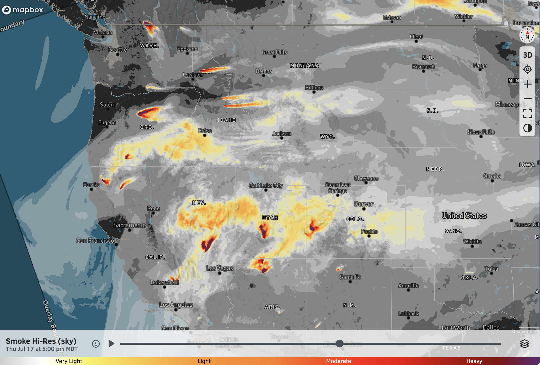
Wildfires continue to burn across the West, with some of the larger and more notable fires over the Southwest. However, we have also seen an uptick in wildfire activity across the Northwest.
Smoke can be expected across parts of the West this week and beyond, but smoke levels can quickly change from day-to-day and even hour-to-hour, so make sure you check our air quality and smoke forecast maps regularly for the latest.
Here is our smoke (sky) forecast for Thursday afternoon:
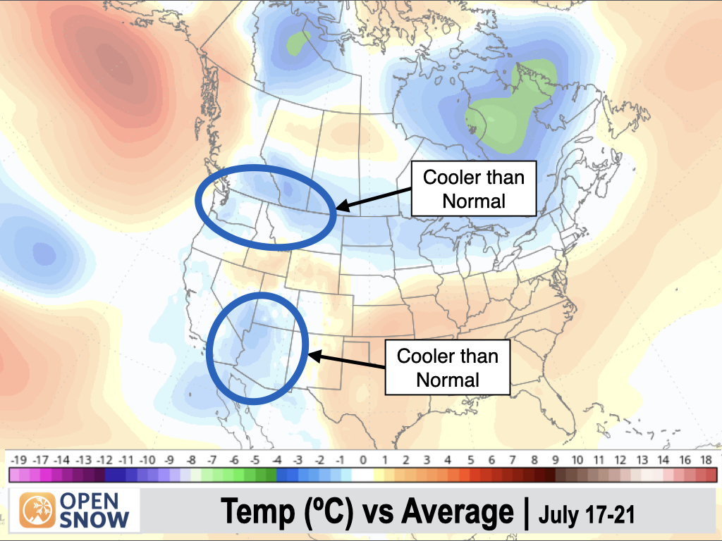
5-Day Temperature Outlook:
It's mid-July, so of course it's going to be hot across the lower elevations and deserts. But, the good news is that no heatwaves are expected as temperatures will be near to below average across most of the West over the next 5 days.
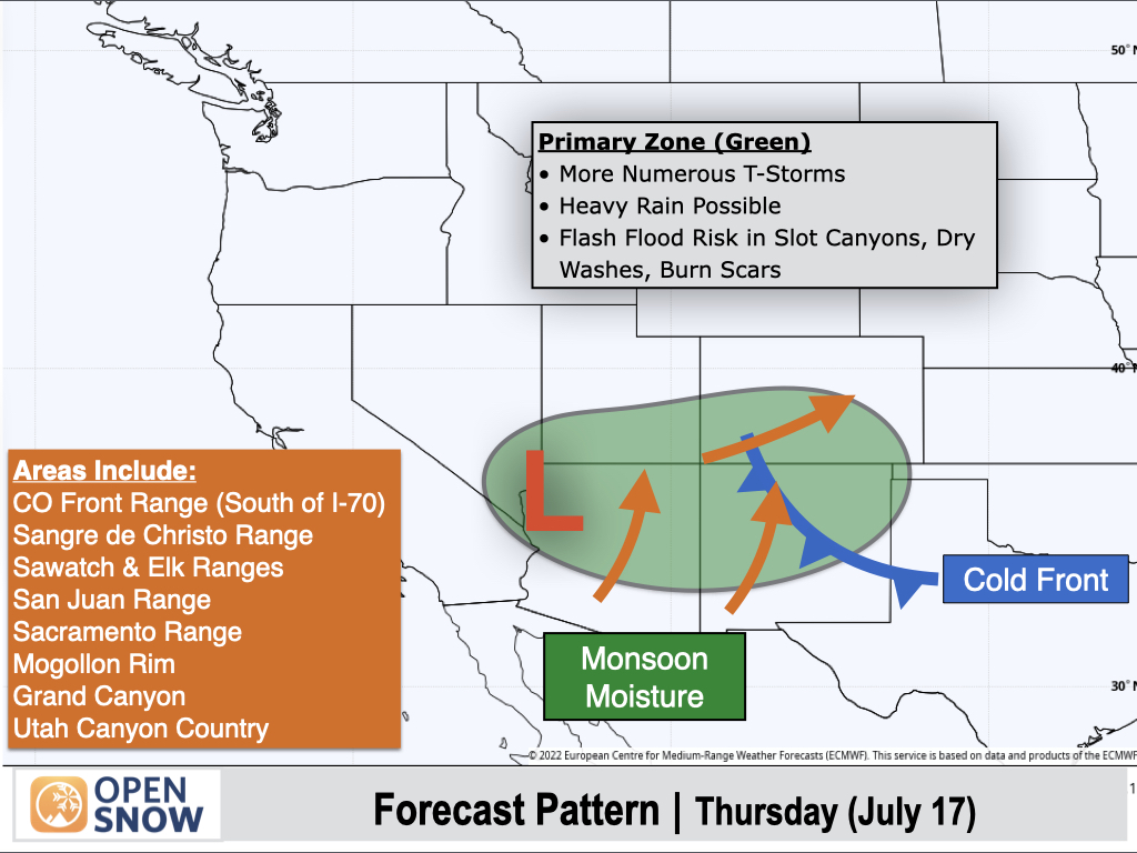
Thursday (July 17):
Monsoonal moisture will continue to increase across the Southwest, aided by an area of low pressure near Vegas that will help to pull moisture northward into Northern Arizona and New Mexico, and into Southern Utah and Colorado. A cold front sliding into New Mexico will also act as a focal point for thunderstorm development.
Thunderstorms will be scattered to widespread in coverage across the green-shaded region, with stronger storms capable of producing heavy rain. Flash flooding is also possible in slot canyons, dry washes, and burn scars.
Orange arrows on the map indicate the expected direction that thunderstorms will travel.
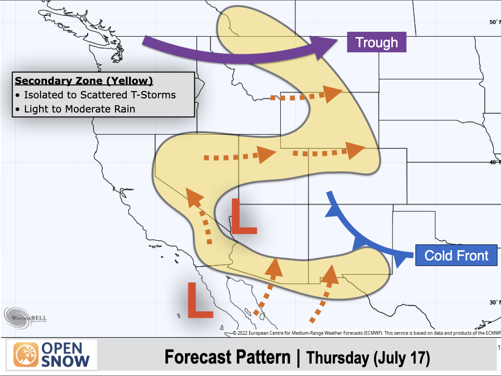
Yellow-shaded areas will be on the fringes of the monsoon with isolated to scattered afternoon thunderstorms. Most storms will produce light to moderate rain, though some localized downpours couldn't be ruled out in these areas.
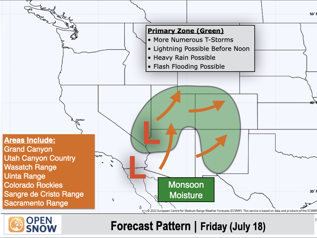
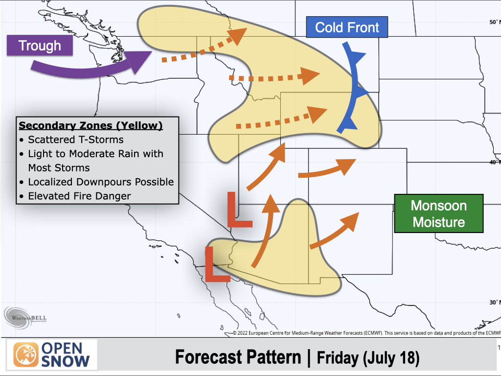
Friday (July 18):
Deeper monsoonal moisture will push northward with an uptick in thunderstorms expected across Northern Utah and Colorado, while southern portions of these states, along with New Mexico and Northern Arizona, will see another active day as well.
Strong thunderstorms will be capable of heavy rain, with isolated flash flooding also possible, especially in the canyon regions.
Monsoonal moisture will also increase across the Northern Rockies in advance of a trough moving into the Northwest. Scattered thunderstorms can be expected in these areas, with most storms producing light to moderate rain, though locally heavy rain is also possible.
Thunderstorm activity will be more isolated across Southern Arizona, but localized heavy downpours couldn't be ruled out.
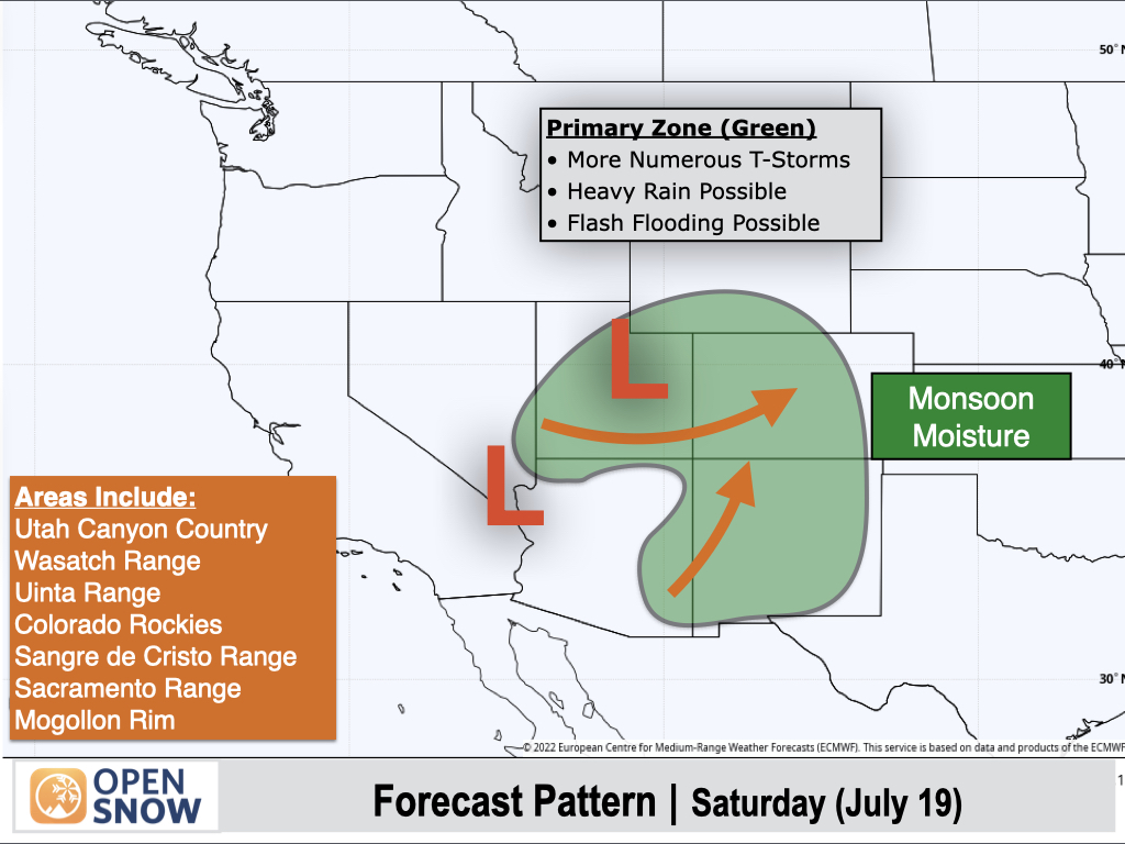
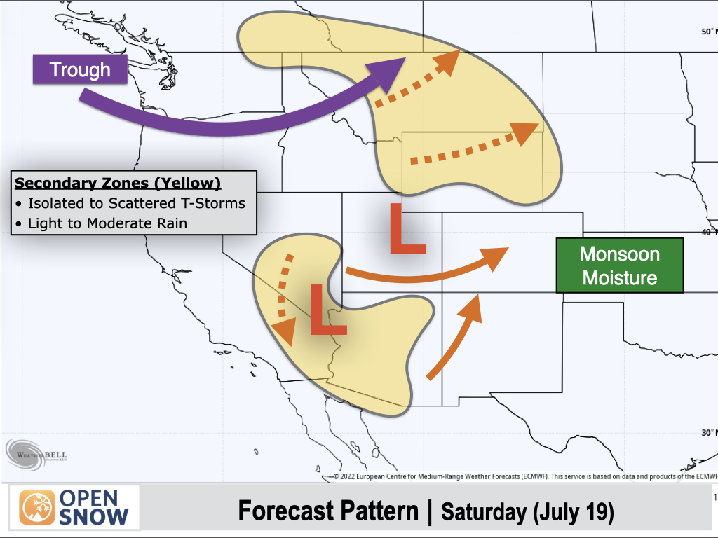
Saturday (July 19):
The monsoonal circulation will continue to favor the Southwest with not much change from Friday, except that Northern Arizona, including the Grand Canyon, will see a decrease in moisture, while Eastern Arizona will see an increase in moisture.
Storms across the Southwest and Southern Rockies will remain capable of producing heavy rain and frequent lightning. Also, with it being a Saturday, if you're planning to climb a 14er or another peak in the Rockies, be sure to get an early start, as thunderstorm development is possible prior to noon over the higher peaks.
Yellow-shaded areas on Saturday include the Northern Rockies, Southern Sierra, and portions of Nevada and Arizona, where isolated to scattered thunderstorms can be expected. Most storms in these areas will produce light to moderate rain, though localized downpours are also possible.
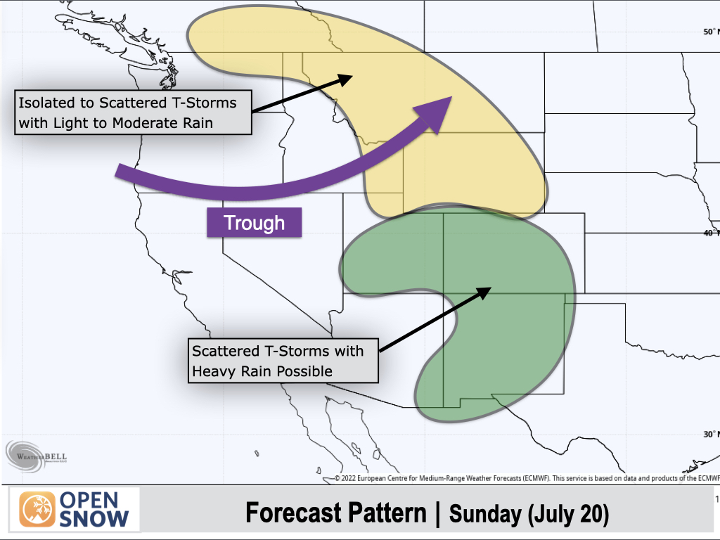
Sunday (July 20):
Utah, Colorado, and New Mexico will remain favored for thunderstorms as rich monsoonal moisture remains in place, while a deepening trough across the Northwest will also support isolated to scattered thunderstorms across the Northern Rockies and perhaps the Northern Cascades.
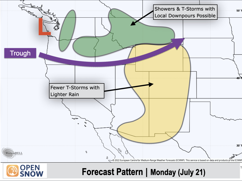
Monday (July 21):
The pattern will flip on Monday as strong westerly winds to the south of the deepening trough scour out much of the monsoonal moisture in place. As a result, the Southwest and the Southern and Central Rockies will see a reduction in thunderstorm activity compared to prior days, with more isolated coverage and lighter rainfall expected.
On the northern side of the trough, Pacific moisture and instability will arrive, resulting in an increased chance of showers and thunderstorms across the Cascades, Wallowas, and Northern Rockies, some of which could produce locally heavy downpours.
Extended Forecast
Outlook for July 22-30:
The pattern from July 22-26 favors below-normal temperatures across the Far West and Northern Rockies, while above-normal temperatures are expected to return to the Central Rockies and adjacent plains.
From July 22-26, NOAA's 6-10 day outlook favors above-normal rain chances across the Northwest and Northern Rockies as disturbances are projected to continue tracking across these regions.
This pattern could also suppress the monsoon somewhat over the Southwest, with below-normal rainfall expected in Utah, Arizona, and Nevada, while Colorado and New Mexico look to see more of a seasonal thunderstorm pattern with near-normal rainfall expected.
Looking further out, NOAA's 8-14 day outlook from July 24-30 favors below-normal rainfall across much of the West with a relatively weak monsoon expected early on in this period. However, we are also seeing longer-range signals hinting at a strengthening monsoon toward the end of this period.
Thanks so much for reading! Next update on Friday (July 18).
Alan Smith
About Our Forecaster


