News

By Alan Smith, Meteorologist Posted 1 year ago July 12, 2024
Expert Tips: Using Hourly Weather Forecasts to Evaluate Fire Danger

Track ongoing wildfires and evaluate fire danger for your location using OpenSnow's hourly weather forecasts, which are available for any location and elevation in the world.
Hourly forecasts include critical factors for fire danger such as temperature, humidity, wind, lightning, and precipitation.
New to OpenSnow?
⤵⤵⤵⤵⤵
No credit card required.
⤴⤴⤴⤴⤴
Pre-Existing Fire Danger
Wildfire danger is multi-faceted as it depends on past weather and climate conditions, as well as present and near-future conditions.
The National Interagency Fire Center and local fire managers will rate fire danger from low to extreme based on the dryness of vegetation fuels and the fuel load, which has to do with how much vegetation is susceptible to burning.
You can think of this as a pre-requisite to fire weather. Fuels can already be dry enough to burn, while daily and hourly weather conditions can exacerbate or reduce fire danger on a shorter-term basis.
To view whether or not there is a pre-existing fire danger in your area, we first recommend that you check with your local city, county, or fire district to determine the current fire danger. If you are unable to find this information, you can also view this national fire danger map from the Wildland Fire Assessment System:
View → Current Fire Danger Maps

If fire danger is rated as "Moderate" or higher in your location, then we recommend that you use OpenSnow to pay close attention to ongoing fires and daily and hourly weather forecasts.
Hourly Weather Forecasts for Any Location
View the latest weather forecast for your current location or any other location, worldwide.
- Go to the Favorites screen.
- Tap the "Weather" chip under the "Locations" tab
- Tap the "Current Location" card.
- View estimated conditions and the 10-day forecast.

View Forecasts Anywhere
Get the forecast for any mountain, park, town, or any location on Earth in OpenSnow.
Save up to 15 custom locations anywhere on Earth to view on your Favorites screen for quick and convenient access to the latest 10-day weather forecast.
- Go to the "Maps" tab.
- Tap anywhere or search for a city.
- Tap "Add to Favorites".
- Choose the name, location type, and favorites list.
- Compare any location on your Favorites screen.

Once you have a forecast page open, make sure you select the "Weather" chip under the "Locations" tab. Then, you can view hourly weather forecasts for different variables.
Here are the weather variables we recommend looking at specifically to evaluate fire danger:
- Temperature
- Humidity
- Wind
- Lightning
- Precipitation
Temperature
Hot temperatures are conducive to fire danger and fire activity because excessive heat affects both ignition and combustion processes. This also explains why fire danger is typically highest during the afternoon hours, when temperatures are highest.
On our 10-day forecasts, days with the warmest high temperature forecasts are likely to result in higher fire danger compared to cooler days (all other factors equal).
Also, extended stretches of hot temperatures (usually 80s or 90s or higher for valleys and towns) can also lead to a steady increase in fire danger over time.

Relative Humidity
Relative humidity as a percentage is a function of both temperature and moisture, and is a key indicator of whether or not the atmosphere is dry enough to influence fire danger. Low relative humidity levels lead to further drying of vegetation fuels on a short-term basis and can lead to short-term spikes in fire danger on a day-to-day basis.
The relative humidity is lowest when the air temperature is high and the dewpoint temperature is low. Smaller differences between air temperature and dewpoint temperature indicate higher relative humidity. In other words, cooler temperatures and/or high atmospheric moisture levels reduce fire danger.
Critical relative humidity levels vary by region, but typically relative humidity values of 15% or lower result in elevated fire danger, while values of less than 10% result in significant fire danger.
Relative humidity is usually lowest during the afternoon hours when temperatures are highest. As a result, fire danger is often highest between about midday and sunset, all other factors equal.

Learn More → Dewpoint vs. Humidity
Wind
When fuels are dry and relative humidity is low, wind is one of the most important factors that can influence fire danger and spread potential. Sustained periods of strong and/or gusty winds can lead to rapidly spreading wildfires, and can exacerbate fire behavior from ongoing fires.
Sustained wind speeds or frequent gusts of 25 mph or higher are considered to be the minimum threshold for significant fire weather concerns when dry conditions (or ongoing fires) are already present. As wind speeds increase above 25 mph, fire danger becomes even more of a concern as new fires can quickly spread out of control.
Also, if vegetation fuels are dry enough to burn and precipitation is not in the forecast, high wind events can lead to significant fire weather concerns even if temperatures are relatively cool and humidity values are above critical levels.
Wind direction is equally important as this determines the direction in which fires are likely to move. Wind direction refers to the direction the wind is blowing from, so a wind direction from the SW indicates a fire is likely to advance toward the NE (for example).
Wind-driven extreme fire events are the scariest in terms of rapidly spreading fires, for which you may have a short lead time to evacuate.

Lightning and Precipitation
These two are equally important when it comes to thunderstorms, as lightning is a common trigger for wildfires, whereas heavy rain can reduce fire danger.
Modest amounts of atmospheric moisture with dry air holding in place in the lower levels of the atmosphere will often result in dry thunderstorms, which are storms that produce cloud-to-ground lightning but very little rainfall. Dry thunderstorms increase the potential for wildfires when fuels are dry and relative humidity is low.
First, when looking at our daily and hourly forecasts, you can select the Lightning tab to view which days lightning is possible.
Next, look at the Precipitation tab and view the forecast 24-hour rainfall total underneath the graph. Rainfall amounts vary highly over small distances, which makes modeling thunderstorm rainfall challenging.
However, forecast rainfall amounts of less than 0.10 inches indicate a higher likelihood of dry thunderstorms, whereas forecast rainfall amounts of greater than 0.10 indicate a higher likelihood of wet thunderstorms – with the caveat that "dry" lightning strikes can still occur away from thunderstorm rainfall and can trigger new wildfires.

Active Fires Map
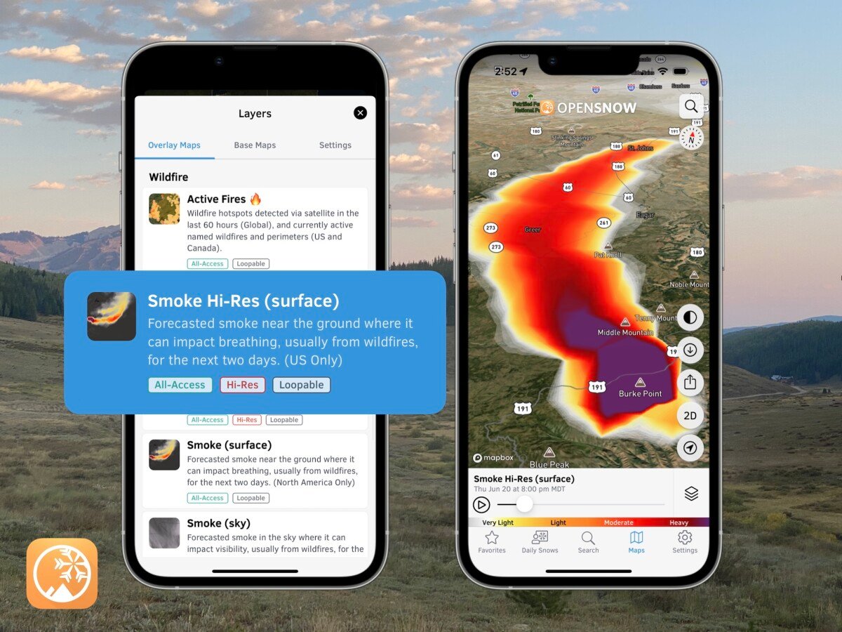
Once you have determined the fire weather concerns for your area, you can use our Active Fires Map to track ongoing wildfire behavior. We show wildfire perimeters as updated by wildfire managers (typically once/day), while satellite-detected hot spots can help you visualize more real-time fire activity.
View → Active Fires Map

Questions? Send an email to [email protected] and we'll respond within 24 hours. You can also visit our Support Center to view frequently asked questions and feature guides.
Alan Smith
About The Author


