News

By Alan Smith, Meteorologist Posted 3 months ago April 7, 2025
March 2025 Review & April Outlook for the Western U.S.
March 2025 Review
Late-season skiing conditions were excellent across much of the West this year thanks to frequent storms and heavy snowfall in March. Precipitation (and in most cases, snowfall) was above normal across the Sierra, Pacific Northwest, and Central/Northern Rockies while the Southern Colorado and New Mexico were drier than normal.

Despite the snowy pattern, temperatures ended up warmer than normal in March across most of the West. The one exception was California where temperatures were right around normal.

Snowpack heading into early April is near to slightly above normal across the Sierra and the Central and Northern Rockies with well above normal snowpack across Oregon, Northern California, and Western Idaho.
Snowpack is below normal across Washington and British Columbia despite the late-season improvement, while snowpack across the Southwest is well below normal.

April 2025 Preview
The first few days of April featured cold and snowy conditions across the West, and likely the last big powder cycle for some areas.
The rest of April is trending warmer and drier with a quick transition into spring.
NOAA's monthly outlook that was produced a week ago (on March 31) projected above-normal temperatures across the Southwest with equal chances for above or below-normal temperatures across the West Coast and Northwest.

Similarly, NOAA's monthly outlook projected below-normal precipitation across the Southwest with equal chances for above or below-normal precipitation across the Northwest.
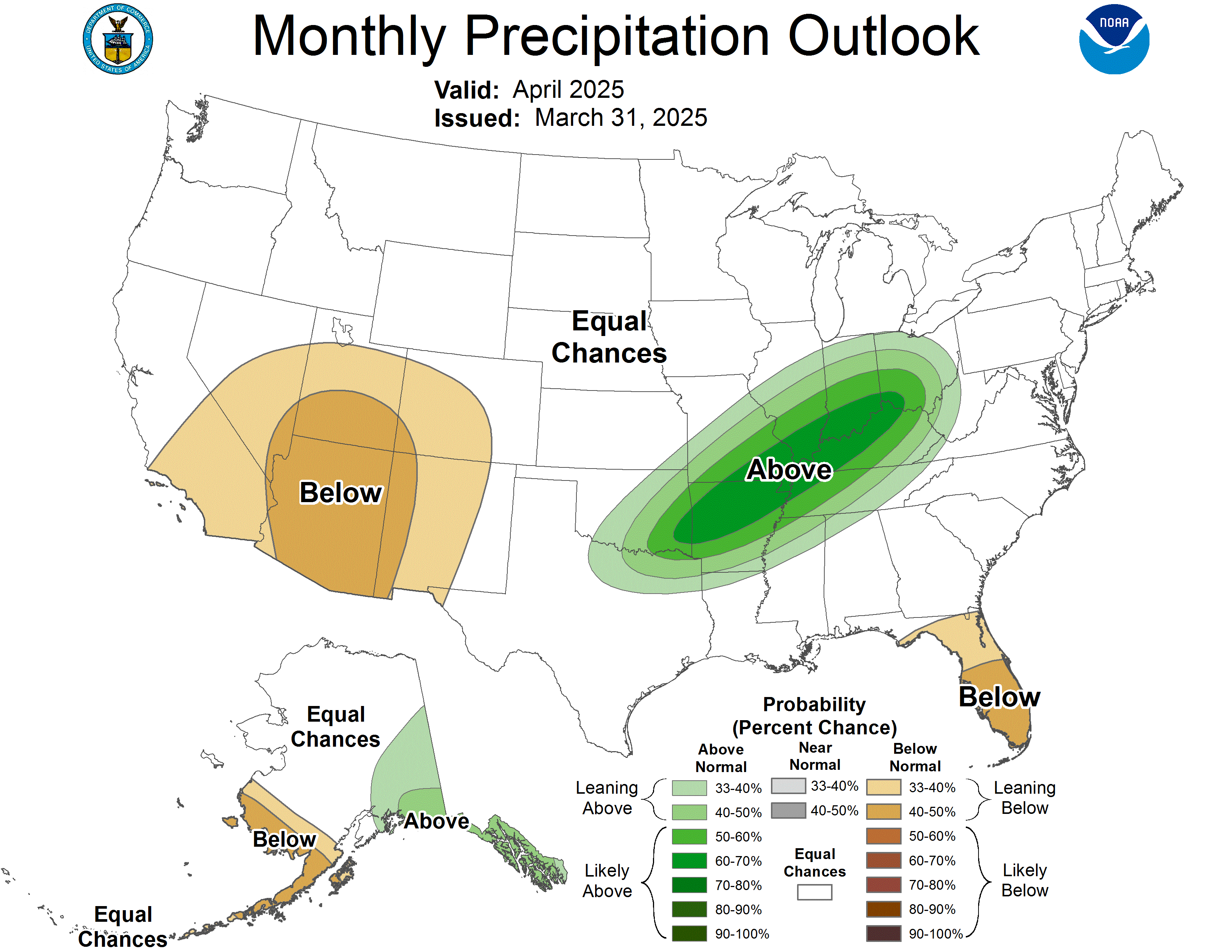
Since these outlooks were published, we have seen a trend toward warmer and drier-than-normal conditions for a majority of the Western U.S. for the rest of April in recent medium to long-range projections as high pressure is expected to be the dominant pattern for most of the month.
Storms could still sneak in from time to time, but overall April 2025 looks like it could be a relatively quiet month with snow potentially melting at a faster rate than usual.
The far Pacific Northwest (Washington, Northern Idaho/Montana) could see more storms compared to the rest of the West. A more active storm track is also expected in Canada with above-average precipitation favored for BC and Alberta.
Thanks so much for reading! I will post the next monthly update in early May.
Alan Smith
About The Author


