News

By Alan Smith, Meteorologist Updated 11 months ago August 15, 2024
Western US & Canada 2024 Active Wildfire Maps

Wildfire activity has continued to expand across Western North America recently due to the combination of persistent above-average temperatures, low relative humidity, gusty winds, and dry thunderstorms.
Track current wildfire perimeters, hot spots, and wildfire info using OpenSnow's Active Fires Map. Wildfire perimeters and fire info are available for the U.S. and Canada, while satellite-detected hot spots are available globally.
New to OpenSnow?
⤵⤵⤵⤵⤵
No credit card required.
⤴⤴⤴⤴⤴
How to View the Active Fires Map
- Tap the "Maps" tab.
- Tap the overlay button.
- Tap the Active Fires map.
- Scrub the bottom slider.
Also, we recently added a 3D Maps feature, which offers a great way to visualize fire perimeters over terrain.
How to View the Active Fires Map (and Other Maps) in 3D:
Mobile
- Tap the "3D" button on the "Maps" tab.
- Increase or decrease the tilt by using two fingers and moving up or down.
- Rotate the map in any direction by using two fingers.
- Tap the direction icon to reset the map to point north.
Desktop
- Click the "3D" button on the "Maps" tab.
- Increase or decrease the tilt by holding the "Control" key and your mouse/trackpad button while moving your cursor up or down.
- Rotate the map in any direction by holding the "Control" key and your mouse/trackpad button while moving your cursor from side to side.
- Tap the direction icon to reset the map to point north.

Next, let's take a look at some of the active wildfires ongoing across the West.
Alexander Mountain Fire (Colorado):
This fire, located just west of Loveland, was first discovered on July 29 and has burned 9,668 acres as of August 8. This fire has seen big improvements over the last week due to favorable weather bringing rain and dampening the flames as well as letting wildfire crews control the fire. The fire is 94% contained and is minimally burning and smoldering as of August 8. The cause of the fire is still unknown.

This fire, located east of Bakersfield near Lake Isabella, was first discovered on July 24 and has burned 59,288 acres as of August 6. The fire is burning brush and short grass and has exhibited minimal behavior with smoldering. This fire has seen big improvements and is now 91% contained as of August 6 and the cause of the fire is unknown.

This fire, located in the Domeland Wilderness of the Southern Sierra, was first discovered on July 13 and has burned 23,597 acres as of August 13. The fire is burning timber and brush and has exhibited active behavior. The fire is 70% contained as of August 13 and the cause of the fire is unknown.

This human-caused fire, located just north of Chico, was first discovered on July 24 and has burned 429,260 acres as of the evening of August 12. This is currently the fourth-largest fire in California history. The fire is burning timber and tall grass and is now exhibiting minimal behavior. The fire is 41% contained as of August 12.

This fire, located southeast of Orleans California in northern California and was first discovered on August 9 and has burned 8,617 acres as of August 15. The fire is burning timber and has exhibited active behavior. The fire is 0% contained as of August 15 and the cause of the fire is unknown.

Diamond Fire Complex (Oregon):
This lightning-caused fire cluster, located north of Crater Lake National Park, was first discovered on July 16 and has burned 9,663 acres as of mid-morning on August 14. The fire is burning timber and brush and has exhibited active behavior. The fire complex is 29% contained as of August 14.

This lightning-caused fire, located southeast of Eugene, was first discovered on July 17 and has burn 24,103 acres as of August 14. The fire is burning timber and has exhibited active behavior. The fire is 31% contained as of August 14 and several other active fires are also burning nearby.

This lightning-caused fire, located in Central Oregon, was first discovered on July 22 and has burned 86,870 acres as of early morning on August 14. The fire is burning short grass and brush and has exhibited moderate behavior. The fire complex has seen big improvements due to favorable weather and is 71% contained as of August 14.

This fire, located in Northeast Oregon, was first discovered on July 18 and has burned 115,190 acres as of August 14. The fire is burning timber and tall grass and has exhibited extreme behavior. The fire is 48% contained as of August 14 and the cause of the fire is unknown.

This human-caused fire, located in Central Oregon, was first discovered on July 10 and has burned 151,670 acres as of mid-morning on August 14. The fire is burning timber and tall grass and has exhibited moderate behavior. The fire is 89% contained as of August 14.

This lightning-caused fire, located near Hells Canyon, was first discovered on July 24 and has burned 31,421 acres as of August 14. The fire is burning timber and brush and has exhibited moderate behavior. The fire is 42% contained as of August 14.

This lightning-caused fire, located east of Cascade, was first discovered on August 5 and has burned 18,535 acres as of August 15. The fire is burning timber and has exhibited active behavior. The fire is 0% contained as of August 15.

Cougar Creek Fire (Washington):
This fire, located in Southeast Washington, was first discovered on July 15 and has burned 24,091 acres as of August 13. The fire is burning timber and brush and has exhibited minimal behavior with smoldering. The fire is 60% contained as of August 13 and the cause of the fire is unknown.

This human-caused fire, located west of Yakima, was first discovered on July 23 and has burned 45,601 acres as of August 9. The fire is burning short grass and brush and has exhibited minimal behavior with smoldering. The fire is 70% contained as of August 9.

Williams Mine Fire (Washington):
This lightning-caused fire, located south of Mount Adams, was first discovered on August 5 and has burned 11,149 acres as of August 14. The fire is burning timber and brush and has exhibited active behavior. The fire is 2% contained as of August 14.

This fire, located near North Cascades National Park, was first discovered on July 8 and has burned 38,708 acres as of August 14. The fire is burning timber and short grass and has exhibited minimal behavior. The fire is 18% contained as of August 14 and the cause of the fire is unknown.

This lightning-caused fire, located in North Central Washington, was first discovered on July 17 and has burned 53,462 acres as of August 8. The fire is burning tall grass and brush and has exhibited minimal behavior. The fire is 98% contained as of July 25.

Shetland Creek Fire (British Columbia):
This lightning-caused fire was first discovered on July 11 and has burned 69,392 acres as of August 13. This fire is located on the eastern side of the Coast Range and is considered to be a fire of note.

Nemo Creek and Aylwin Creek Fires (British Columbia):
This pair of lightning-caused fires was first discovered on July 17 and collectively has burned nearly 24,271 acres as of August 13. These fires are surrounding Slocan Lake near Valhalla Provincial Park, and the Nemo Creek Fire on the west side of the lake is considered out of control.

Argenta Creek Fire (British Columbia):
This lightning-caused fire was first discovered on July 17 and has burned 47,328 acres as of August 5. This fire is located on the eastern side of the Purcell Range, just north of Kootenay Lake, and is considered out of control.

Mt. Morro Fire (British Columbia):
This lightning-caused fire was first discovered on July 16 and has burned 33,312 acres as of August 5. This fire is located in Top of the World Provincial Park in Southeast BC and is considered to be out of control.

Dogtooth Fsr Fire (British Columbia):
This lightning-caused fire was first discovered on July 21 and has burned 14,036 acres as of August 5. This fire is located just south of Golden and Kicking Horse and is considered a fire of note.

Jasper Wildfire Complex (Alberta):
The devastating Jasper wildfire complex has now burned 46,886 acres of August 4, and this included significant damage in the town of Jasper on July 24. Jasper National Park remains closed to the public as of August 4.

Smoke and Air Quality
Smoke from these wildfires is also impacting portions of the Interior West this week. Be sure to stay on top of the air quality situation and smoke forecast for your location by using the following maps...
Air Quality Real-Time Map
Use this map to view the current PM 2.5 air quality index from PurpleAir sensors. Shown as the 10-minute average for the past 24 hours and available worldwide.
View → Air Quality Real-Time
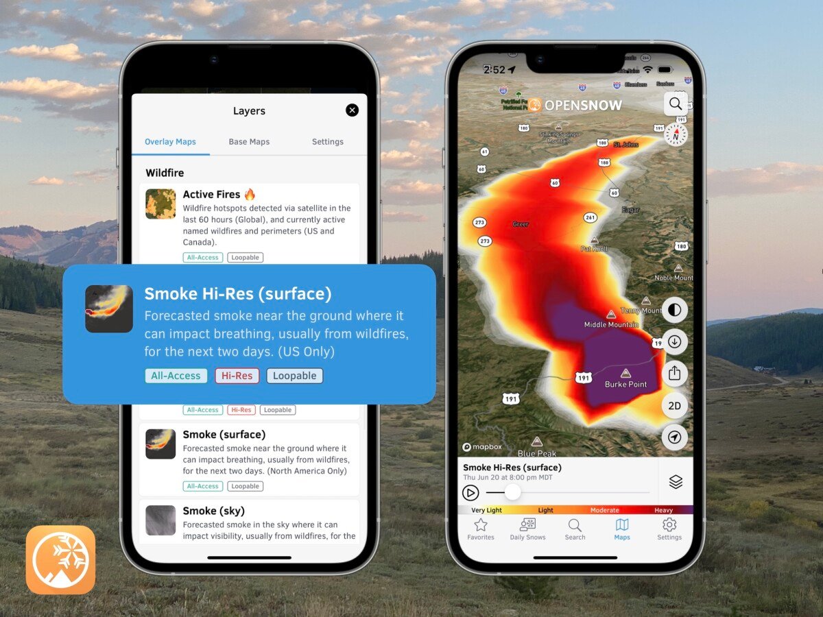
Smoke Hi-Res (surface) Map
Use this map to track smoke for the next 2 days near the ground where it can impact breathing. Updated every hour and available for the continental United States.
View → Smoke Hi-Res (surface)
Smoke Hi-Res (sky) Map
Use this map to track smoke for the next 2 days in the sky where it can impact visibility. Updated every hour and available for the continental United States.
View → Smoke Hi-Res (sky)
Air Quality Forecast Map
Use this map to view the likely location of smoke and other pollutants for the next 5 days. Updated 4 times per day and available worldwide.
View → Air Quality Forecast
Questions? Send an email to [email protected] and we'll respond within 24 hours. You can also visit our Support Center to view frequently asked questions and feature guides.
Alan Smith
About The Author


