Tahoe Daily Snow

By Bryan Allegretto, Forecaster Posted 9 years ago December 19, 2014
Christmas Cold...
Summary:
A cold front is approaching the area this morning and will push through the area today bringing snow. 1-3 inches could fall by Saturday morning, with 3-6 inches possible along the crest. Over the week and into next week high pressure builds in bringing dry conditions. The ridge shifts NW away from the area by Wednesday allowing a cold system to drop in from the Northwest. That could bring several inches of snow into Christmas Day. Beyond that confidence is low in the pattern.
Details:
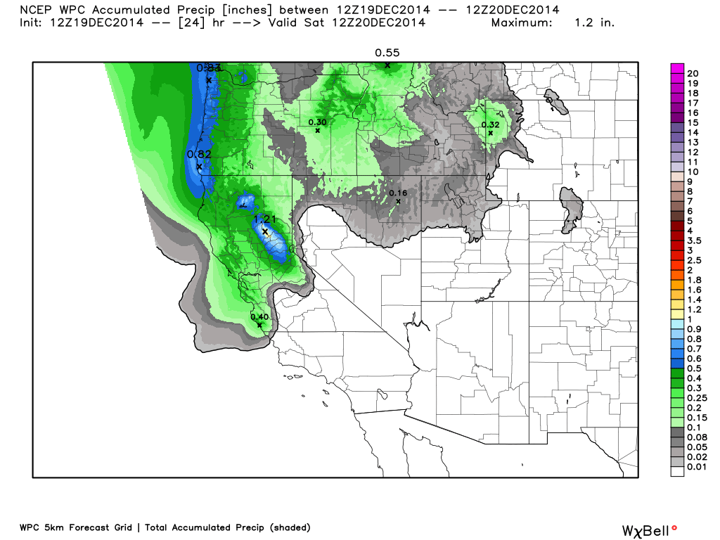
The cold front and associated precip band is pushing towards the area this morning. That will bring a quick shot of steadier snow today and then some lingering snow showers along the crest tonight. By Saturday morning the mountains could see 1-3 inches of snow and up to an inch at lake level. West of the basin along the crest we could see 3-6 inches. The highest amounts should be Northwest of the lake near Donner Summit. Not much change in the forecast from yesterday.
The next storm moves into the Pacific NW on Saturday and clouds and some light showers could possible make it as far South as the Tahoe basin. By Sunday the ridge is building off the coast and we will see dry conditions through Tuesday.
By Christmas Eve the ridge position has retrograded NW towards the Gulf of Alaska. A cold storm will drop into the Pacific NW and push South through the area. This could bring us several inches of snow Christmas eve into Christmas Day. Maybe in the 1-3 inches at lake level and 3-6 inches on the mountains range. It will also bring in much colder air by Christmas Day. We may stay in the 20's for highs most of the day even down to lake level.
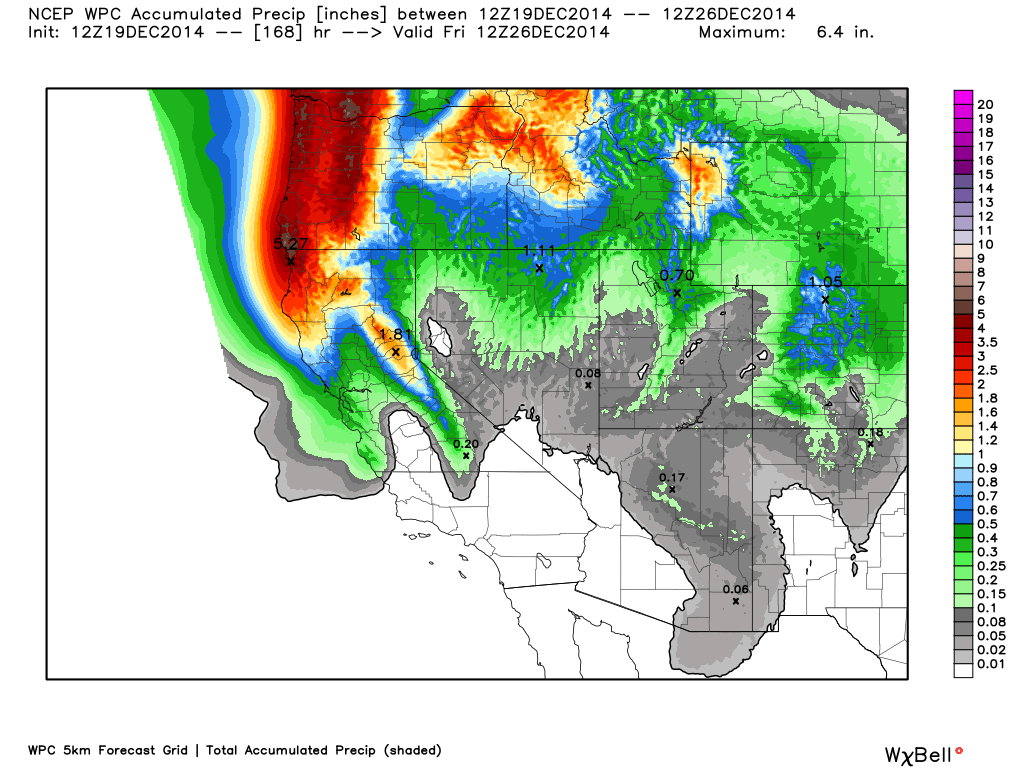
Here is the total precip forecast through Thursday. Notice the heavier amounts in the Pacific NW from the storm over the weekend.
Long-Range:
Last night the European control model had jumped fully on board with the GFS in showing the ridge shifting over Alaska and a train of storms moving into CA starting around the 28th. This morning the models have completely flipped. The GFS had shown that pattern for a few days. This morning the latest runs keep the ridge in the Northeast Pacific with a cold pattern over much of the country, and weak systems sliding down to our East over the Rockies. This is why I call it the "unreliable" long-range of the models, or "fantasy range".
We may see it flip back but for now some more studying of what is happening with the pattern in the long-range is needed. The CFSv2 over the past few days has been showing January much drier than before as well. Sigh....
Stay tuned....BA
About Our Forecaster
Bryan Allegretto
Forecaster
Bryan Allegretto has been writing insightful posts about snow storms for over the last 15 years and is known as Tahoe's go-to snow forecaster. BA grew up in south Jersey, surfing, snowboarding, and chasing down the storms creating the epic conditions for both.
Free OpenSnow App


