News

By Sam Collentine, Meteorologist Posted 10 years ago December 16, 2013
Weather for the week - Dec 16 to Dec 20, 2013
For this week, the upper Midwest and New England will receive snow through Wednesday while the West begins to see their next system come Wednesday night. A ridge of high pressure will remain in place over the West through Wednesday allowing for an Alberta Clipper to dive into the eastern half of the United States. This system will not be as cold as this past weekend's so don't expect to see totals quite as high.
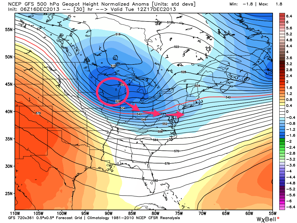
The storm track for the eastern half of the United States, according to the American GFS, as of Tuesday morning. Source: WeatherBell.com, analysis by OpenSnow.
For the upper Midwest, expect totals to range from 3 to 6 inches with higher amounts possible along the shores of Lake Superior and Lake Michigan. Always remember to grab the latest details for this area of the country from Meteorologist Andrew Murray in The Upper Midwest Daily Snow.
As for this past weekend's winner for the best powder across the US, New England can expect to see anywhere from 2 to 10 inches depending on the location. Areas of upstate New York, New Hampshire, and Maine look to have the best potential for the highest amounts. Meteorologist Brian Clark will have the details in The New England Daily Snow.
Looking into the second half of this week, a stormier pattern will begin to settle into the West beginning on Wednesday night. This system is what Meteorologists call a "split flow pattern". There will be a stronger area of energy, a closed low, off the coast of California while a weaker area of energy moves across the Nothern Rockies.
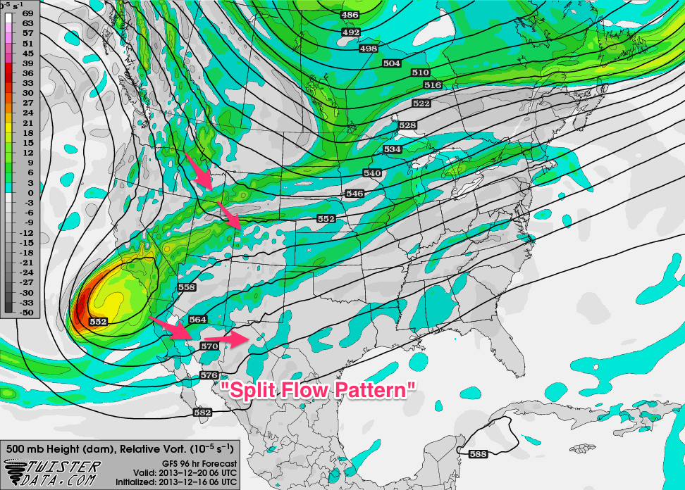
The "split flow pattern", according the American GFS, as of Thursday night. Source: TwisterData.com, analysis by OpenSnow.
Almost all areas of the West will receive snow during the second half of this week with Washington, Idaho, Montana, and British Columbia coming away with the highest amounts. California, Utah, and Colorado will also receive snow but accumulations will be on the lighter side with the stronger area of energy staying to the south. Again, if you're searching for powder this week, head north.
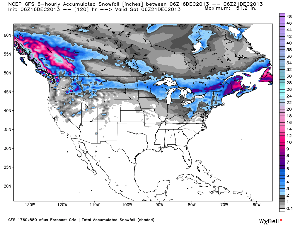
Total accumulated snowfall, according to the American GFS, as of Friday night. Source: WeatherBell.com
Always remember to check our Powder Finder, forecasts for each mountain, and our Daily Snow posts throughout the week for more details.
SAM COLLENTINE
About The Author
Sam Collentine
Meteorologist
Sam Collentine is the Chief Operating Officer of OpenSnow and lives in Basalt, Colorado. Before joining OpenSnow, he studied Atmospheric Science at the University of Colorado, spent time at Channel 7 News in Denver, and at the National Weather Service in Boulder.
Free OpenSnow App


