Boise Region Daily Snow
By Matthew Platt, Forecaster Posted 1 year ago March 31, 2023
Ullr Giveth
Summary
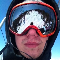
My goodness what a 48 hours at Bogus. I rode there yesterday and it was easily the deepest day of the past couple years. Had a couple old timers tell me it was the best day in the past decade. I believe it. We have a very active next 5 days and then spring will arrive in a hurry. Let's take a look!
Short Term Forecast
Just to show how good of a year it has been at Bogus check out the graphic below:
Bogus easily topped its previous SWE record with over 35 inches of liquid this winter. Absolutely incredible.
The northern areas should see on and off showers throughout the day today. Enough to pick up 1-3 inches. The next storm moves into the area early Saturday morning. This will be a strong storm and will perform very well for Tamarack and Brundage. Temperatures will be cold tomorrow up that way with snow levels well below 4k feet. Bogus will be a bit warmer but will still be below 4500 feet. Good news is that tomorrow will be the warmest day for us. Snow levels will be even lower through the middle of next week.
After tomorrow's storm, it looks like we see follow on storms moving in Sunday afternoon, Monday, Tuesday, and Wednesday will be the final storm (possibly for the season). The strongest storm in this series will be Saturday's storm with about an inch of liquid dropped during the day up north. Good enough for 8-14 inches of snow. Obviously expect to be storm riding all day on Saturday. Bogus will see amounts of 6-10 inches.
Models show follow on showers Sunday through Wednesday. Some of them could be pretty significant. Our internal plumes are showing up to 2.5 inches of liquid dropped through Wednesday up north and about 1.75 at Bogus. The UofU plumes are even more bullish with well north of 30 inches of snow accumulating through the middle of next week:
Best days to ride? Obviously, Saturday will be good with free refills all day, but I think really every day from Sunday-Wednesday will feature great snow. Keep an eye on the snow stakes around the area and get after it!
Extended Forecast
Get after it because the end is nigh. After Wednesday all models are in good agreement that we dry up and warm up. We could warm up significantly with the GFS forecasting mid-60s by next weekend (in Boise). There is some indication that precipitation and cooler temperatures could return by late April. But by that point it will be too late and resorts will be shut down.
Obviously it has been an incredible year, but I am happy to see warmer temperatures in the forecast. It has been a long season.... well over 6 months since snow first started flying. I will post a few more times and then post a final obituary on the season. Get out there this week and early next week!