South America Daily Snow

By Luke Stone, Forecaster Posted 2 years ago May 28, 2023
Welcome to the South America Daily Snow!
Summary
This is the first South American forecast of the season, and I will be publishing these every Monday, Wednesday, and Friday through the end of August. I know a lot more people are chasing storms to this region these days, so hopefully these forecasts will help you plan your trip, as well as keep your excitement for snow going throughout the North American summer.
Short Term Forecast
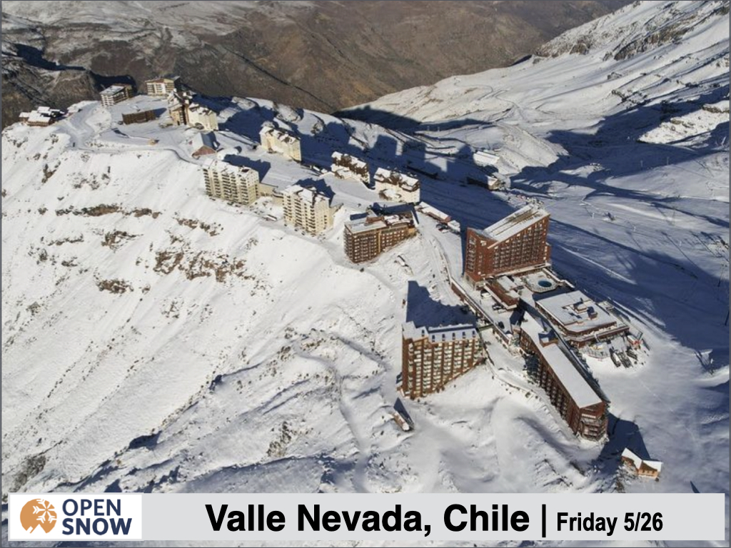
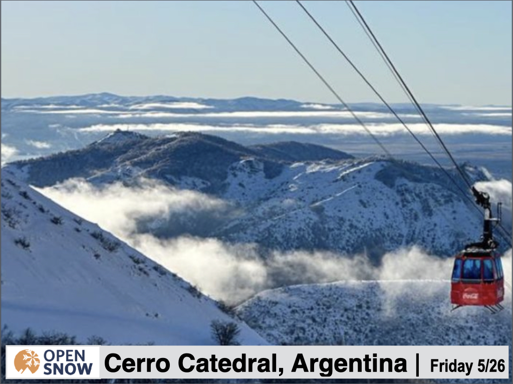
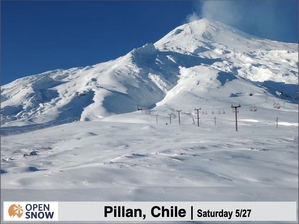
After a quiet weekend, snow chances return next week, with a very warm storm early and potentially a big snow producer later in the week. With impressive snowfall across much of Argentina and Chile in the last seven days, the South American winter is off to a great start. Most resorts generally open mid to late June. Check out a few shots from the snowy start to the season below.
Forecast for Saturday 5/27 - Sunday 5/28
Not a whole lot going on this weekend, with temperatures running mainly above normal, especially on Sunday. The warmth shouldn't do too much damage to the existing snowpack from the recent storms.
Forecast for Monday 5/29 - Wednesday 5/31
Unfortunately, the weekend warmth will continue through the early part of the week. With a strong storm arriving, this will produce mostly clear precipitation. A strong and stubborn low pressure system off the southwestern corner of the continent will send waves of moisture to the Andes starting Monday night. While snow levels will be quite high initially, they will lower later in the week. For this first storm, snow levels will range from 2400m to 3000m south to north. As a result, this will be mostly a rain event through Wednesday except for some minor accumulations at the higher elevations, particularly in the Mendoza and Valparaiso regions.
Forecast for Thursday 6/1 - Sunday 6/4
Things start to get more interesting toward the latter part of the week, as a better push of cold air enters the region from the south. Precipitation will be lighter on Thursday, before picking up again Thursday night as the cold front approaches. Rain will transition to snow from south to north, with snow levels falling considerably, down to 900m farthest south and down to 2100m in the north. This will result in mostly snow for most resorts, with good dense base building snow at lower elevations. After the transition to snow Thursday night, snow will continue heavily on Friday as temperatures continue to fall. The moisture continues through Saturday and Sunday, with additional accumulations. Significant accumulations are likely during this period, especially on Friday and Saturday, before temperatures start to increase once again Saturday night. Below is the GFS storm total through Sunday.
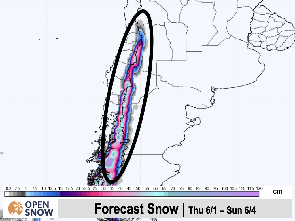
Corralco, Cerro Catedrla, and Nevados de Chillan look to be some of the deeper resorts with this storm, which should drop up to 80 cms at upper elevations near Corralco. Generally amounts will decrease as you move north and south from this region, but most resorts should still see 25+ cms.
Extended Forecast
Outlook for Monday 6/5 - Friday 6/10
Don't expect much of a break starting next week. Snow levels will continue to rise on Monday with rain turning back to snow at lower elevations and maybe upper elevations as well, however moisture looks to impact from Corralco and south. Another cold front is possible Tuesday night into Wednesday, lowering snow levels and bringing more heavy snow perhaps extending as far north as Nevados de Chilean. The models then show a break in the action, but since that is nearly two weeks away, I will update you on that later.
Thanks for reading the first South America daily snow of the season. Follow me @lstone84 on Instagram to check out some new content I will be creating for the North American summer months. Let me know what you think.
Announcements
Moving forward, posts will be updated every Monday, Wednesday, and Friday morning, so please subscribe to get these in your inbox!
About Our Forecaster


