South America Daily Snow

By Luke Stone, Forecaster Posted 2 years ago May 29, 2023
Very Active Pattern Continues, as a Barrage of Storms Bring Rain and Snow
Summary
We have an active weak of weather ahead, with lots of precipitation headed to the Andes of central and southern Argentina/Chile. Not surprisingly, snow will mix with rain at times, but overall this will be a net gain for the resorts in the Andes. Long range looks a bit quiet, but with resort openings more than two weeks out there is nothing to worry about.
Short Term Forecast
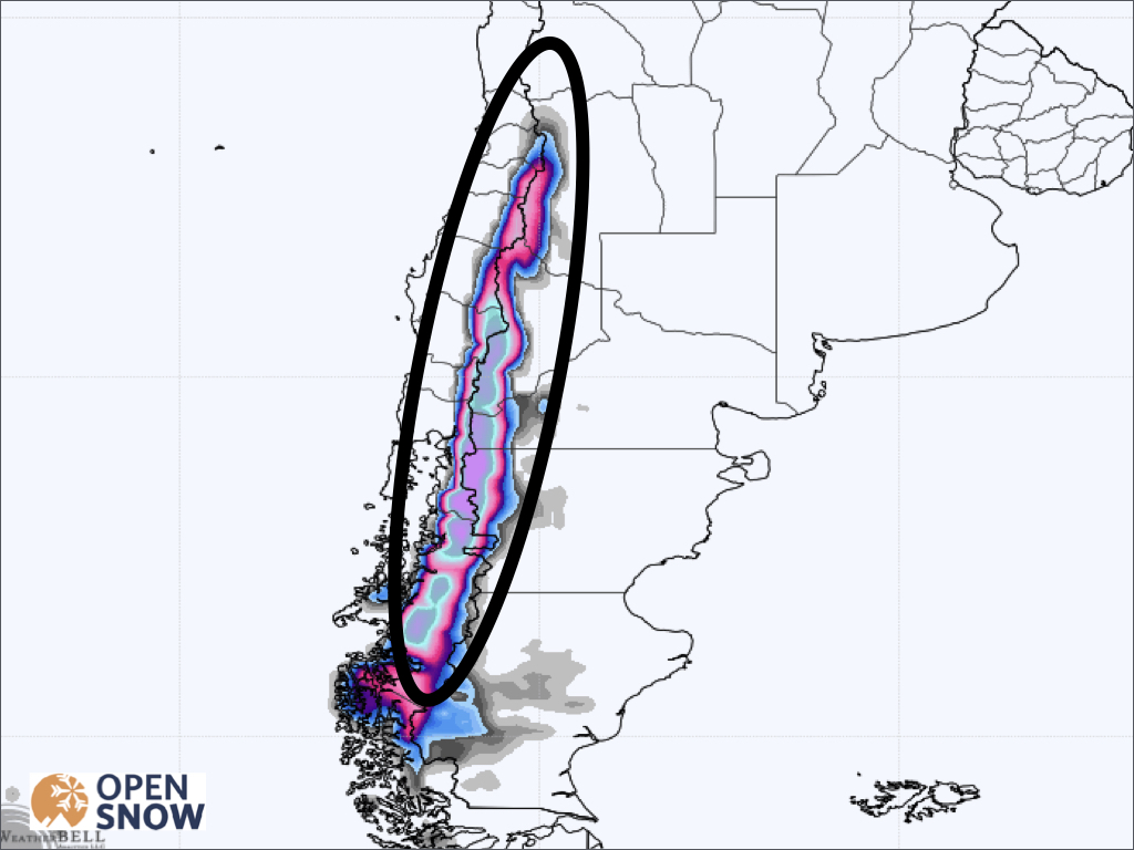
The next seven to ten days will be very active in the central and southern Andes, with one storm coming after the next. Temperatures will not be overly cold throughout this period, but will be cold enough at times for substantial snowfall. Snow levels will fluctuate with each storm, with a series of warm and cold fronts, with rain falling at lower elevations of resorts at times. Check out the figure below showing the several rounds of rain and snow just though next weekend.
Forecast for Monday 5/29 - Wednesday 5/31
Ahead of the first storm, some light snow will be falling in the Andes of northern Chile/Argentina on Monday, especially at upper elevations of Portillo and Los Penitentes, where a few cms could accumulate above 3000m.
On Monday night, moisture from the first in the series of storms arrives in the southern mountains of Chile/Argentina, along with warm temperatures and high snow levels. Unfortunately things stay warm through Tuesday Night before some colder air works in turning some rain back to snow. Accumulations for this period will be minor, with around 5-15 cms expected.
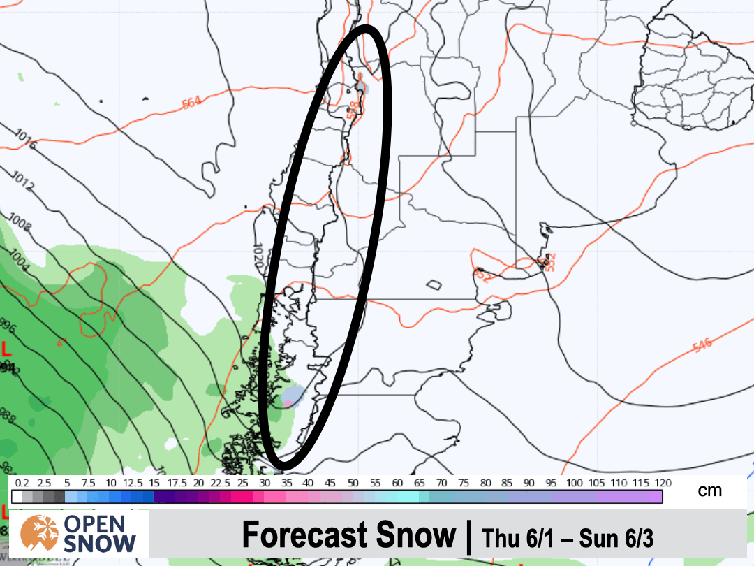
Forecast for Thursday 6/1 - Saturday 6/3
The first part of the day should stay mainly dry, before the next storm moves in Thursday evening, and is overall a colder system. Many areas will start a rain, but should quickly turn over to snow. Moisture will begin in the southern part of the region, and slowly push north through Thursday night and Friday, with heavy snow as far north as Portillo. Snow will continue Friday night and Saturday, but will shift farther south once again. There will be some impressive snow totals from this round, as seen in the GFS snow forecast below for Thursday through Saturday.
Forecast for Sunday 6/4 - Wednesday 6/7
Another system will arrive on Sunday, keeping the precipitation going. Once again, it will be accompanied by a warm front, increasing snow levels and changing snow for many areas back to rain. This won't be long lived though, as the cold front will be approaching later on Sunday, and should have advanced far enough north by Monday morning to transition precipitation back to snow for all resorts. This storm has the potential to bring even more snow, even farther north, so I will be watching this one closely.
Extended Forecast
Outlook for Thursday 6/8 - Monday 6/12
Another strong storm is showing up on the models around Thursdays the 8th and lasting through the weekend. At the moment, temperatures look cool enough for mostly snow. Beyond that, there may be a break in the action except for the far southern resorts in Chile/Argentina, but I will update that as we get closer.
Thanks for reading the South America daily snow! Follow me @lstone84 on Instagram to check out some new content I will be creating for the North American summer months. Let me know what you think.
About Our Forecaster


