South America Daily Snow

By Luke Stone, Forecaster Posted 1 year ago July 24, 2023
Big Totals from the Last Storm, and More Snow on the Way
Summary
Wow did this last storm deliver! I saw some impressive totals at many resorts and yesterday was one of the best days of the season in South America. Once the rain transitioned to snow, it really cranked! Another solid storm will start on Monday, followed by an extended warm and wet period.
Short Term Forecast
Several resorts received signficsn snow from this last storm, and conditions on Saturday and especially Sunday were great. Check out some totals below:
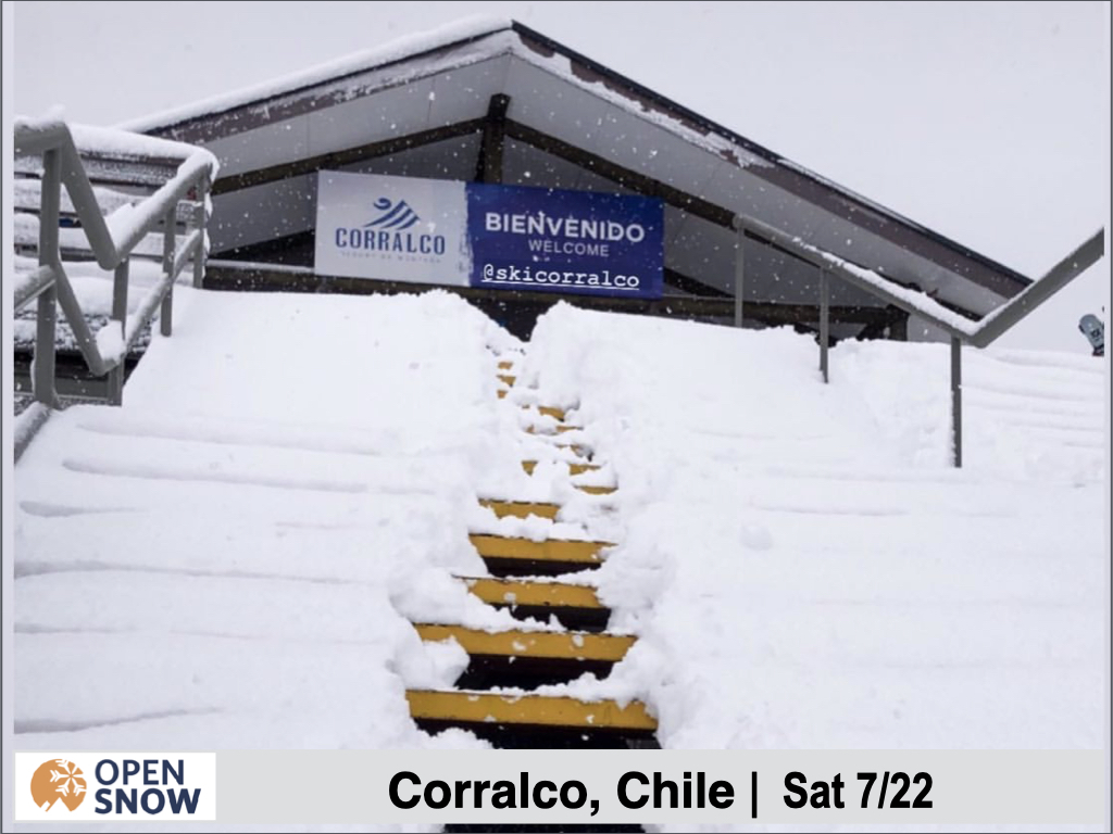
Corralco: 55 cms
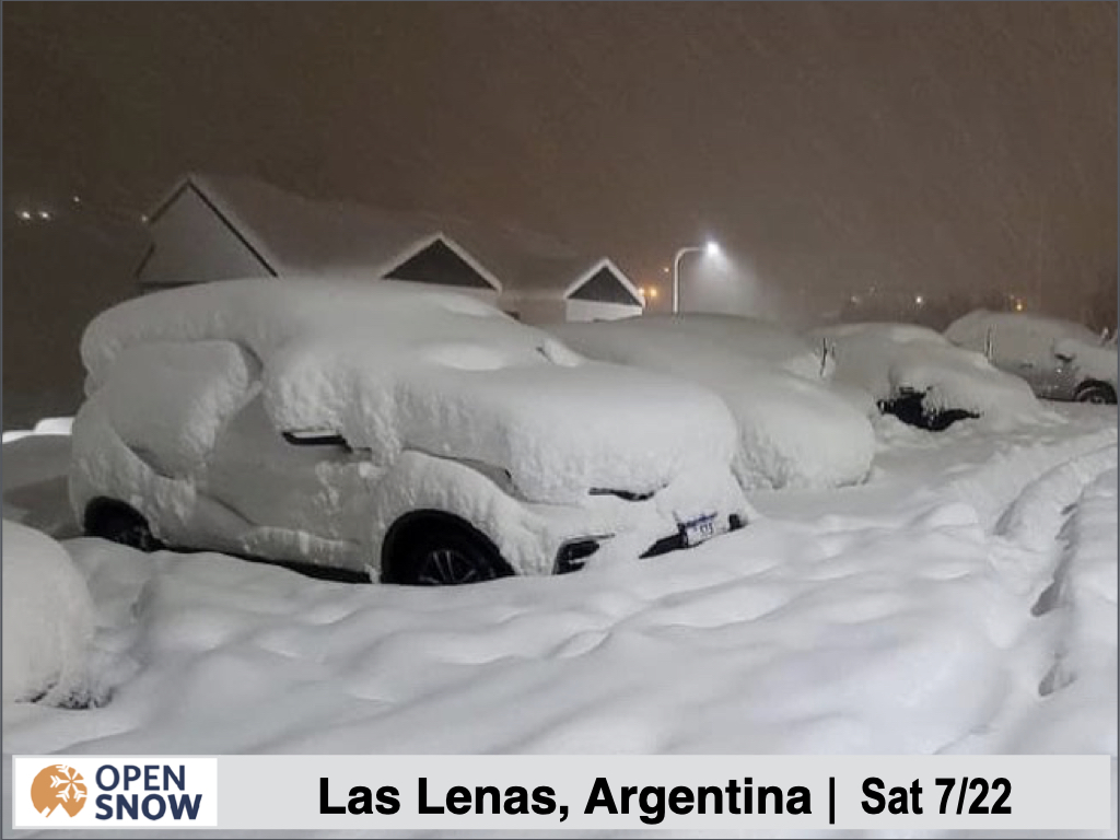
Las Lenas: 60+ cms
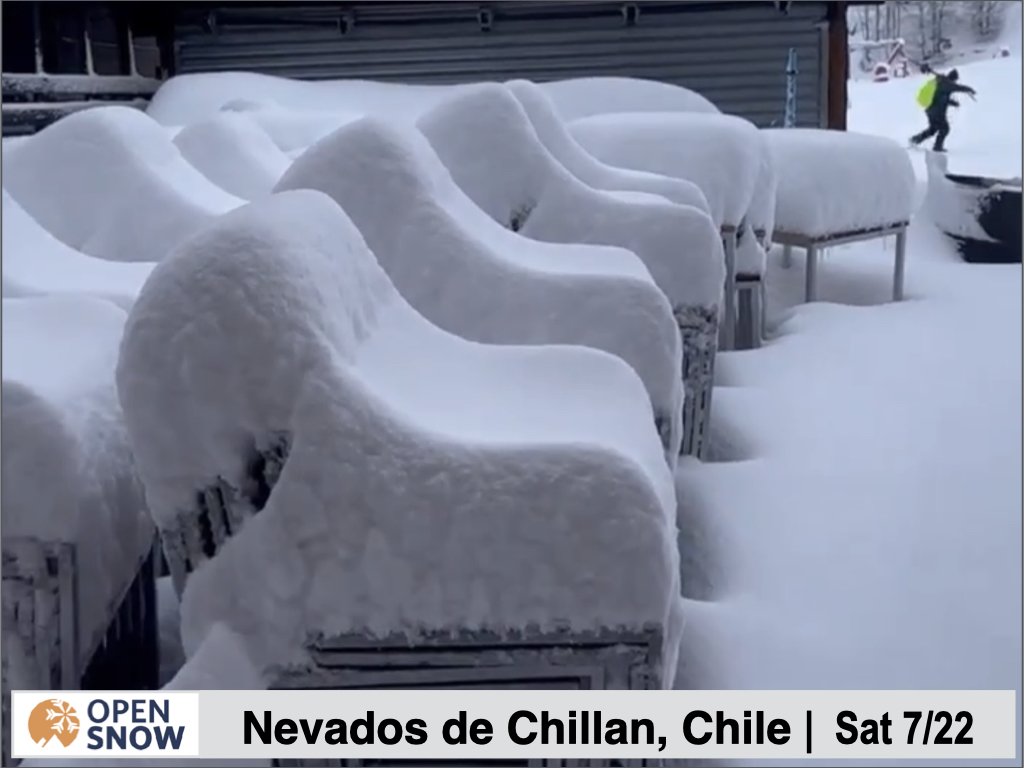
Nevados de Chillan: 45 cms
Cerro Bayo: 30 - 50 cms
The winds were strong during this storm but there was a lot of fresh snow to enjoy on Saturday and Sunday. Check out a few shots from the storm below.
Forecast for Monday 7/24 - Tuesday 7/25
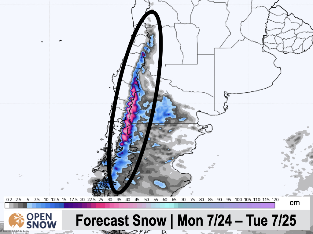
We won't have much of a break before the next storm, which will favor the central and southern resorts, begins Monday morning. Some light snow will fall Monday morning, with heavier snow arriving for the central and southern resorts in the afternoon. This heavier precipitation will stick around through Tuesday morning, before shifting north and continuing through the evening. Snow will taper to showers Tuesday night before ending overnight.
Many resorts will see between 20 - 40 cms from this event, and again the winds will be strong. Pucon, Corralco, Antillanca, Las Araucarias, Cerro Catedral, Volcan Osorno, Nevados de Chillan, an Cerro Bayo should all do well, with Tuesday being a classic storm day, and some additional fresh snow for Wednesday as well. Check out the snow map from the European model below:
Forecast for Wednesday 7/26 - Sunday 7/30
Beginning Wednesday night, we are going to enter an extended warm and wet period. While the storm track is a bit farther south then recent storms, rain will still be a threat for several days. From Wednesday through the end of the weekend, rain showers will be a possibility each day. A warm air mass will settle in over the region during this time, and a southerly storm track will keep precipitation chances alive each day.
While there is greater confidence in rain from Wednesday through Thursday from the first warm wave of moisture, the setup for the weekend is less certain. Hopefully we can get the next round of warm storms to trend cooler or farther south.
Extended Forecast
Outlook for Monday 7/31 - Friday 8/4
The pattern looks to remain active in the long range, with another storm arriving Sunday night. Again, it will likely be warm when this storm arrives, but a cold front should move through overnight and cool things off by Monday. This storm should also track pretty far south, with the cold front never extending too far north. Still, significant snow for the central and southern resorts is possible early next week. I will have more info on this storm in the next post.
Thanks for reading the South America daily snow! Follow me @lstone84 on Instagram to check out some new content I will be creating for the North American summer months.
About Our Forecaster


