US & Canada Daily Snow

By Alan Smith, Meteorologist Posted 4 months ago March 14, 2025
Heavy Snow for the West this Weekend and Next Week
Summary
An active pattern will continue across the West with multiple strong storms expected this weekend and next week. All major ski regions from the Southwest to Canada are favored. The East will remain in a spring-like pattern with rain expected on Sunday.
Short Term Forecast
Helpful Links:
7-Day Snow Forecast:
Get ready for lots of snow across the West! Some areas such as Tahoe and Canada have already received significant snowfall over the past week, and more snow is on the way for these areas. The Rockies are about to get in on the action as well with multiple storms and powder days over the next week.
More details from our local experts...
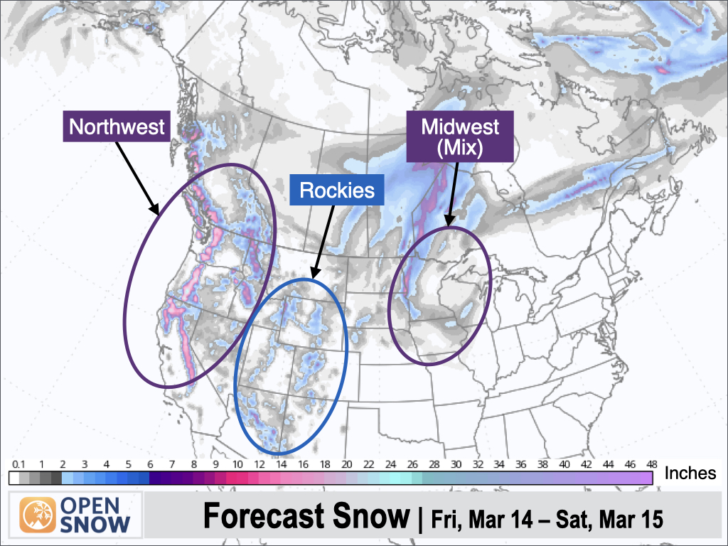
Forecast for Fri (Mar 14) to Sat (Mar 15):
Snow will continue across the Rockies on Friday as a storm moves through, and colder air will also arrive. Another storm will bring more snow to the Sierra and the Central Rockies from later Friday and into Saturday. A strong storm will also impact the Northwest with heavy snow for Oregon, Washington, Idaho, and BC.
East of the Rockies, a powerful storm system will move across the Midwest with mixed precipitation across Minnesota and Wisconsin, while a significant severe weather outbreak is expected from the Upper Midwest Midwest to the Mid-South.
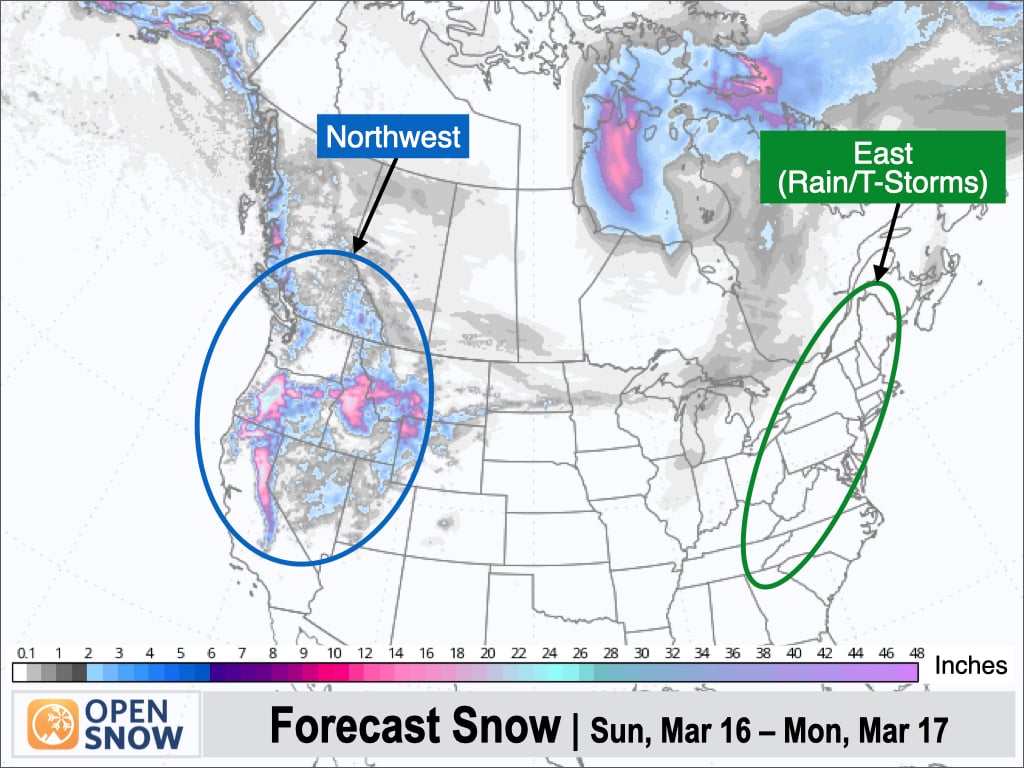
Forecast for Sun (Mar 16) to Mon (Mar 17):
A strong storm will bring more heavy snow to the Northwest, Northern Rockies, Tahoe, and Utah with excellent late-season skiing conditions expected.
A storm system will move across the East bringing rain and thunderstorms to nearly all ski regions on Sunday, including a threat of severe weather across the Mid-Atlantic and Southeast.
Forecast for Tue (Mar 18) to Wed (Mar 19):
An active pattern will continue across the West with heavy snow expected over the Central Rockies on Tuesday, while the next storm is projected to reach the Northwest on Wednesday night. A storm is also likely in Alaska with heavy snow possible.
The East will see a break in the weather pattern after Sunday's system, but a strong storm is possible over the Upper Midwest with the potential for some areas to see heavy snow depending on the storm track.

Extended Forecast
Outlook for Thu (Mar 20) to Mon (Mar 24):
An active pattern will continue across the West, though the dominant storm track will shift northward with storms favoring the Northwest and Northern Rockies. The Central Rockies and the Sierra could also see snow at times on the southern fringe of the storm track.
In the East, rain looks to be the dominant precipitation type with any storms, though high-elevation snow showers couldn't be ruled out on the backside of any storm systems.

Thanks so much for reading! Next update on Monday (March 17).
Alan Smith
About Our Forecaster


