Western US Daily Snow

By Alan Smith, Meteorologist Posted 2 days ago July 24, 2025
NorCal Thunderstorms and a Break in the Monsoon
Summary
A stubborn trough of low pressure will set up near the California Coast with Pacific moisture and instability streaming into Northern California. This will result in daily rounds of t-storms from Tahoe to Shasta each day from Thu to Sun. Meanwhile, abnormally dry air (for late July) will push into the Southwest, resulting in a break from the monsoon, before moisture returns next week.
Short Term Forecast
YouTube:
Helpful Links:
Wildfire and Smoke Update:
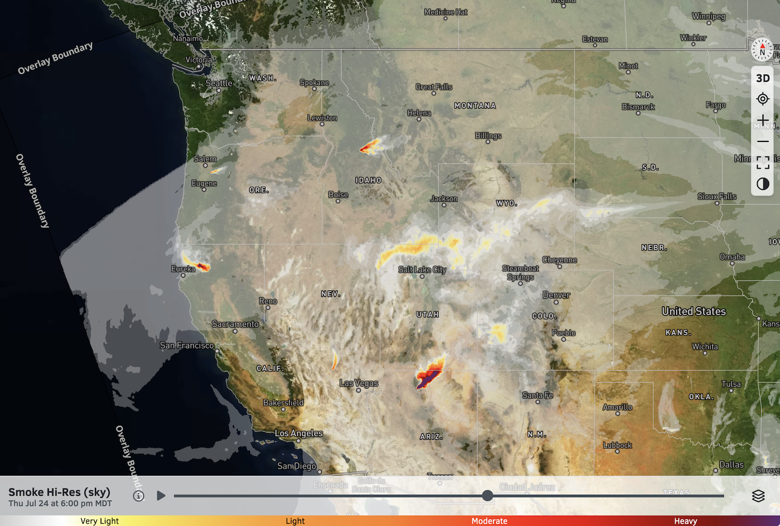
Hot and dry air pushing back into Northern Arizona has supported an uptick in fire intensity and smoke transport with the Dragon Bravo Fire on the north rim of the Grand Canyon.
Other active fires burning across the West right now include the Orleans/Butler Fire Complex in Northern California and the Big Bear Fire in California.
Overall, smoky conditions are generally remaining confined to areas near and just downwind of the more active fires.
High-Res Smoke (Sky) Forecast for 6 PM Thursday:
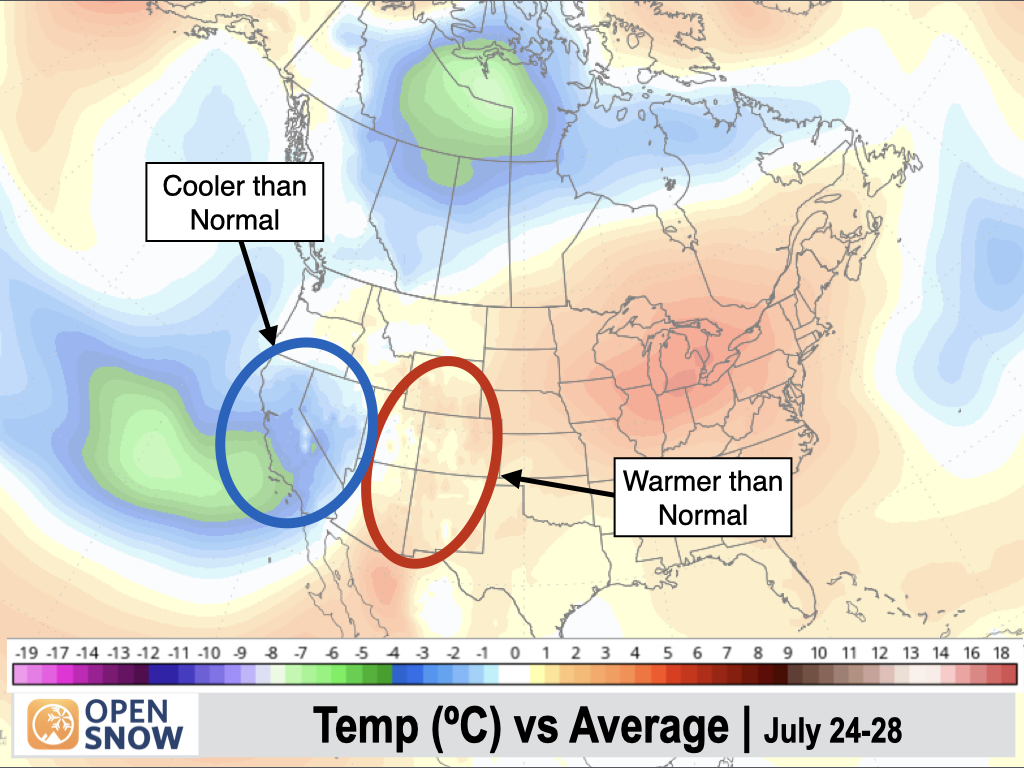
5-Day Temperature Outlook:
A similar temperature regime will remain in place compared to recent days, with below-normal temperatures across California and Nevada, while the Southern Rockies and Southwest will trend above-normal. Temperatures over the Pacific Northwest will be near-normal.
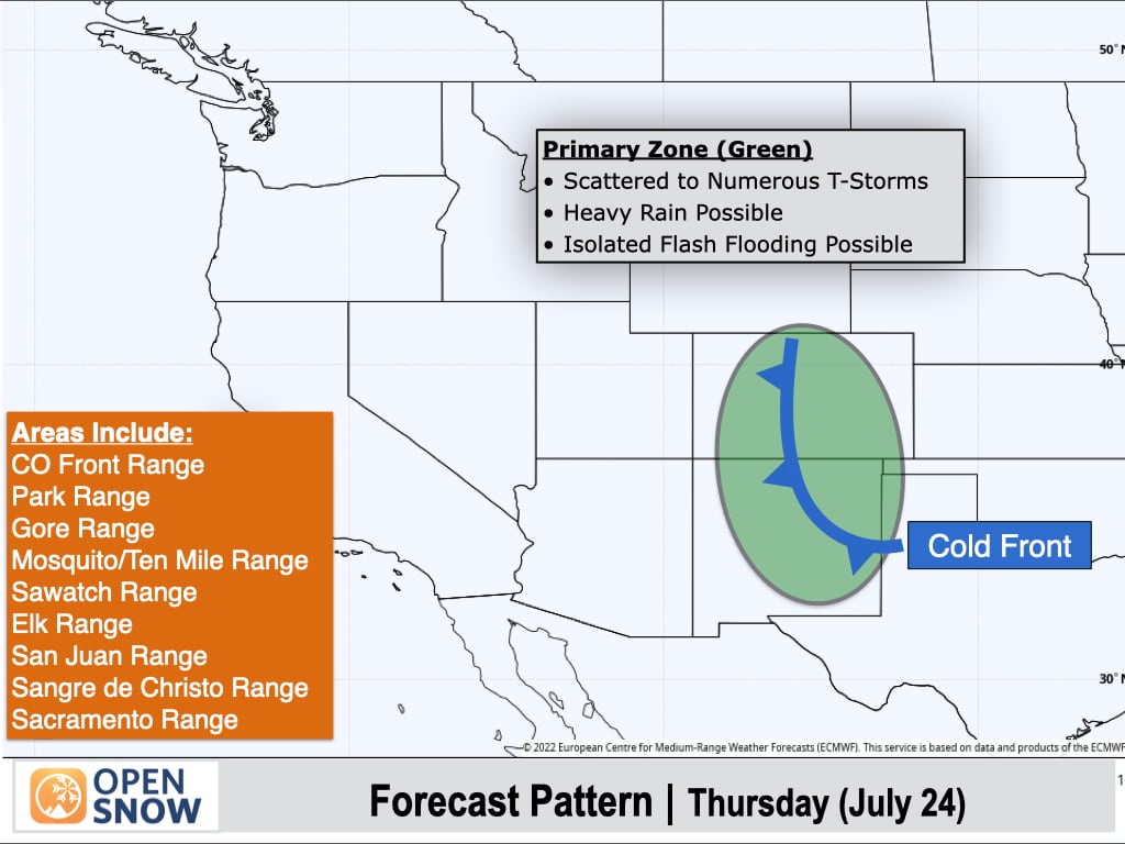
Thursday (July 24):
Monsoonal moisture will remain in place over the Southern Rockies for one more day with a focus along a cold front boundary near the Continental Divide.
Scattered to numerous thunderstorms can be expected over Colorado and New Mexico, with heavy rain possible. There is also some risk for isolated flash flooding in burn scars and steep canyons with poor drainage.
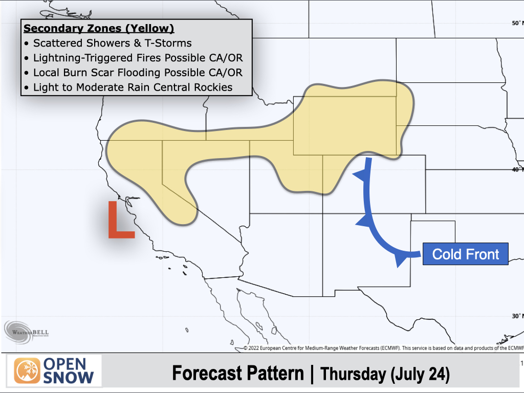
Ahead of a low pressure area just off the coast of California, increasing Pacific moisture will lead to scattered terrain-driven thunderstorms across Northern California. There will be both a risk for lightning-triggered wildfires due to dry fuels in the area, while flash flooding is also possible over burn scars from recent years.
To the east, isolated to scattered thunderstorms with light to moderate rain can be expected over Northern Utah, Southern Idaho, and most of Wyoming.
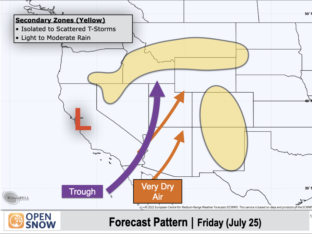
Friday (July 25):
Friday's pattern will feature decreasing moisture over the Southwest, while a low pressure area moving into Northern California will result in another active thunderstorm day. Once again, this area will see a mix of wet and dry thunderstorms with a risk of both wildfires and burn scar flooding.
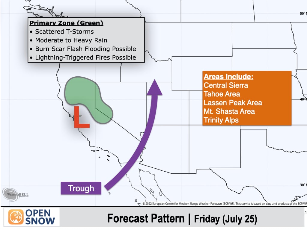
Elsewhere, isolated to scattered thunderstorms can be expected over portions of the Northern Rockies and in Colorado and New Mexico, with storms producing light to moderate rain.
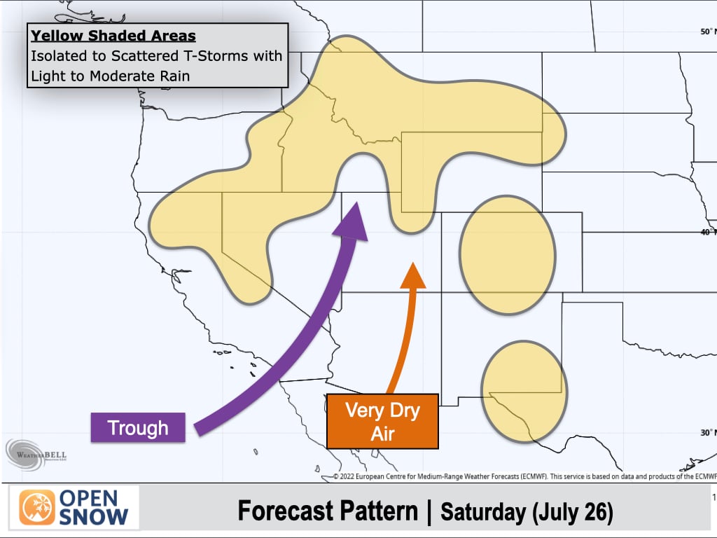
Saturday (July 26):
Abnormally dry air over Arizona and Utah will spread eastward into Colorado and New Mexico as the monsoon shuts down almost entirely for the weekend. Precipitable water values (a measure of water vapor in the atmosphere) will be less than 50% of normal for late July across most of the Four Corners states.
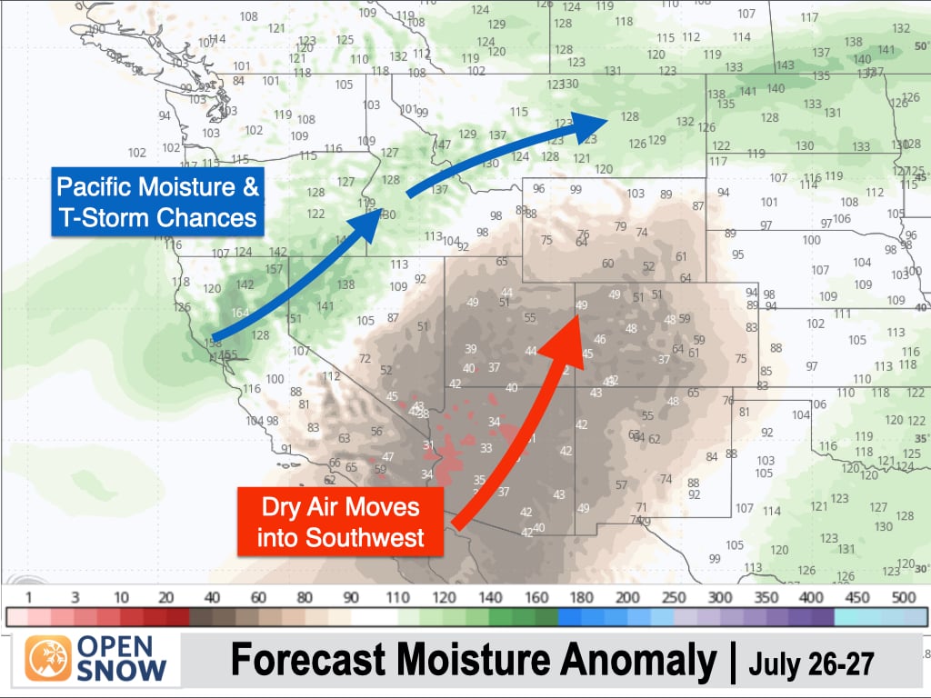
To the north, lingering Pacific moisture will result in isolated to scattered thunderstorms from Northern California to the Northern Rockies, with most storms producing light to moderate rain.
There is still a chance of a few isolated thunderstorms developing over the higher peaks of Colorado and New Mexico, but it will be a less active day than usual for this time of year.
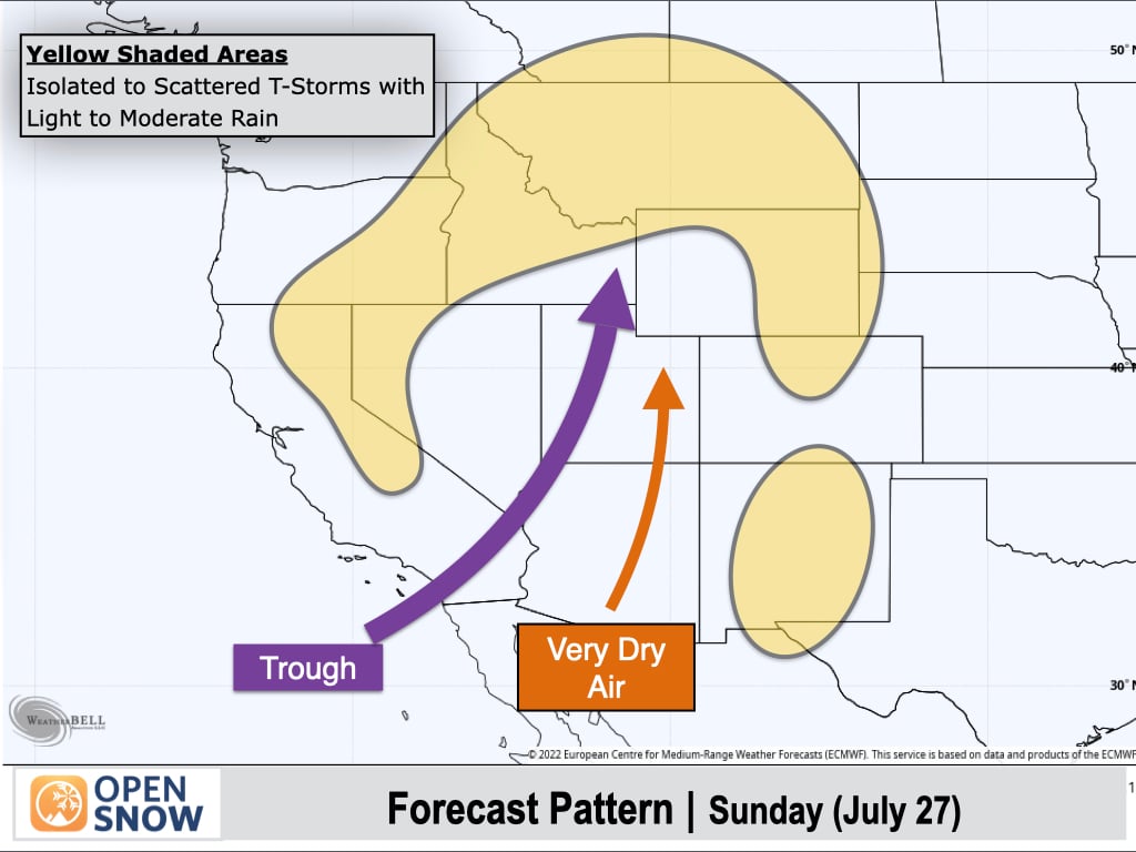
Sunday (July 27):
Further drying is expected across Colorado, and it's possible that the high country could end up with a rare storm-free day, though a few models are hinting at isolated potential over the mountains of Northern Colorado and perhaps far Southern Colorado.
A little bit of monsoonal moisture may also sneak into New Mexico from the south, with isolated thunderstorms possible.
Elsewhere, isolated to scattered thunderstorms can once again be expected from the Sierra and Northern California into the Northern Rockies.
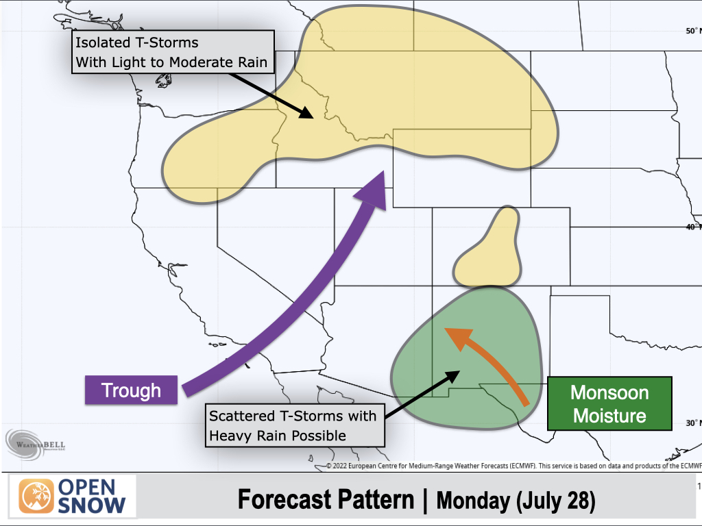
Monday (July 28):
Monsoonal moisture will begin to stream back into New Mexico from the southeast, with a return to more numerous thunderstorms, including heavy rain potential. Some of this moisture could sneak into Colorado as well, for at least some isolated thunderstorm potential.
To the north, lingering Pacific moisture and shortwave energy associated with the stubborn West Coast trough will lead to another day with isolated to scattered thunderstorms, most of which will produce light to moderate rain.
Extended Forecast
July 29 to August 2:
Next week's pattern is looking fairly active as anti-cyclonic (clockwise) winds around a developing high pressure over the High Plains transport deeper monsoonal moisture back into New Mexico and Colorado, and to some extent Utah, Arizona, and Wyoming.
This southerly flow over the Southern/Central Rockies will also be aided by a trough along the West Coast.
Meanwhile, a series of Pacific disturbances are projected to track across the Cascades and Northern Rockies, resulting in chances for showers and thunderstorms.
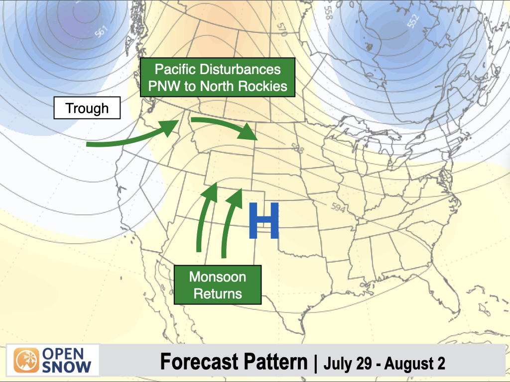
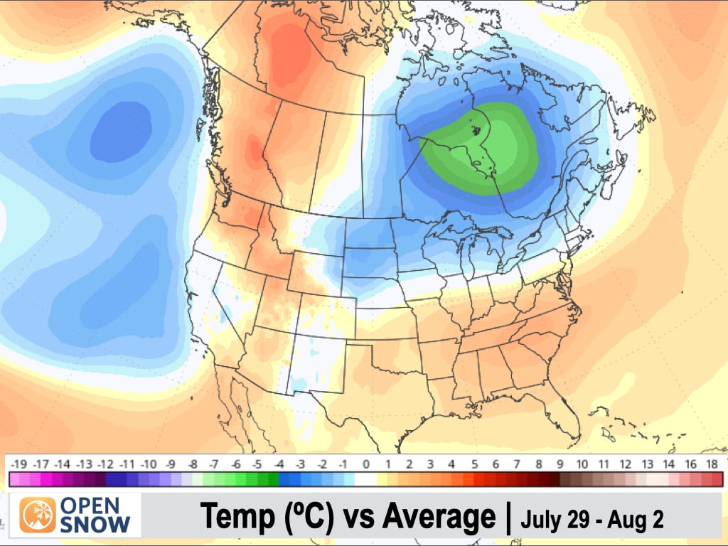
Temperatures are expected to warm up across the Northwest next week, despite the increase in moisture, while near-normal temperatures are favored along the West Coast, and also in New Mexico and Colorado, where increased cloud cover is expected.
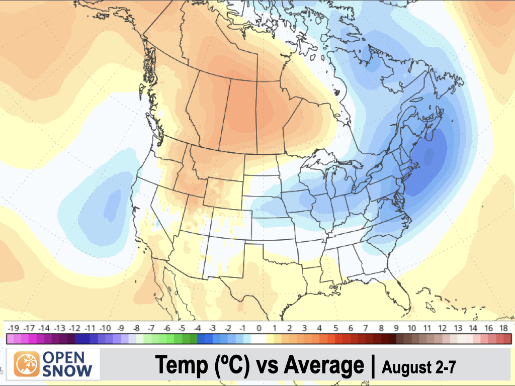
August 3-7:
The high pressure area is projected to shift southward a bit, with the monsoonal flow favoring the Four Corners region. The wettest signals continue to show up over New Mexico and Colorado, but Arizona and Utah will be in play for better moisture transport in this pattern as well.
A trough-dominant pattern will remain over the Northwest and West Coast with the potential for additional disturbances to track across the Cascades and Northern Rockies. This will continue to support frequent shower and thunderstorm chances across these regions.
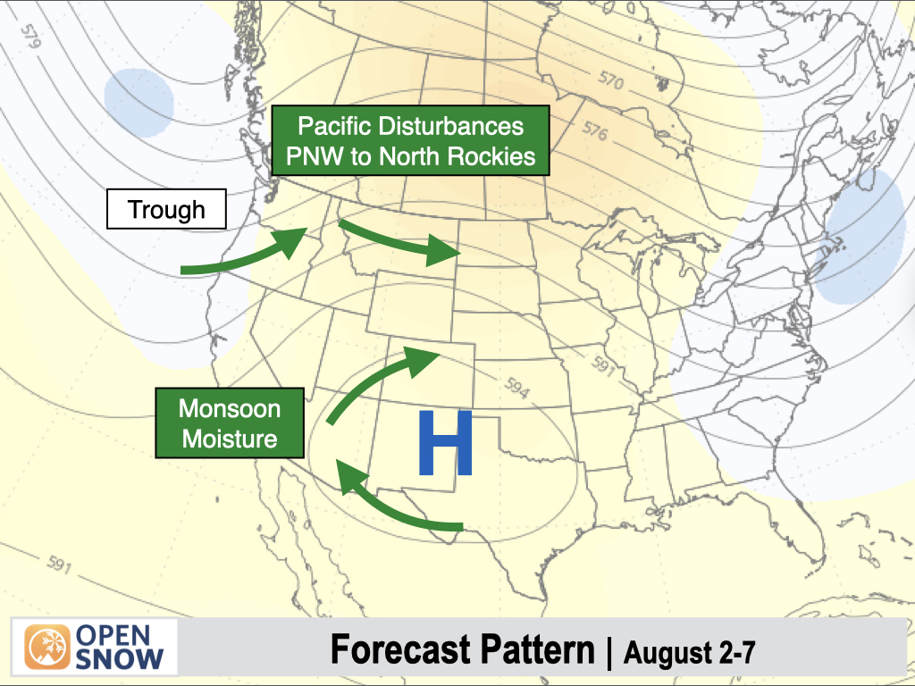
Temperatures are projected to be above-normal over the Interior Northwest and Northern Rockies in this pattern, while cooler temperatures are expected to hold along the West Coast with near-normal temperatures (due to increased moisture and cloud cover) over Colorado and New Mexico.
One wild card to keep an eye on is tropical activity in the Eastern Pacific Ocean. It appears that the tropics are waking up again after a relatively quiet past couple of weeks, and the track of tropical systems can influence monsoon patterns in the Western U.S.
Thanks so much for reading!
I will not be posting on Friday this week, so stay tuned for the next update on Monday (July 28).
Alan Smith
Announcements
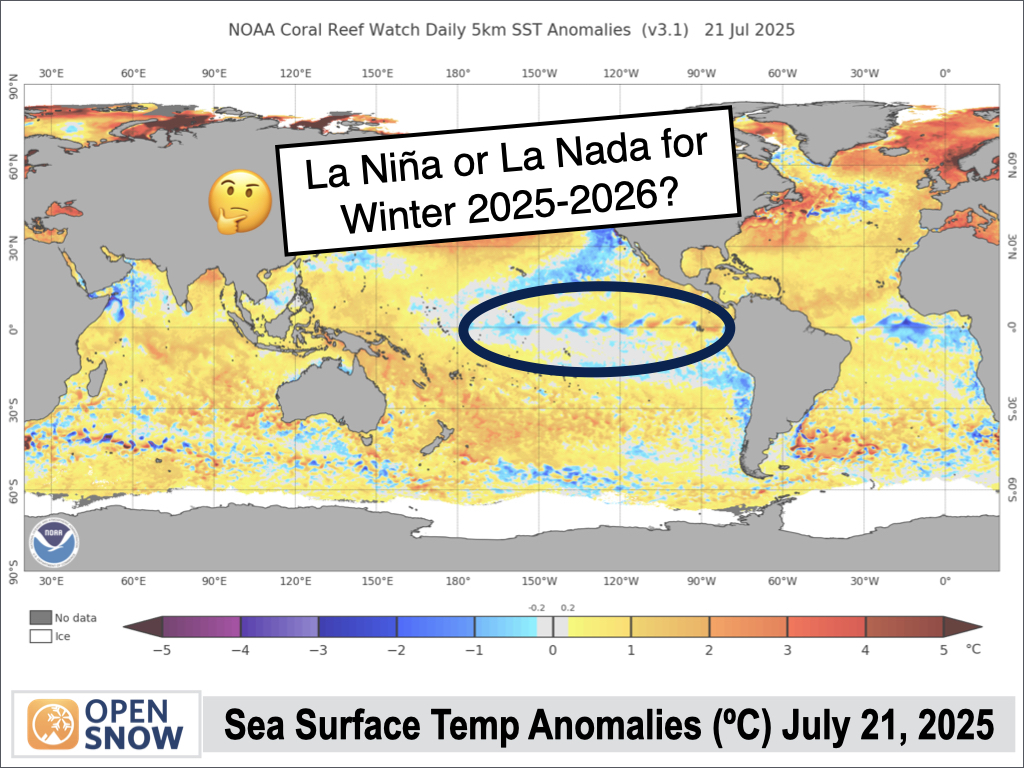
La Nina or La Nada for Winter 2025-2026?
We will publish our winter forecast preview in August, but right now, OpenSnow forecasters are already looking at some of the long-range climate signals that are developing.
Winter Sneak Peak → More Details
About Our Forecaster


