Winter Park Daily Snow

By Joel Gratz, Founding Meteorologist Posted 3 months ago March 29, 2025
Powder on Saturday morning, plus three additional storms in the forecast
Summary
The first storm in the sequence delivered a lot of snow on Friday night, and the second storm will bring more snow on Saturday night.
Update
Helpful Links
Conditions
- New Snow (Mid-Mountain snow stake)
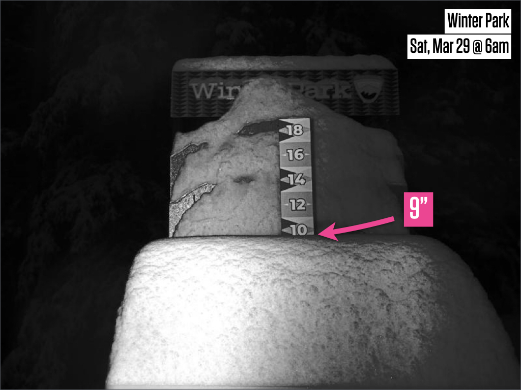
- 9” Friday 5:00 am to Saturday 5:00 am (24 hours)
- 9” Friday 5:00 pm to Saturday 5:00 am (12 hours)
- Last Snowfall
- 9” Friday Night (Mar 28-29)
- Snowpack
- 108% of the 30-year average
- Terrain
- 23 of 24 lifts
- 164 of 171 trails
Saturday (March 29)
On Friday night, a storm delivered cooler air and an upside surprise of 9 inches of snow.
In Friday's forecast, I mentioned the possibility of an upside surprise beyond the 1-3 inches of snow in the forecast, but I thought that most of the 'extra' precipitation would fall just to the east of Winter Park.
In reality, a lot of precipitation did fall east of Winter Park, and Winter Park was on the western edge of the intense precipitation and wound up with 9 inches of thicker-quality snow on the mid-and-upper mountain.

Aside from the first-chair powder, Saturday's weather will likely be a mix of snow showers and partly sunny skies with a high in the 30s.
On Saturday afternoon and Saturday night, the second storm in the sequence will deliver cooler temperatures and more snow with 2-4 inches of possible accumulation. There is again some potential for an upside surprise, but unlike Friday night's storm, the storm on Saturday night will not strengthen over eastern Colorado, so I think that the upside chance is lower than on Friday night.
Sunday (March 30)
If Saturday night's storm brings the 2-4 inches of snow, then Sunday morning's conditions could be somewhat soft for first chair. The rest of Sunday should trend toward drier weather with a high temperature of around 30°F.
Monday (March 31)
Monday should be dry with partly cloudy skies and a high in the 30s.
Tuesday & Wednesday (April 1-2)
The third storm in the sequence should bring 5-10+ inches of snow from Monday night through Tuesday night.
This means that Tuesday could start with some powder and conditions should get deeper through the day.
If the snow continues to accumulate on Tuesday night, then Wednesday morning's first chair could offer soft/powder conditions as well.
This storm will be cool, with temperatures in the teens and 20s, so the snow quality should be reasonably fluffy.
Longer Range
I think Thursday and Friday (April 3-4) will be dry with a high temperature in the 20s, then there could be more snow between Friday and Monday (April 4-7).
The Friday-to-Monday storm may track south of Colorado. If it's track sets up perfectly, there could be significant snow at Winter Park. But there is still a wide range of potential outcomes and we'll figure out the details during the coming days.
Tap below to see our forecasts:
My next update will be on Sunday morning.
Thanks for reading!
JOEL GRATZ
About Our Forecaster


