News

By Joel Gratz, Founding Meteorologist Posted 10 years ago August 18, 2014
How will El Nino impact snowfall for the 2014/2015 ski season?
Over the last few months there’s been a lot of talk about El Nino and how it will affect snowfall this winter. The punchline is that yes, we’ll likely see some flavor of El Nino, and yes, it will likely shift snowfall patterns to favor some mountains and not others.
Since I like to keep you, the powder-obsessed readers of OpenSnow.com, informed with the most credible information about weather and snowfall, I reached out to El Nino himself for more details on his plans for the winter.
Joel Gratz: Thanks for your time today. I’ll keep the questions brief.
El Nino: Yes, let’s hurry this up. I’ve been pressed for time all summer.
JG: What’s been keeping you busy?
El Nino: It’s that Jim Cantore guy from The Weather Channel. He texts me every day, threatening to knee me in the stomach if I don’t give him my plans for the winter. He wants to scoop Al Roker. Dealing with him usually takes up my entire morning.
JG: Ok, moving on. How would you describe yourself?
El Nino: I am warmer than average water in the central Pacific Ocean. Technically, I am at least 0.5 degrees Celsius above average temperature for three months in a row. Sometimes when I’m in my strongest form I am up to 2 degrees C above average, but this doesn’t happen very often.
JG: Where are you located?
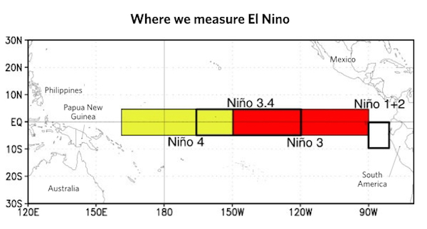
El Nino: I am in the Pacific Ocean between Indonesia and Ecuador. Scientists take my temperature in a few specific areas, with the biggest focus on my “Nino 3.4” region.

JG: Do you take on different forms?
El Nino: I get moody for sure. Sometimes I run hot in the center region (3.4), and other times it’s my east side that warms up the most (1+2 region). You can’t box me in as a simple character because my hot water isn’t always in the same place. I like to mix it up.
JG: Why should we care about you?
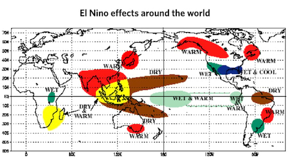
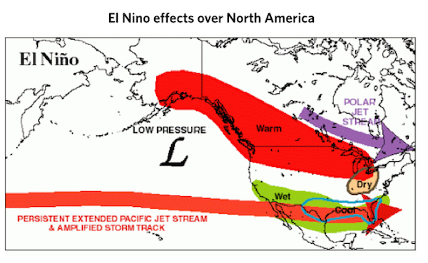
El Nino: Your audience of skiers should pay close attention. I usually become strongest during the northern hemisphere winter season. My hot water changes the position of thunderstorms and wind patterns over the Pacific Ocean. This in turn changes the wind patterns all over of the world, which affects the storm track and ultimately where snow will fall. See, I’m kinda a big deal.


JG: What have past El Ninos meant for snowfall?
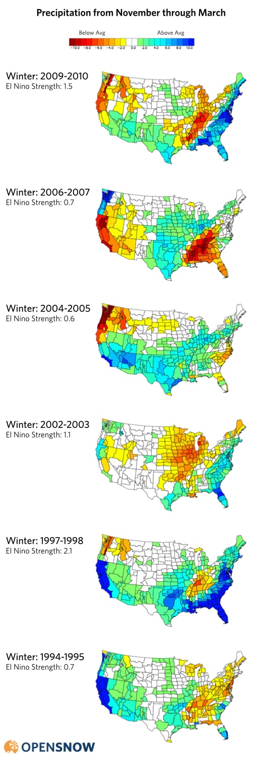
El Nino: That’s a tricky question. It depends how strong I am and where my warmest water is located. For example, here are precipitation patterns during the past six El Nino winters:

See what I mean? Each of these winters was an “El Nino winter”, but the heavier precipitation fell in different spots. I’m a complicated guy, you know.
Don’t think you can judge me by a few thermometers dropped into me from your buoys. You don’t know me, man. You don’t know how hard it is to float out here, get a lot of attention from the media one year, then the next year I’m chopped liver and nobody calls, nobody cares. It’s tough.
JG: Wow. You do have a hard life. Do you have any friends out there to keep you company?
El Nino: Well, despite my self-proclaimed status as “kinda a big deal”, I do have some friends in other ocean areas. One of them is my buddy up the street in the north Pacific Ocean. Her name is the “Pacific Decadal Oscillation”, or “PDO” for short. And I have another acquaintance over in the central Atlantic Ocean called the Atlantic Multidecadal Oscillation, or “AMO”. She’s cool as well, but the distance between us is a real strain on our friendship. You should really talk with all of us, because it’s the combination of me, the PDO and the AMO that control the storm track and where the snow falls.
JG: Gotcha, thanks for the tip. So how strong are you going to be this season?
El Nino: I’m trying to muster up some power though it’s coming slowly. Earlier this spring people thought I’d be super strong by now, but that’s not the case. By the time winter rolls around, I’ll likely be in a weak state, maybe moderate if I can swing it. This generally means that I’ll be 0.5-1.5 degrees Celsius above average.
JG: So the million dollar question is what will you do to our snowfall this winter?
El Nino: You know I can’t give you the details right now as it depends how strong I am and the location of my warmest water. But I can say that in general I favor above-average snowfall for the southwest US, below-average snowfall for the northwest, and perhaps above average for the east coast.
JG: So should I tell OpenSnow.com readers to plan ski trips around this information?
El Nino: Ha, probably not. The atmosphere is temperamental and doesn’t always follow my lead. I will say though that mountains in the southwestern part of the US should do pretty well this year. During the past 6 winters when I was present, snowfall in the southwest was above-average 4 years, average 1 year, and below average 1 year. So the odds point toward above-average snowfall (67%, or 4 out of 6). Yes, I’m looking at you southern California, Arizona, New Mexico, southern Utah, and southern Colorado.
JG: Thanks for your time! I’ll check back in September for an update.
El Nino: You’re welcome. Call anytime -- I’m not going anywhere for a while.
JG: Can you share a picture of yourself?
El Nino: I’ll do one better: I made an autobiographical video a few years ago. Watch it here.
About The Author


