News

By Sam Collentine, Meteorologist Posted 4 years ago September 25, 2020
La Niña & Winter Forecasts, Explained
The following analysis was written by Nathan Lenssen, a lover of powder as well as a Ph.D. student at the International Research Institute for Climate and Society (IRI) at Columbia University.
On September 10th, 2020, NOAA issued a La Niña Advisory, meaning that "La Niña conditions are observed and expected to continue." In this case, the forecast gives a ~75% chance of La Niña persisting through the winter (see the blue bars below).

Source: CPC/IRI ENSO Forecast
As we have written about in the past, La Niña refers to cooler than average ocean temperatures in the Equatorial Pacific Ocean.
Why do we care about the temperature of the Equatorial Pacific in North America?
Small changes in the ocean temperature cause changes in the location of tropical convection (thunderstorms) which in turn changes the location and strength of storms around the world.
La Niña conditions cause tropical thunderstorms to be concentrated and intensified on the far Western edge of the tropical Pacific Ocean. Since convection is upward motion in the atmosphere, imagine that during La Niña, there is a strong disturbance to the atmosphere in the Western pacific that causes ripples of atmospheric waves to shoot off into the Northern Pacific.
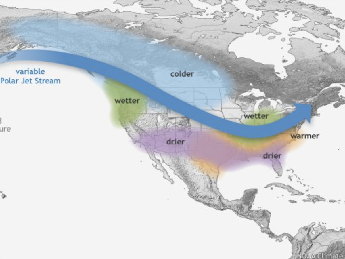
Most importantly for North America, these atmospheric waves line up in such a way that a high-pressure region forms off the coast of California. This high pressure deflects the jet stream and winter storms northward, causing generally wetter conditions in the Pacific Northwest and dryer conditions in the Southern Rockies.

Source: NOAA Climate
How predictable are the impacts of La Niña?
There are two major sources of uncertainty in long-range forecasts predicting weather months in advance.
The first source of uncertainty is how accurately we can predict La Niña or El Niño. As mentioned above, the current forecast gives about a 75% chance of La Niña occurring this winter. Those odds are just about as good as it gets.
The second source of uncertainty is the atmospheric response to La Niña or El Niño. That is, if La Niña occurs, does it always affect weather in North America in the same way?
To determine how La Niña impacts weather in North America, we can look at precipitation records during past La Niña events and compare them to a typical year.
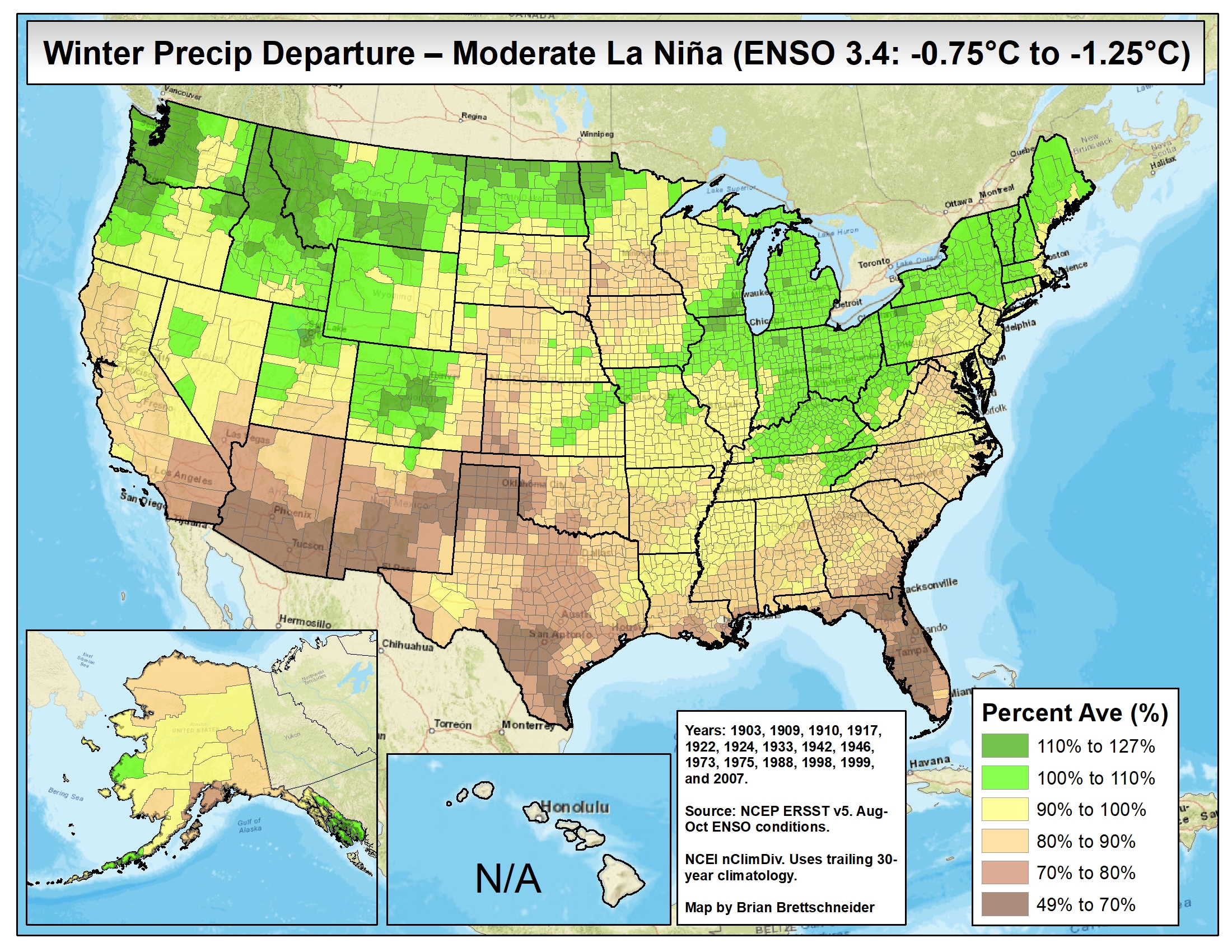
The graphic below shows the average amount of rain/snow during La Niña winters compared to all winters. Green colors mark areas of above-average rain and snow. We see that La Niña leads to drier-than-average weather in the Southern US and wetter/snowier than-average weather in the Northern US.

Source: Brian Brettschneider
The graphic above looks very favorable for above-average snowfall in the Northwest and the Northern Rockies.
But remember, the graphic above simply shows the average precipitation for 15 La Niña winters compared to all winters, and the average can be skewed by just a few big years.
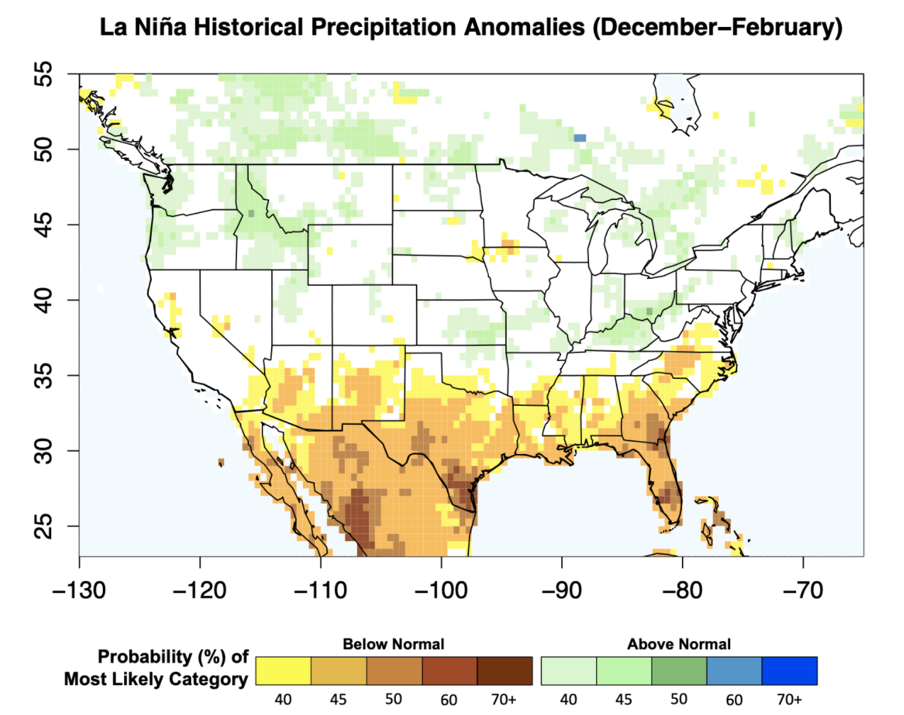
Another way to look at the data is to look at the probability of wetter/snowier or drier conditions, which is what is shown in the graphic below. Again, green regions relate to above-normal precipitation.
Most relevant to our powder dreams, most of the Central Rockies and Northern Rockies show no (statistically) significant tendency towards above- or below-normal precipitation (white color) and there are many areas with decent probabilities for above-average precipitation.
Something to keep in mind, though, is that the probabilities for above-average and below-average precipitation max out at around 50%, so while we can hope and perhaps expect wetter and snowier conditions in the Northwest and drier conditions in the far Southwest, it’s far from a sure bet.

Source: Nathan Lenssen
So where does that leave the winter forecast?
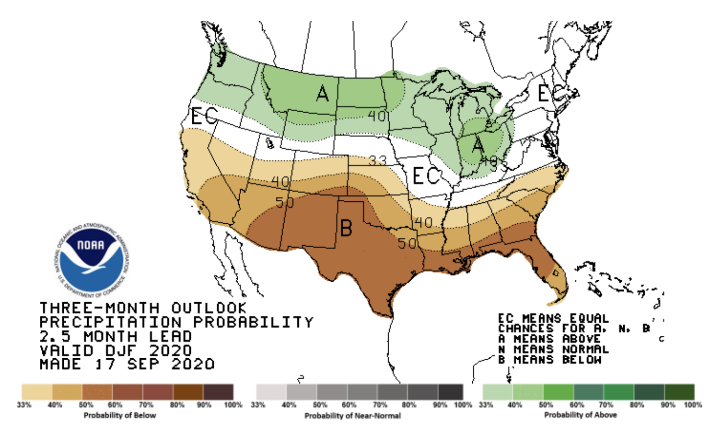
A long-range climate forecast contains both the uncertainty of predicting the oceanic conditions of La Niña and the uncertainty in the atmospheric response over the USA. NOAA’s most recent precipitation climate forecast for the same December-February period looks quite similar to the two historical analyses of La Niña shown above.

Source: NOAA CPC
These long-range probabilities for snowier-than-average or drier-than-average weather conditions might be useful for ski areas making decisions over the course of an entire season. To find the best powder days, however, we have to stick with the 1-10 day weather forecast to dial in the specifics of each storm.
Download the OpenSnow app and stay tuned to our forecasts for the latest weather updates.
This analysis was written by Nathan Lenssen, a lover of powder as well as a Ph.D. student at the International Research Institute for Climate and Society (IRI) at Columbia University.
About The Author


