News

By Joel Gratz, Founding Meteorologist Posted 10 years ago January 29, 2015
NEW FEATURES: Canadian mountains added, forecast data improved
I have good news, sports fans. A bunch of things just got better around here:
Oh, Canada!
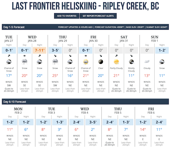
- You’ll now find forecasts for over 200 locations in Canada. This includes ski areas plus all of the heli-ski lodges, cat-ski lodges, and backcountry huts that we could find.
- In addition to the forecasts for Canadian locations, we also show the snow report for areas that provide one, as well as webcams for as many locations as we could. When a mountain didn’t have a webcam, we tried to find a webcam along a nearby road.
- You can find these new Canadian forecasts here: http://www.opensnow.com/forecasts
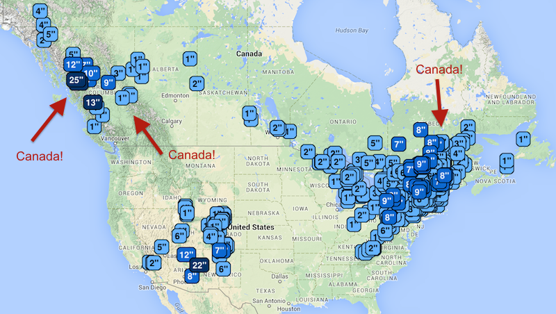
- Bonus: all Canadian ski areas are now a part of our Powder Finder. Check out the forecasts (and reports) on the map: http://opensnow.com/powder

Better forecast data
We’ve also been working hard to improve the weather data that powers our forecasts:
- No change: The snow forecasts in Colorado and the Tahoe region are still done by hand (Joel in Colorado, BA in Tahoe). We look at data from multiple models and then offer our best forecast based on local experience.
- No change: For snow forecasts out to 3 days in the United States (except Colorado and Tahoe), we use data from local National Weather Service offices. There are 122 of these offices and the local meteorologists usually do a pretty good job of capturing the effects of the mountains.
- Big change: For forecasts in Canada from days 1-10, and for the United States from days 4-10, we are now using data from the European forecast model (called the ECMWF).
- This model is, on average, the most accurate of the four major weather models that predict weather across the globe. The other models are the American GFS, the British UKMet, and the Canadian GEM. Previously, we were using data from the American GFS model.
- The European model often produces the most consistent and the most accurate forecast. Not always, but it’s usually very good. That said, any of these models could be the most accurate for any given storm.
- We take data from multiple runs of the European model and average it. Every 12 hours, a new forecast “run” of the model is released. Because there can be swings in the forecast from run-to-run, we average a few runs of the model to smooth out the kinks. Nobody likes seeing forecasts for 6-10 inches, then it changes to 1-3 inches, and then it changes back to 7-11 inches. That type of fluctuation isn’t good for your emotional health, and it's also scientifically irresponsible to promote a forecast based on one model run from one model, especially many days into the future.
- Eventually, I’d love to use and display data from multiple models, as this "ensemble" approach is proven to be the most accurate. For now, though, I’m happy with the upgrade to the European model and how we are averaging multiple model runs.
- The big change that you’ll see is that we now offer snow forecasts, temperature forecasts, and wind forecasts for each day and night out to 10 days. This detail was previously only offered out to 5 days.

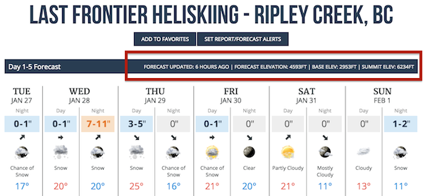
- We also added the time when the forecast was last updated, and the elevation of the forecast compared to the base and summit elevation of the mountain.

Where to find the new forecasts
For all US and Canadian locations, the forecast data is free to view out to 5 days. To view the 6-10 day forecast, please support us and upgrade to an All-Access Pass ($19/yr).
All Canadian mountains are available on our website, which works great on desktop or on your mobile device's web browser. They are also available on our iPhone and Android apps.
The 6-10 day forecasts are not yet available on our mobile apps for iPhone and Android, and we’re working on that. In the meantime, you can view these longer-range forecast on our website via desktop or the web browser on your phone or tablet.
As always, thanks for your support. You've helped us progress much further than I thought we’d make it when I started writing forecasts in 2007! If you see something odd with the new forecasts, or you notice that the forecasts are much different than reality, please get in touch with me directly. Thanks!
JOEL GRATZ
[email protected]
About The Author


