News

By Joel Gratz, Founding Meteorologist Posted 12 years ago December 10, 2012
Storms to continue for next two weeks (at least)
Don't trust the details of long range forecasts. Catch the important part there? Don't trust THE DETAILS of long range forecasts. There's almost no accuracy in snowfall predictions beyond about 4-5 days. However, sometimes we can do pretty well at predicting the overall weather pattern and storm track out to 7-10+ days. And this is one of those times.
About a week ago we started talking about a pattern change, and that pattern change started with this past weekend's storm. However, this new pattern was leaving out Tahoe and parts of Oregon as the storms went just a bit too far north to bring snow to these areas.
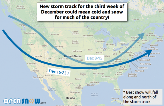
The good news is that the storm track is going to "flatten" during the middle of December, and this should mean cold air and snow for most of the west, all the way from Canada down to Arizona and New Mexico. The east coast could still be in a back-and-forth pattern between cold and warm temperatures, but as far as the west is concerned, things couldn't look any better for the next two weeks.
Read forecasts for resorts across the country
See our 5-day snow forecast map

It's possible that this favorable storm track could continue further out in time, but I'm only comfortable projecting things out to about 10 days and *maybe* two weeks. Again, we can't predict the details of each storm this far out, but a favorable storm track means that most areas will see a good chance of snow and cold through the middle of the month. Wooohooo!
About The Author


