News

By Joel Gratz, Founding Meteorologist Posted 11 years ago October 14, 2013
The weather pattern this week - Oct 14 to Oct 20, 2013
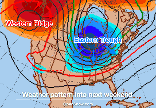
While the end of September and early October brought consistent storms and snowfall across the higher elevations of the western US, the second half of October should focus more of the action and cooler weather on the eastern US.
Looking ahead to the next week through Sunday, October 20th, the weather pattern will feature a cool and wet trough in the east and a drier and warmer ridge in the west. Source: Penn State e-wall and OpenSnow.com

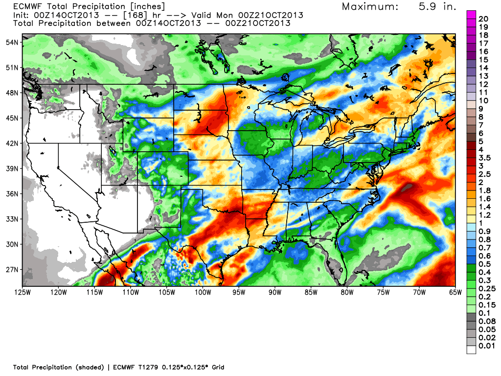
What does this mean for precipitation? Usually troughs are associated with the more active weather, and that holds true in this case. The total precipitation from Monday October 14th through Sunday October 20th favors the eastern 2/3rds of the country. Source: WeatherBell.com

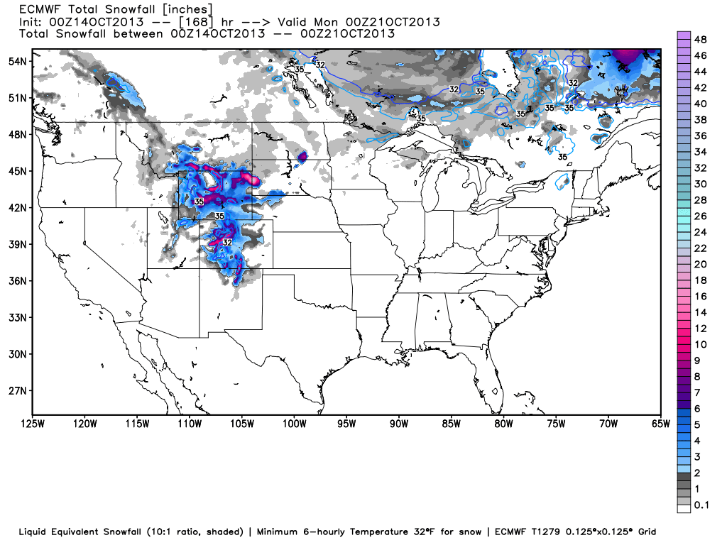
Of course what really matters to us is how much of this precipitation will fall in the form of snow. Since temperatures are still moderate during this fall transition period, the most snow will fall in the higher elevations of Montana, Wyoming, and Colorado. Most of this snow will fall early in the week, with a possible second round of lighter accumulations on Thursday into Friday. Source: WeatherBell.com

If you have an eagle-eye, you'll notice that the map above shows potential snowfall in northern New York and Vermont. Indeed as the cooler trough builds over the eastern part of the country late this week and through the weekend, the highest peaks over 5,000 feet could see a few flakes. Chances are even better for high-elevation snowfall in New England by early next week.
JOEL GRATZ
About The Author


