Australia Daily Snow

By Mike O'Connor, Meteorologist Posted 1 year ago July 4, 2024
Dry, Settled Pattern Gradually Unwinds Next Week
Summary
The settled, dry spell continues through this weekend before a weak storm system brings showers of rain and high-altitude snow Monday into Wednesday. Then, models are lining up for a stronger storm to deliver decent snowfall next week Thursday and Friday.
Short Term Forecast
Current Conditions
A storm at the weekend dropped around 20cm of fresh snow onto Australian ski resorts. Victorian resorts were on the winning side as a lot of that fell to base levels. However, in New South Wales temperatures were a little too warm and the lower slopes mostly just copped a whole lot of rain - nearly 55mm of it!
Although that snowfall improved things considerably, the Australian snowpack is still a little skint with most resorts reporting depths ranging between 20cm to 40cm while a lot of terrain remains closed. However, the weather has been mostly clear and overnight temperatures mostly getting into the negatives, so a lot of man-made powder has also been added to the main runs. It's the mid-year school holidays, so conditions are great for the kids.
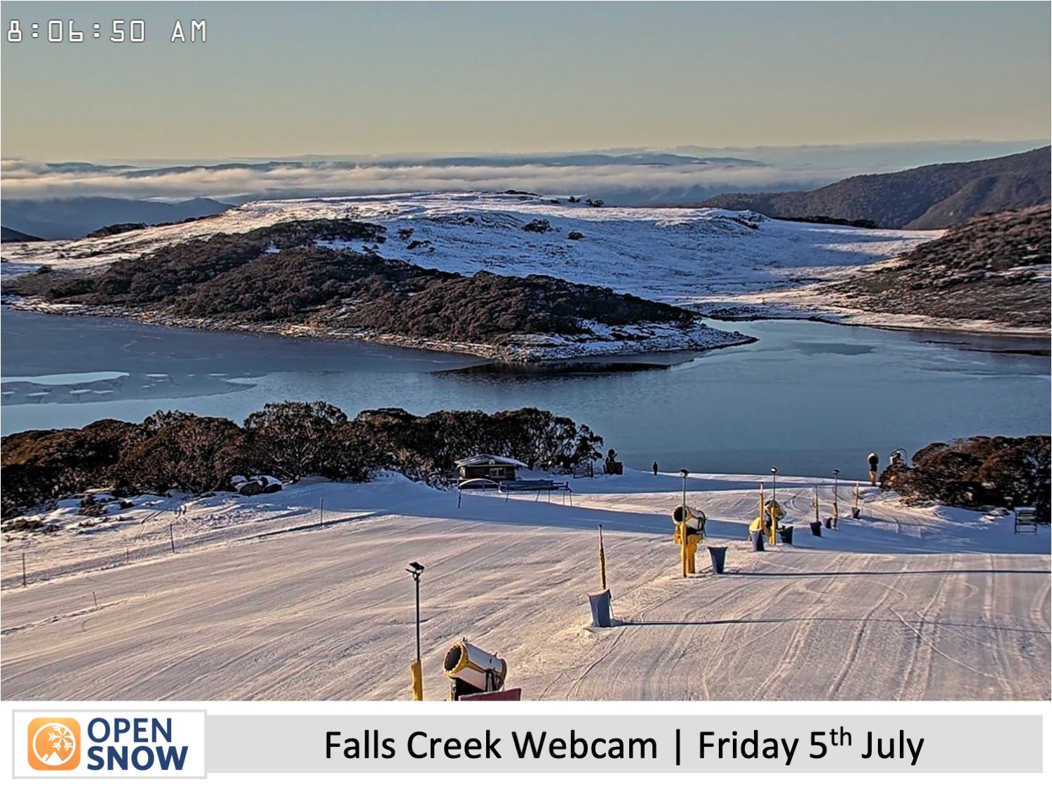
Forecast for Friday & the Weekend (5th to 7th July)
High pressure remains in control of the weather chart during this time, bringing mostly clear, calm sunny skies to the Australian Alps. However, northerly winds develop on Sunday, which will push in some cloud over New South Wales from late in the day. Until then, snowmakers will be able to keep the switch flipped on the snow machines as overnight temperatures are expected to dip below zero.
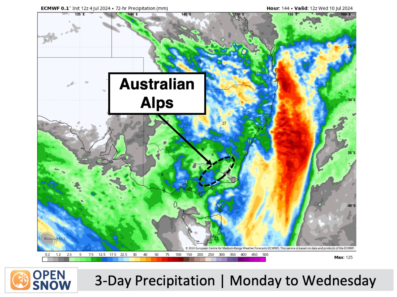
Forecast for Monday to Wednesday (8th to 10th July)
It'll be a damp few days as a weak storm system from the north and west passes over the Australian Alps. Light showers develop on Monday as northerly winds strengthen, before becoming a little heavier and more persistent for a time on Tuesday while the winds drop off and turn westerly. The showers will eventually clear on Wednesday as the weak storm system departs.
Any snow that does manage to fall during this period will be limited to terrain above 1800-1900m, which is mostly likely late Tuesday through Wednesday.
Extended Forecast
A more intense storm system is set to impact the Australian Alps beginning late on Thursday, July 11th, delivering substantial snowfall to at least mid-elevations initially, then tapering to lighter snow down to lower elevations on Friday, July 12th.
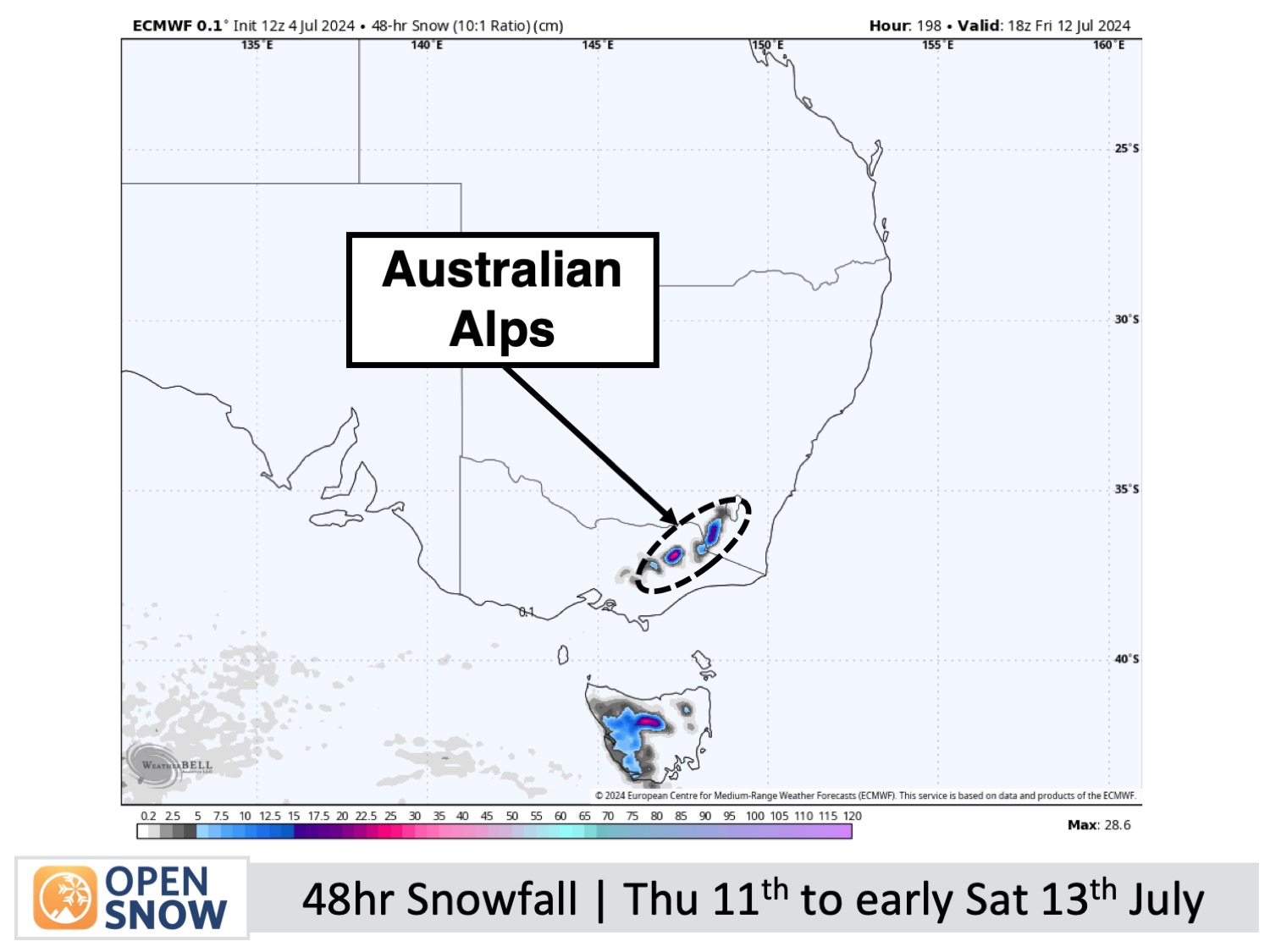
Occasional light snow showers may also continue to pop up over the weekend of July 13th and 14th before another bout of settled high-pressure likely sets in.
Thanks for reading. I'll keep these forecasts coming every Monday, Wednesday & Friday throughout the southern hemisphere season.
Mike O'Connor
About Our Forecaster


